MyTopo
Classic USGS Golden City Arkansas 7.5'x7.5' Topo Map
Couldn't load pickup availability
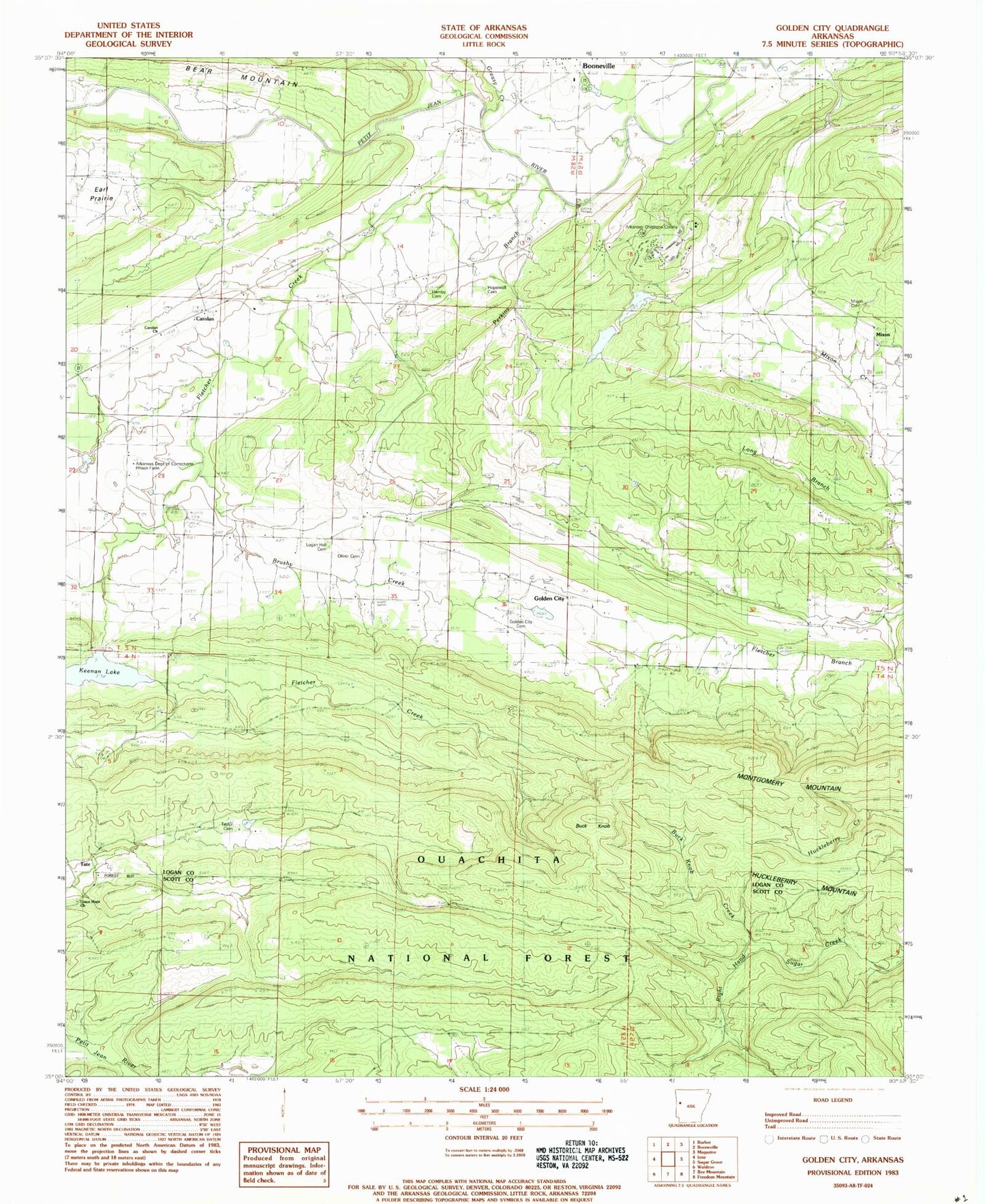
Historical USGS topographic quad map of Golden City in the state of Arkansas. Map scale may vary for some years, but is generally around 1:24,000. Print size is approximately 24" x 27"
This quadrangle is in the following counties: Logan, Scott.
The map contains contour lines, roads, rivers, towns, and lakes. Printed on high-quality waterproof paper with UV fade-resistant inks, and shipped rolled.
Contains the following named places: Arkansas Childrens Colony, Auxiliary Dam Number One, Auxiliary Dam Number Two, Bear Mountain, Boy Scouts Lake Dam, Brushy Creek, Buck Knob, Buck Knob Creek, Carolan, Carolyn Church, Earl Prairie, Fletcher Creek, Girard, Golden City, Golden City Cemetery, Golden City Volunteer Fire Department, Greasy Creek, Hamby Cemetery, Hopewell Cemetery, Huckleberry Mountain, Human Development Center, Keenan Lake, KEZU-FM (Booneville), Logan Hall Cemetery, Logan Hall Church, Mixon, Mixon Baptist Church, Mixon Cemetery, Montgomery Mountain, Oliver Cemetery, Perkins Branch, Tate, Township of Cauthron, Union Hope Baptist Church, ZIP Code: 72927