MyTopo
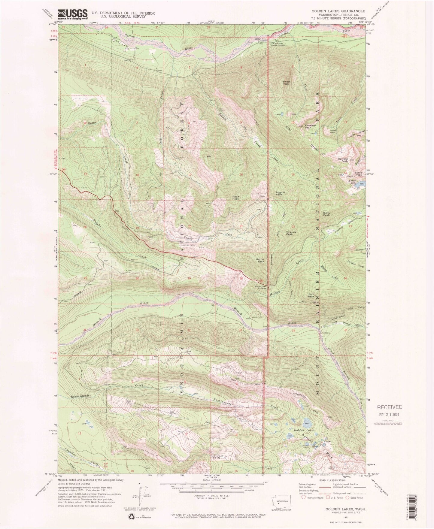
Classic USGS Golden Lakes Washington 7.5'x7.5' Topo Map
Couldn't load pickup availability
Historical USGS topographic quad map of Golden Lakes in the state of Washington. Typical map scale is 1:24,000, but may vary for certain years, if available. Print size: 24" x 27"
This quadrangle is in the following counties: Pierce.
The map contains contour lines, roads, rivers, towns, and lakes. Printed on high-quality waterproof paper with UV fade-resistant inks, and shipped rolled.
Contains the following named places: Alki Crest, August Peak, Berry Peak, Boundary Trail, Carbon River Entrance, Carbon River Ranger Station, Crater Creek, Eunice Lake, Florence Peak, Golden Lakes, Hayden Creek, Howard Peak, June Creek, Martin Peak, Meadow Creek, Mountain Meadows, Mowich Lake Entrance, North Mowich River, North Park, Paul Peak, Paul Peak Trail, Poch Creek, Poch Peak, South Mowich River, Spray Creek, Sunset Park, Sweet Peak, Tolmie Creek, Tolmie Peak, Virginia Peak, Grindstone, Wonderland Trail