MyTopo
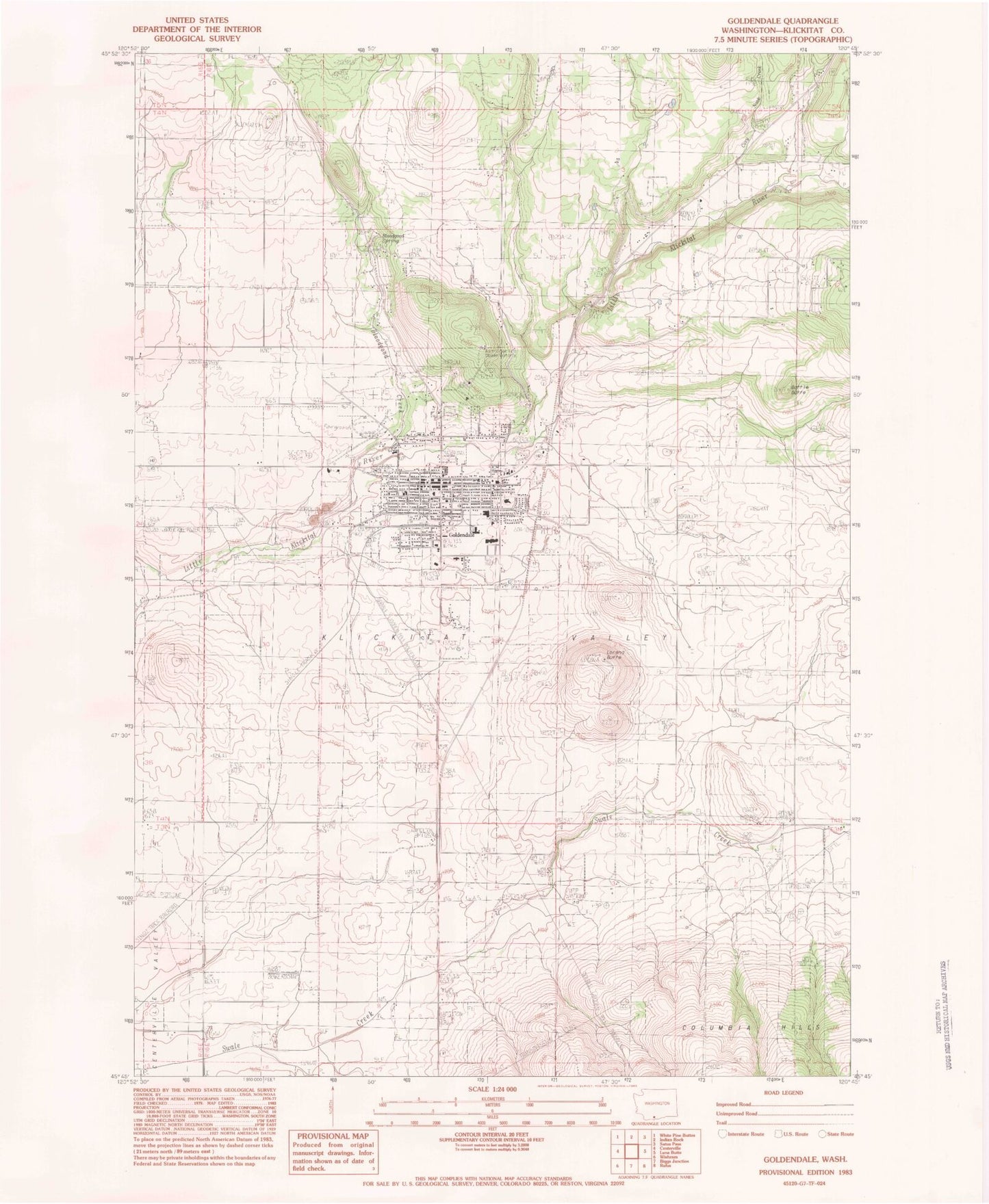
Classic USGS Goldendale Washington 7.5'x7.5' Topo Map
Couldn't load pickup availability
Historical USGS topographic quad map of Goldendale in the state of Washington. Map scale may vary for some years, but is generally around 1:24,000. Print size is approximately 24" x 27"
This quadrangle is in the following counties: Klickitat.
The map contains contour lines, roads, rivers, towns, and lakes. Printed on high-quality waterproof paper with UV fade-resistant inks, and shipped rolled.
Contains the following named places: Amidon Ranch, Battle Butte, Bloodgood Creek, Bloodgood Spring, Broken Boulder Farm, City of Goldendale, Cozy Nook Creek, Econe Park, Goldendale, Goldendale Airport, Goldendale Astronomical Observatory, Goldendale Country Club Golf Course, Goldendale Division, Goldendale High School, Goldendale Middle School, Goldendale Police Department, Goldendale Post Office, Goldendale Primary School, IOFF Mountain View Cemetery, Jenkins Creek, KLCK-AM (Goldendale), Klickitat County, Klickitat County Fairgrounds, Klickitat County Jail, Klickitat County Rural 7 Fire and Rescue Station 1, Klickitat Valley Ambulance, Klickitat Valley Hospital, KZPC-FM (Goldendale), Lorena Butte, Van Aelst Dam, ZIP Code: 98620