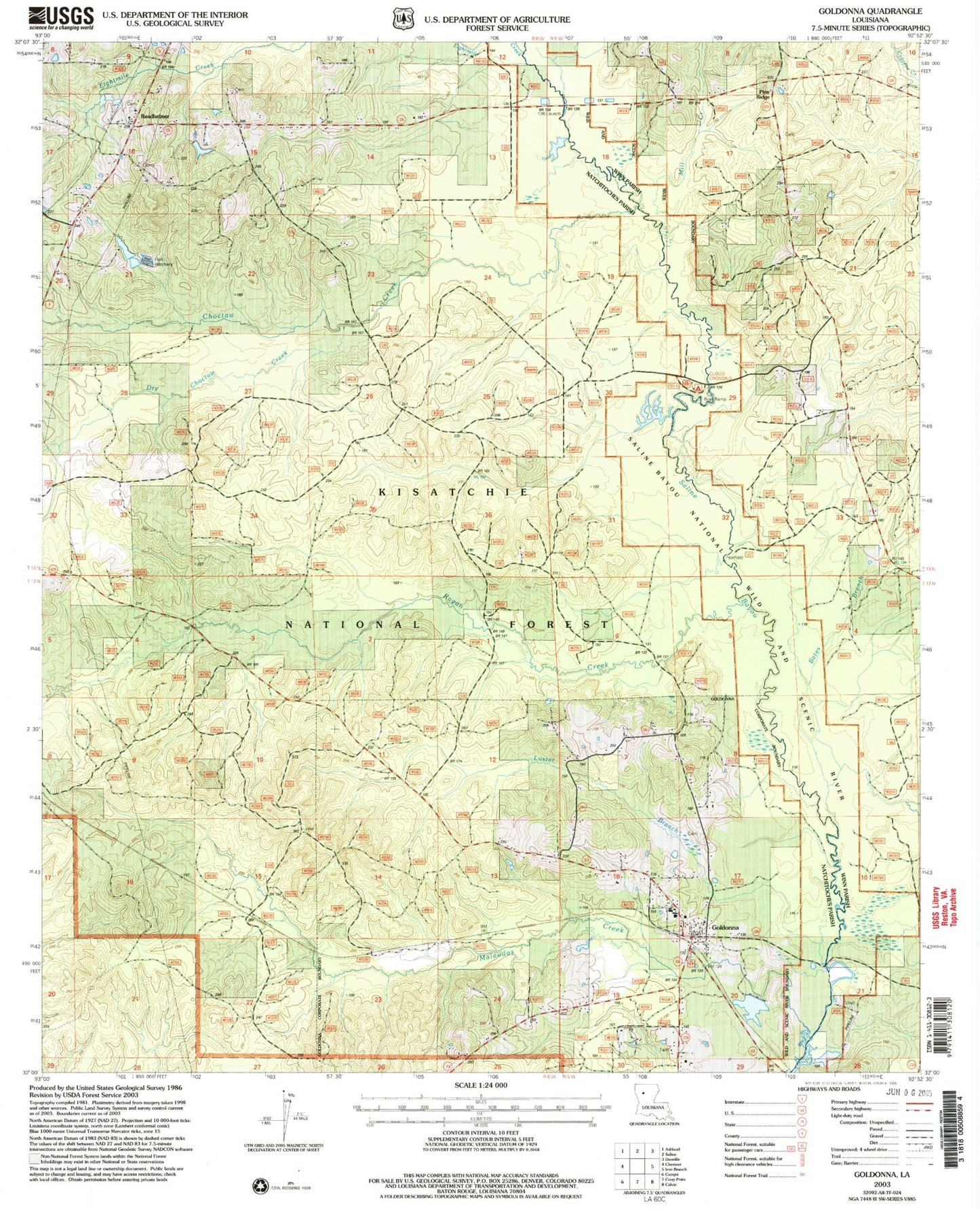
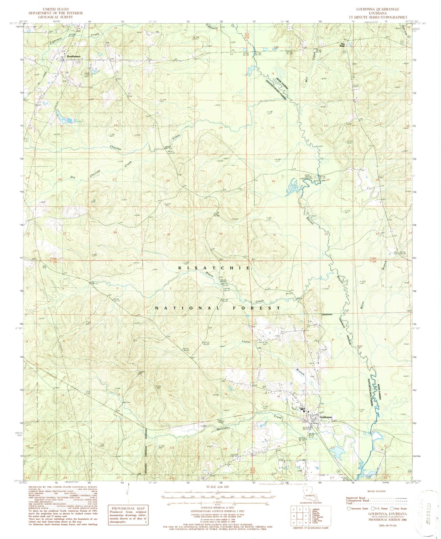
MyTopo
Classic USGS Goldonna Louisiana 7.5'x7.5' Topo Map
Couldn't load pickup availability
Historical USGS topographic quad map of Goldonna in the state of Louisiana. Map scale may vary for some years, but is generally around 1:24,000. Print size is approximately 24" x 27"
This quadrangle is in the following counties: Natchitoches, Winn.
The map contains contour lines, roads, rivers, towns, and lakes. Printed on high-quality waterproof paper with UV fade-resistant inks, and shipped rolled.
Contains the following named places: Bates Branch, Choctaw Creek, Cloud Bridge, Cloud Crossing Campground, Drakes Salt Lick, Dry Choctaw Creek, Eightmile Creek, Goldonna, Goldonna Area Fire Protection District 2, Goldonna Cemetery, Goldonna Post Office, Goldonnna Elementary Junior High School, Green Grove Church, Harris Bridge, Jilks Branch, Luster Branch, Malaudos Creek, Mill Creek, Oshkosh, Pine Ridge, Pine Ridge Church, Pleasant Chapel, Ragan Creek, Readheimer, Readhimer Census Designated Place, Saline Bayou Wild and Scenic River, Village of Goldonna, ZIP Code: 71031