MyTopo
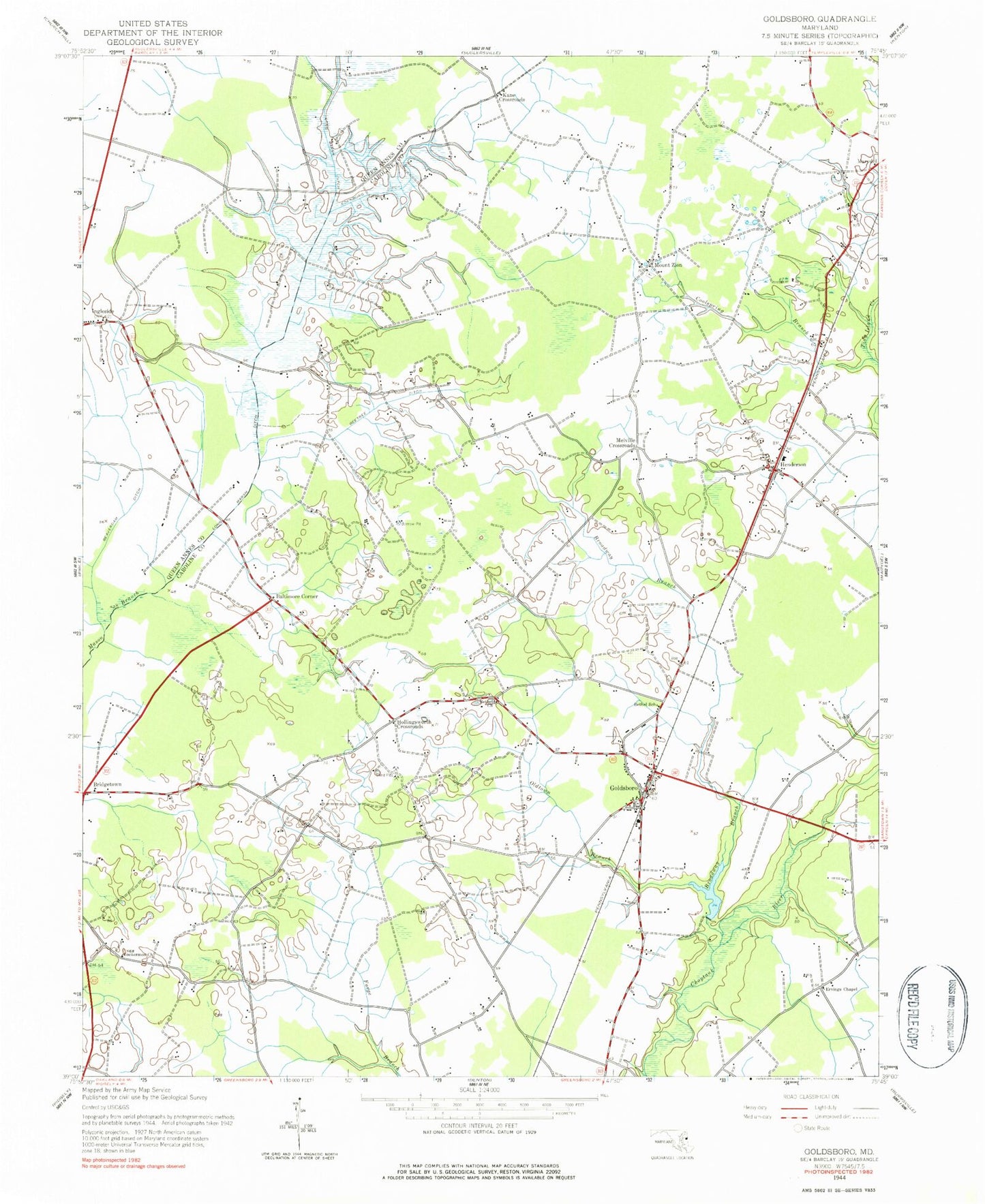
Classic USGS Goldsboro Maryland 7.5'x7.5' Topo Map
Couldn't load pickup availability
Historical USGS topographic quad map of Goldsboro in the state of Maryland. Map scale may vary for some years, but is generally around 1:24,000. Print size is approximately 24" x 27"
This quadrangle is in the following counties: Caroline, Queen Anne's.
The map contains contour lines, roads, rivers, towns, and lakes. Printed on high-quality waterproof paper with UV fade-resistant inks, and shipped rolled.
Contains the following named places: Baltimore Corner, Beaverdam Ditch, Beetree Ditch, Bethel Church, Bethel School, Bridgetown, Bridgetown School, Bridgetown United Methodist Church, Broadway Branch, Caroline Acres Mobile Home Park, Caroline Acres Wastewater Treatment Plant, Choptank Hundred, Choptank Pines, Christ Church, Church of Christ in Christian Union, Coolspring Branch, District 1 Henderson, Edenburg Ditch, Ervings Chapel, Goldsboro, Goldsboro Community Park, Goldsboro Post Office, Goldsboro Railroad Station, Goldsboro Town Hall, Goldsboro Volunteer Fire Company Station 700, Henderson, Henderson Community Park, Henderson Post Office, Henderson School, Henderson United Methodist Church, Highland Farm, Hollingsworth Circle, Kane Crossroads, Lake Bonnie, Lake Bonnie Dam, Lockermon Church, Long Marsh, Long Marsh Ditch, Melville Crossroads, Mount Zion, Mount Zion Cemetery, Mount Zion Church, New Union United Methodist Church, Oldtown Branch, Pippins Church, Rochester Cemetery, School Number 1, School Number 2, Simpers Cross Roads, Town of Goldsboro, Town of Henderson, Trinity Methodist Church, Union Corner, Union Memorial Cemetery, Wesleyan Church, ZIP Codes: 21636, 21640, 21644