MyTopo
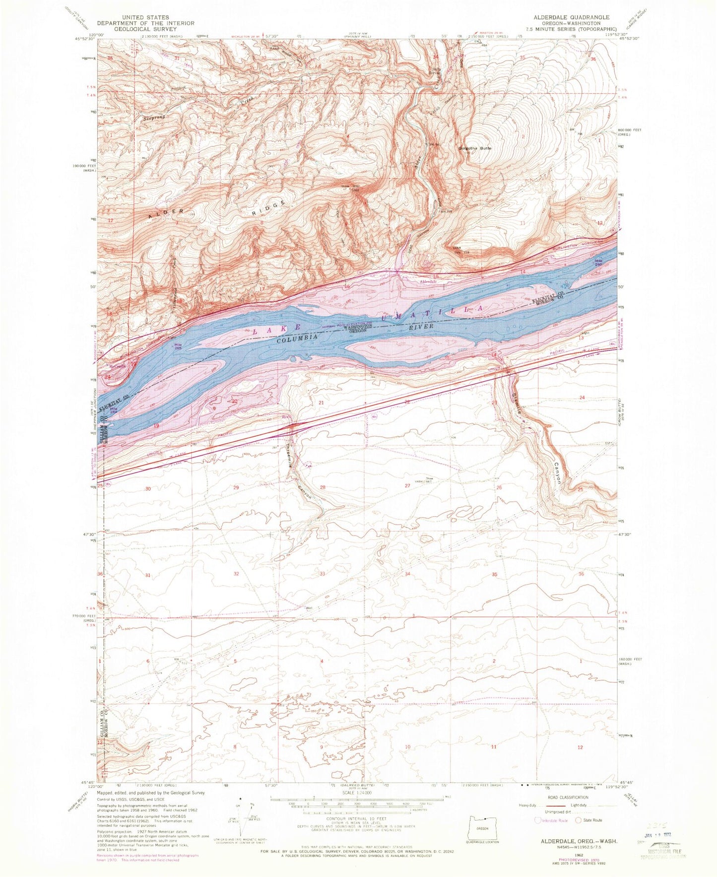
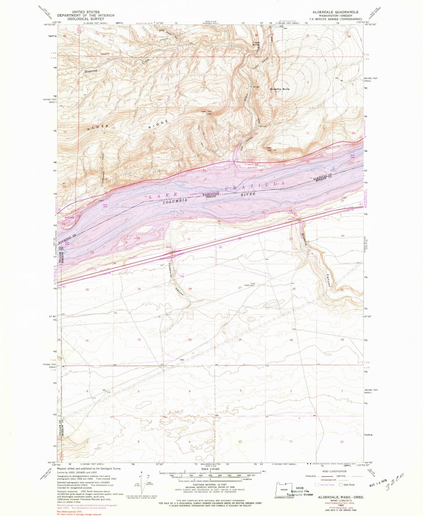
Classic USGS Golgotha Butte Washington 7.5'x7.5' Topo Map
Couldn't load pickup availability
Historical USGS topographic quad map of Golgotha Butte in the states of Washington, Oregon. Map scale may vary for some years, but is generally around 1:24,000. Print size is approximately 24" x 27"
This quadrangle is in the following counties: Gilliam, Klickitat, Morrow.
The map contains contour lines, roads, rivers, towns, and lakes. Printed on high-quality waterproof paper with UV fade-resistant inks, and shipped rolled.
Contains the following named places: Alder Creek, Alder Ridge, Alderdale, Alderdale Treaty Fishing Access Site, Boardman Rural Fire Protection District Station 3, Boulder, Cottonwood Creek, Golgotha Butte, Lake Umatilla, McCredie, Quesna County Park, Quesnal Park Boat Ramp, Sally Spring, Simtag Farms Airstrip, Sixmile Canyon, Sixprong Creek, Threemile Canyon, Threemile Canyon Treaty Fishing Access Site, ZIP Code: 97818