MyTopo
Classic USGS Gonzales Wash Arizona 7.5'x7.5' Topo Map
Couldn't load pickup availability
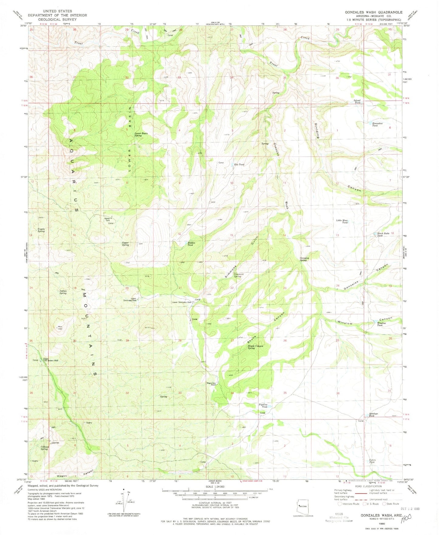
Historical USGS topographic quad map of Gonzales Wash in the state of Arizona. Map scale may vary for some years, but is generally around 1:24,000. Print size is approximately 24" x 27"
This quadrangle is in the following counties: Mohave.
The map contains contour lines, roads, rivers, towns, and lakes. Printed on high-quality waterproof paper with UV fade-resistant inks, and shipped rolled.
Contains the following named places: Antelope Tank, Black Butte Tank, Cabezas Spring, Coters Tank, Coyote Spring, Dividing Canyon, Eds Tank, Gonzales Canyon, Gonzales Spring, Gonzales Wash, Hidden Tank, Horseshoe Tank, Indian Spring, Island Tank, Little Mesa, Little Mesa Tank, Lower Basin, Lower Basin Spring, Lower Simmons Peak, Lower Simmons Well, Parsons Field, Pipeline Tank, Red Canyon, Simmons Gulch, Simmons Spring, Skunk Canyon, Skunk Canyon Spring, Upper Hidden Simmons Gonzales, Upper Simmons Well, Upper Spring, Upper Tom Brown Well, Wagon Bow Ranch, Wagon Canyon, Wagon Canyon Spring, Winslow Canyon, Winslow Tank