MyTopo
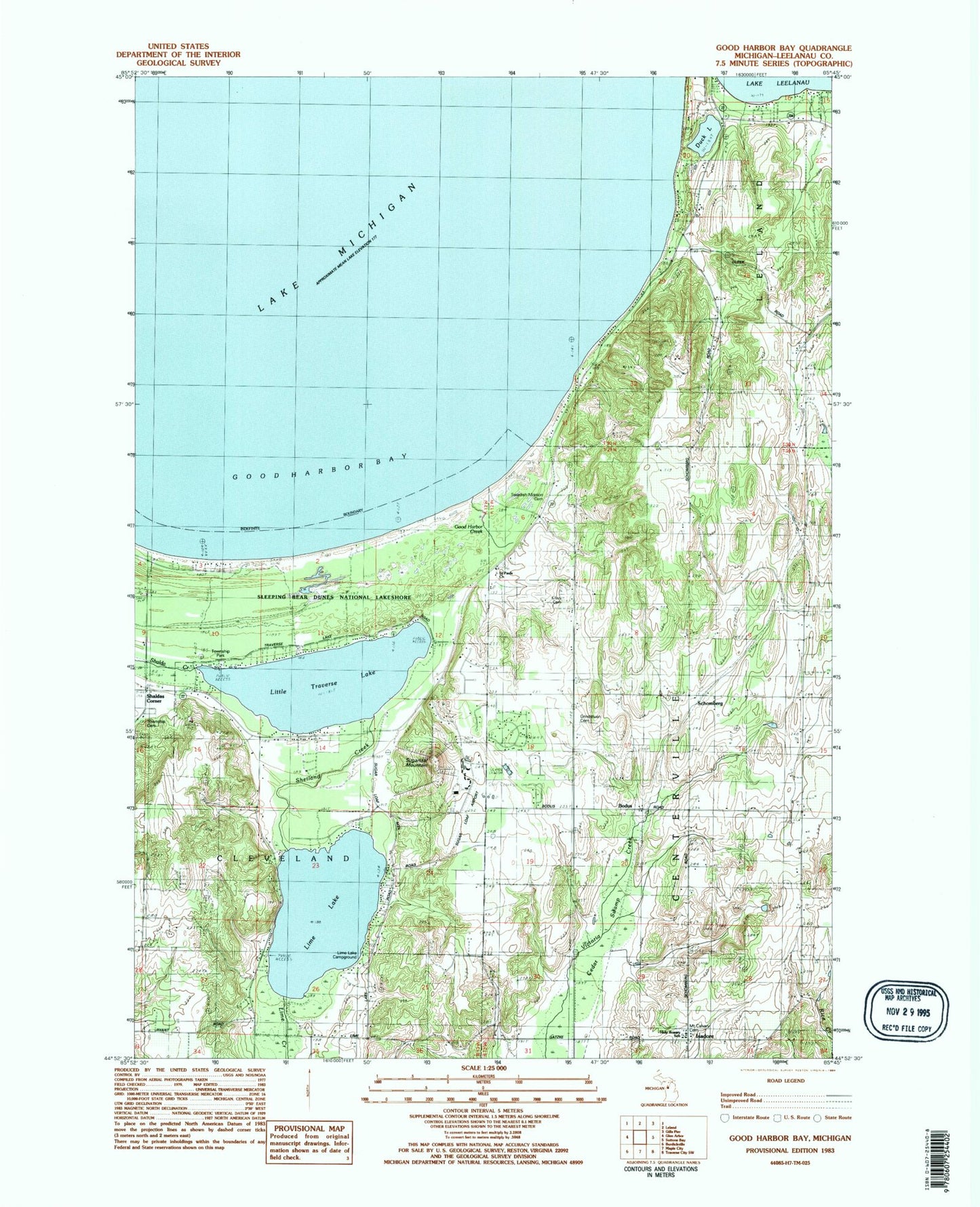
Classic USGS Good Harbor Bay Michigan 7.5'x7.5' Topo Map
Couldn't load pickup availability
Historical USGS topographic quad map of Good Harbor Bay in the state of Michigan. Typical map scale is 1:24,000, but may vary for certain years, if available. Print size: 24" x 27"
This quadrangle is in the following counties: Leelanau.
The map contains contour lines, roads, rivers, towns, and lakes. Printed on high-quality waterproof paper with UV fade-resistant inks, and shipped rolled.
Contains the following named places: Cleveland Cemetery, Community Church, Duck Lake, Good Harbor Bay, Grindstuen Cemetery, Kilwy Cemetery, Lime Lake, Little Traverse Lake, North University, Saint Pauls Church, Shetland Creek, Sugarloaf Mountain, Swedish Mission Cemetery, Bodus, Isadore, Schomberg, Mount Calvary Cemetery, Good Harbor Creek, Lime Creek, Holy Rosary School, Lime Lake Campground, Shaldas Corner, Miller-Herrold Airport, Sugar Loaf Resort Airport (historical), WBKP-FM (Leland), Township of Centerville, Kings Challenge Golf Club, Sleeping Bear Golf Club, Cleveland Township Hall, Holy Rosary Church, Shetland Post Office (historical), Schomberg Station (historical), Schomberg Post Office (historical), Isadore Post Office (historical), Good Harbor Post Office (historical), Saint Paul Lutheran Cemetery