MyTopo
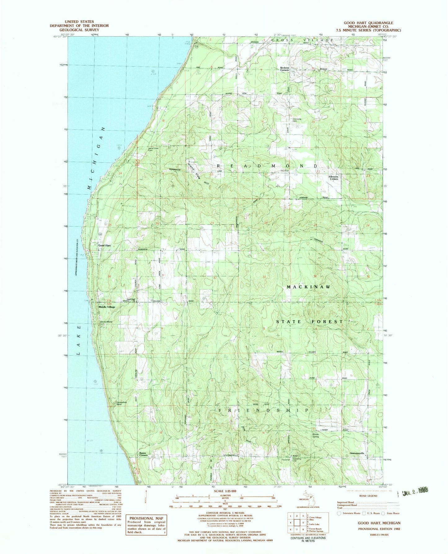
Classic USGS Good Hart Michigan 7.5'x7.5' Topo Map
Couldn't load pickup availability
Historical USGS topographic quad map of Good Hart in the state of Michigan. Map scale may vary for some years, but is generally around 1:24,000. Print size is approximately 24" x 27"
This quadrangle is in the following counties: Emmet.
The map contains contour lines, roads, rivers, towns, and lakes. Printed on high-quality waterproof paper with UV fade-resistant inks, and shipped rolled.
Contains the following named places: Beckons Corners, Beran Baptist Cemetery, Devils Elbow, Frienship Township Cemetery, Good Hart, Good Hart Church, Good Hart Post Office, Horseshoe Bend, Island View Cemetery, Island View Hill, Johnsons Corners, Middle Village, Morris Spring, Readmond / Friendship / Cross Village Fire and Rescue, Readmond Post Office, Readmond Township Cemetery, Ryans Corners, Saint Ignatius' Catholic Chuch Cemetery, Sogonosh Valley School, Stutsmanville, Stutsmanville Chapel, Township of Friendship, Township of Readmond, WMKC-FM (Saint Ignace), ZIP Code: 49740