
MyTopo
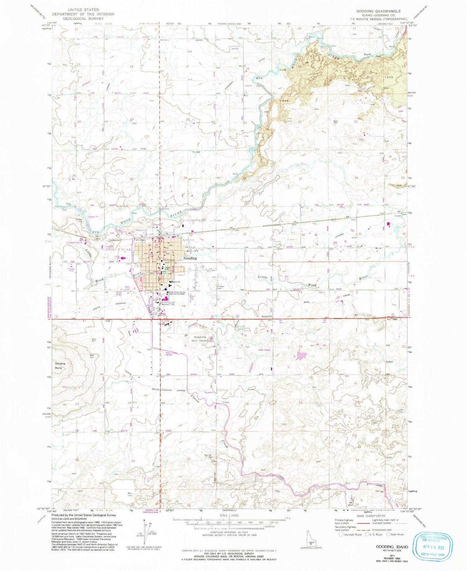
Classic USGS Gooding Idaho 7.5'x7.5' Topo Map
Couldn't load pickup availability
Historical USGS topographic quad map of Gooding in the state of Idaho. Map scale may vary for some years, but is generally around 1:24,000. Print size is approximately 24" x 27"
This quadrangle is in the following counties: Gooding.
The map contains contour lines, roads, rivers, towns, and lakes. Printed on high-quality waterproof paper with UV fade-resistant inks, and shipped rolled.
Contains the following named places: 1465 Lateral, 83330, City of Gooding, Clover Creek, Crosstie, Elmwood Cemetery, Frahm Elementary-Junior High School, Gibbons Elementary School, Gooding, Gooding City Overflow, Gooding City Rural Fire Department, Gooding County Emergency Medical Services, Gooding County Fairgrounds, Gooding County Sheriff's Office, Gooding Division, Gooding High School, Gooding Police Department, Gooding Post Office, Idaho School for the Deaf and Blind, KCRQ-FM (Gooding), KRXR-AM (Gooding), KRXR-AM (Twin Falls), Lateral 1465A1, Lateral 1465A2, Lateral 1465A3, Lateral 3453, Lateral B1, Lateral B1A, Lateral B1A1, Lateral B1B, Lateral B2, Lateral B3, Lateral B4, Lateral X-4, North Canyon Medical Center, Pioneer Cemetery, Poorman Ditch, South Gooding Main Canal, South Gooding Siphon, Twin Falls North Main Canal, Union 2 Ditch


