MyTopo
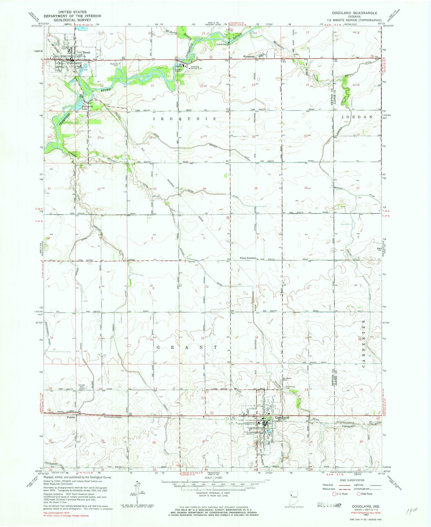
Classic USGS Goodland Indiana 7.5'x7.5' Topo Map
Couldn't load pickup availability
Historical USGS topographic quad map of Goodland in the state of Indiana. Map scale may vary for some years, but is generally around 1:24,000. Print size is approximately 24" x 27"
This quadrangle is in the following counties: Jasper, Newton.
The map contains contour lines, roads, rivers, towns, and lakes. Printed on high-quality waterproof paper with UV fade-resistant inks, and shipped rolled.
Contains the following named places: Ade Hospital, Barten Ditch, Bower Ditch, Brook, Brook - Iroquois Township Volunteer Fire Department, Brook Elementary School, Brook Post Office, Brook Volunteer Fire Department, Darroch Ditch, Foresman, Foster Park, Goodland, Goodland Cemetery, Goodland Elementary School, Goodland Post Office, Goodland Volunteer Fire Department, Hazelden Country Club, Hickory Branch, Hunter Ditch, Jones Ditch, Moran Ditch, Mosquito Creek, Mount Calvary Cemetery, O'Brien Ditch, Percy Junction, Perkins, Riverside Lake, Stack Ditch, Town of Brook, Town of Goodland, Township of Grant, Township of Iroquois, Weiss Ditch, Zion Church, ZIP Code: 47948