MyTopo
Classic USGS Goodman SW Wisconsin 7.5'x7.5' Topo Map
Regular price
$16.95
Regular price
Sale price
$16.95
Unit price
per
Couldn't load pickup availability
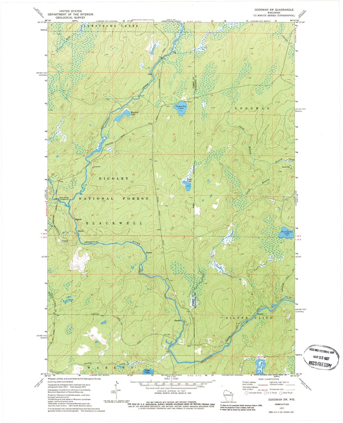
Historical USGS topographic quad map of Goodman SW in the state of Wisconsin. Map scale may vary for some years, but is generally around 1:24,000. Print size is approximately 24" x 27"
This quadrangle is in the following counties: Forest, Marinette.
The map contains contour lines, roads, rivers, towns, and lakes. Printed on high-quality waterproof paper with UV fade-resistant inks, and shipped rolled.
Contains the following named places: Armstrong Creek, Burnt Bridge Campground, Camp Six Lake, Goose Lake, Halley Creek, Michigan Creek, North Branch Harvey Creek, Porcupine Lake, Revolver Lake, Rock Creek, South Branch Harvey Creek, Valley Lake, ZIP Code: 54125