MyTopo
Classic USGS Goodrich Wisconsin 7.5'x7.5' Topo Map
Regular price
$16.95
Regular price
Sale price
$16.95
Unit price
per
Couldn't load pickup availability
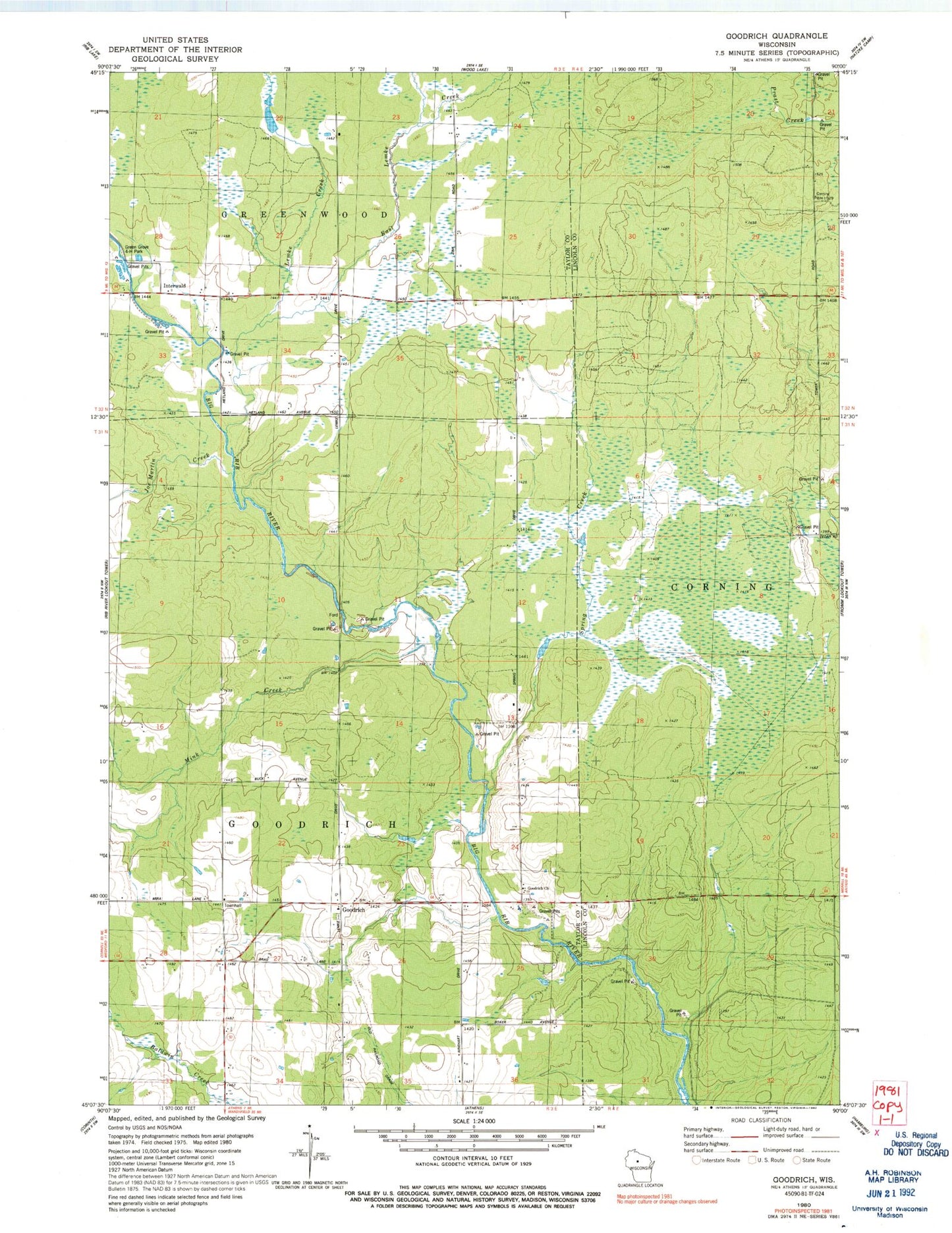
Historical USGS topographic quad map of Goodrich in the state of Wisconsin. Map scale may vary for some years, but is generally around 1:24,000. Print size is approximately 24" x 27"
This quadrangle is in the following counties: Lincoln, Taylor.
The map contains contour lines, roads, rivers, towns, and lakes. Printed on high-quality waterproof paper with UV fade-resistant inks, and shipped rolled.
Contains the following named places: East Lemke Creek, Goodrich, Goodrich Church, Goodrich Townhall, Green Grove 4-H Park, Green Meadow School, Interwald, Joe Martin Creek, John's Field, Lemke Creek, Mink Creek, Saint Andrews Evangelical Lutheran Parish Cemetery, Spring Creek, Town of Goodrich