MyTopo
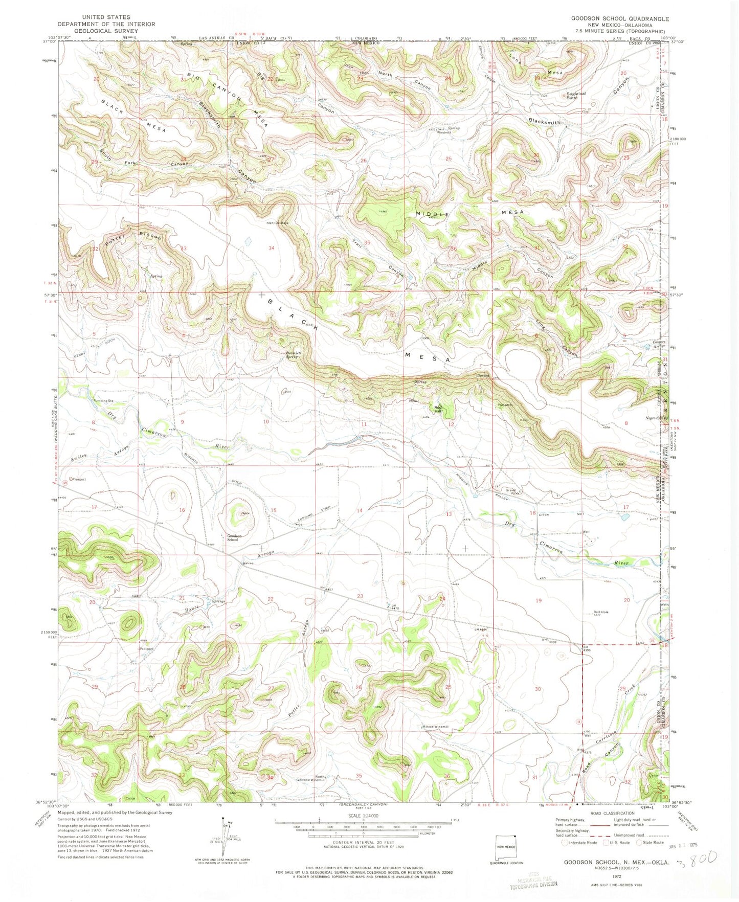
Classic USGS Goodson School New Mexico 7.5'x7.5' Topo Map
Couldn't load pickup availability
Historical USGS topographic quad map of Goodson School in the states of New Mexico, Oklahoma. Map scale may vary for some years, but is generally around 1:24,000. Print size is approximately 24" x 27"
This quadrangle is in the following counties: Baca, Cimarron, Union.
The map contains contour lines, roads, rivers, towns, and lakes. Printed on high-quality waterproof paper with UV fade-resistant inks, and shipped rolled.
Contains the following named places: Big Canyon, Big Canyon Mesa, Black Mesa Prospect, Bontz Arroyo, Bramlett Spring, Ellmore Canyon, Goodson, Goodson School, Independence Group, Lone Mesa, Long Canyon, Middle Canyon, Middle Mesa, Negro Spring, North Canyon, North Gillespie Windmill, Potter Arroyo, Potter Rincon, Quimby, Rabbit Ear Fire Department Kenton Station, Red Hill, Rincon Windmill, Road Canyon, Roberts Ditch, Sloan Creek, Smiley Arroyo, South Fork Canyon, Sugarloaf Butte, Trail Canyon, Twin Windmill, Whitley, Wiggin, Wiggins Ralley Ditch Number 1