MyTopo
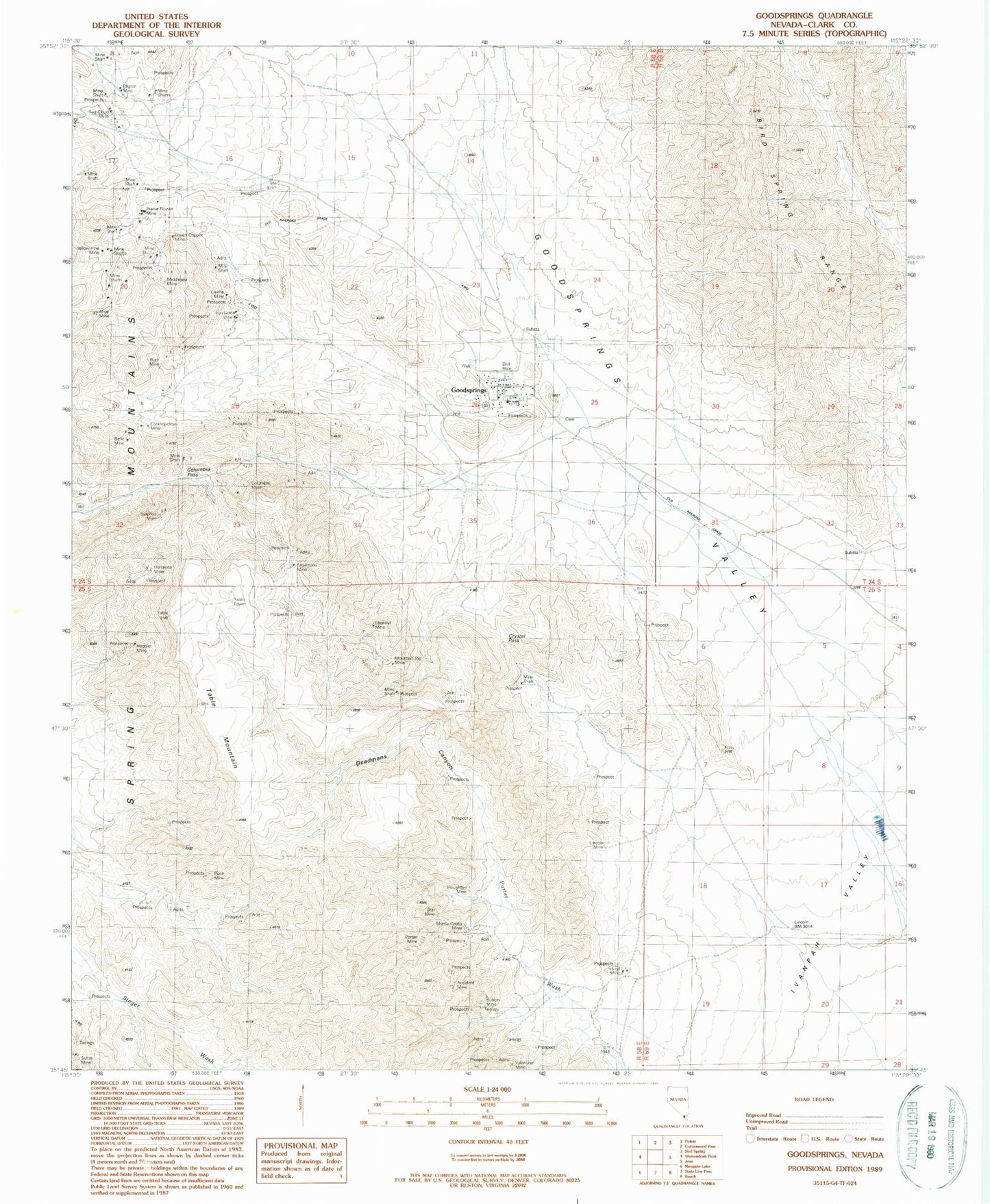
Classic USGS Goodsprings Nevada 7.5'x7.5' Topo Map
Couldn't load pickup availability
Historical USGS topographic quad map of Goodsprings in the state of Nevada. Map scale may vary for some years, but is generally around 1:24,000. Print size is approximately 24" x 27"
This quadrangle is in the following counties: Clark.
The map contains contour lines, roads, rivers, towns, and lakes. Printed on high-quality waterproof paper with UV fade-resistant inks, and shipped rolled.
Contains the following named places: Accident Mine, Alice Mine, Anchor Mine, Argentena Mine, Argentena Mine Camp, Belle Mine, Bullion Mine, Clark County Fire Department Station 78, Columbia Mine, Columbia Pass, Cosmopolitan Mine, Crystal Pass, Deadmans Canyon, Frederickson Mine, Good Spring, Goodsprings, Goodsprings Census Designated Place, Goodsprings Elementary School, Goodsprings Park, Goodsprings Rural Station Post Office, Goodsprings Valley, Green Copper Mine, Hermosa Mine, Hoosier Mine, Horseshoe Gulch, Houghton Mine, Ireland Mine, Iron Gold Mine, Lavina Mine, Lincoln Mine, Lookout Mine, Lookout Peak, Middlesex Mine, Monte Cristo Mine, Mountain Top Mine, New England Mining Companys Spring, New England Springs, Pilgrim Mine, Porphyry Gulch, Porter Mine, Porter Wash, Prairie Flower Mine, Puelz Mine, Red Cloud Mine, Ruth Mine, Star Mine, Surprise Mine, Table Mountain, Valentine Mine, Volcano Mine, Yellow Pine Mine