
MyTopo
Classic USGS Goodview Virginia 7.5'x7.5' Topo Map
Couldn't load pickup availability
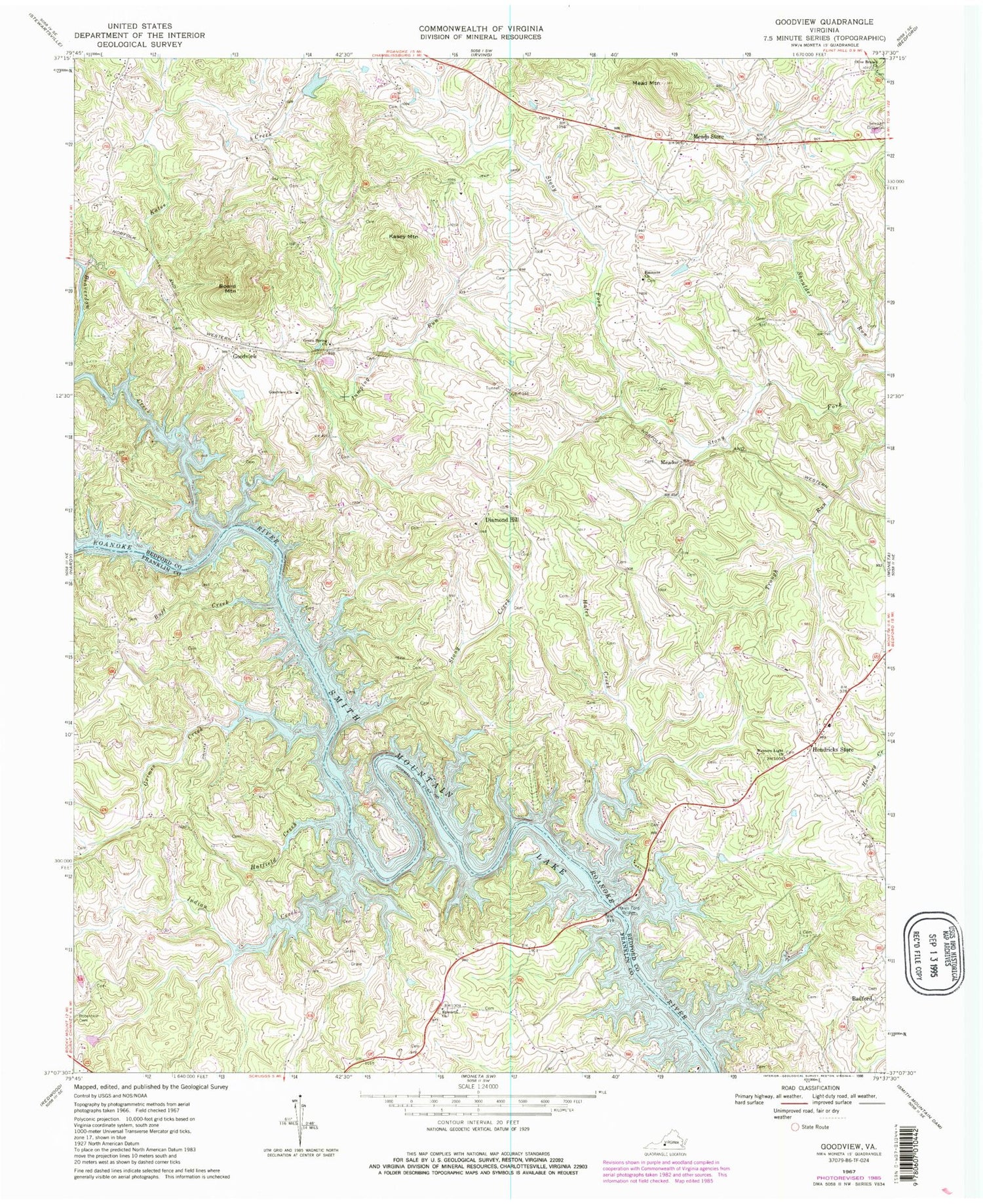
Historical USGS topographic quad map of Goodview in the state of Virginia. Map scale may vary for some years, but is generally around 1:24,000. Print size is approximately 24" x 27"
This quadrangle is in the following counties: Bedford, Franklin.
The map contains contour lines, roads, rivers, towns, and lakes. Printed on high-quality waterproof paper with UV fade-resistant inks, and shipped rolled.
Contains the following named places: Altice Cemetery, Aylor Cemetery, Basham Cemetery, Beaverdam Creek, Beechwood Shores, Board Mountain, Booth - Joplin Cemetery, Buff Creek, Cape Carlyn, Carters Island Ford, Casey Cemetery, Clevilas, Diamond Hill, Diamond Hill Church, Ellis Cemetery, Ellis-Blankenship Cemetery, Emmaus, Emmaus Church, Emmaus School, Epworth Church, Epworth United Methodist Church Cemetery, Ferguson - Hatcher Cemetery, Goodview, Goodview Church, Goodview Post Office, Green Spring Church, Grimes Creek, Haleford, Hales Creek, Hales Ford, Hales Ford Bridge, Hatfield Creek, Hendricks Store, Hetrick Dam, Hetrick Pond, Holdrens Dam, Holdrens Pond, Indian Creek, Jenkins Cemetery, Jumping Run, Kasey Mountain, Kates Creek, Maxey Cemetery, Mead Mountain, Meador, Meador Cemetery, Meadows Mill, Meads Store, Minter Cemetery, Moneta Post Office, Moneta Volunteer Fire Department Station 3, Olive Branch Church, Perdue Cemetery, Promised Land School, Robertson Cemetery, Staunton River Middle School, Stony Creek, Teels Mill, Turners Ford, WBLU-AM (Moneta), Western Light Church, Westlake Golf and Country Club, Wilson Cemetery, ZIP Codes: 24095, 24121


