MyTopo
Classic USGS Goodyears Bar California 7.5'x7.5' Topo Map
Couldn't load pickup availability
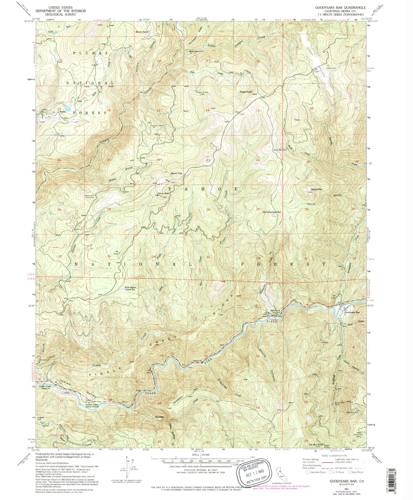
Historical USGS topographic quad map of Goodyears Bar in the state of California. Map scale may vary for some years, but is generally around 1:24,000. Print size is approximately 24" x 27"
This quadrangle is in the following counties: Sierra.
The map contains contour lines, roads, rivers, towns, and lakes. Printed on high-quality waterproof paper with UV fade-resistant inks, and shipped rolled.
Contains the following named places: Bald Mountain, Bald Top, Bee Tree Borrow Pit, Bow Creek, Brown Bear Mine, Brush Creek Mine, Bunker Hill Mine, Collins Ravine, Colony Mine, Convict Flat Picnic Area, Devils Canyon, Eureka, Eureka Cemetery, Eureka Creek, Eureka Diggings, Fiddle Creek, Fiddle Creek Camp Ground, Fiddle Creek Ridge, Fiddle Creek Trail, Florida House, Golden Bear Mine, Goodyears Bar, Goodyears Bar Cemetery, Goodyears Bar Census Designated Place, Goodyears Creek, Grant Ravine, Halls Ranch, Halls Ranch Guard Station, Halls Ranch Trail, Head Dam, Humbug Creek, Indian Hill, Indian Rock Picnic Area, Indian Valley, Indian Valley Camp Ground, Little Canyon Creek, Little Fiddle Creek, Little Humbug Creek, Lower Carton Campground, Magnolia Mine, Marvin Ranch, McMahon Mine, McMahons, Mount Pleasant, Mount Pleasant Ranch, New Kirk Mine, Old Mountain House, Pipe Creek, Ramshorn Camp Ground, Ramshorn Creek, Ramshorn Trail, Rock Creek, Rocky Peak, Rocky Rest Campground, Saint Catherine Creek, Saint Charles Hill, Saint Charles Ranch, Saint Joe Bar, Sawmill Ravine, Scalan Mine, Scales, Scales Cemetery, Shower Branch, Snow Creek, Snowden Hill, Sugarloaf, Upper Carlton Campground, Wet Ravine, Woodruff Creek, Young America Creek