MyTopo
Classic USGS Goose Island Michigan 7.5'x7.5' Topo Map
Couldn't load pickup availability
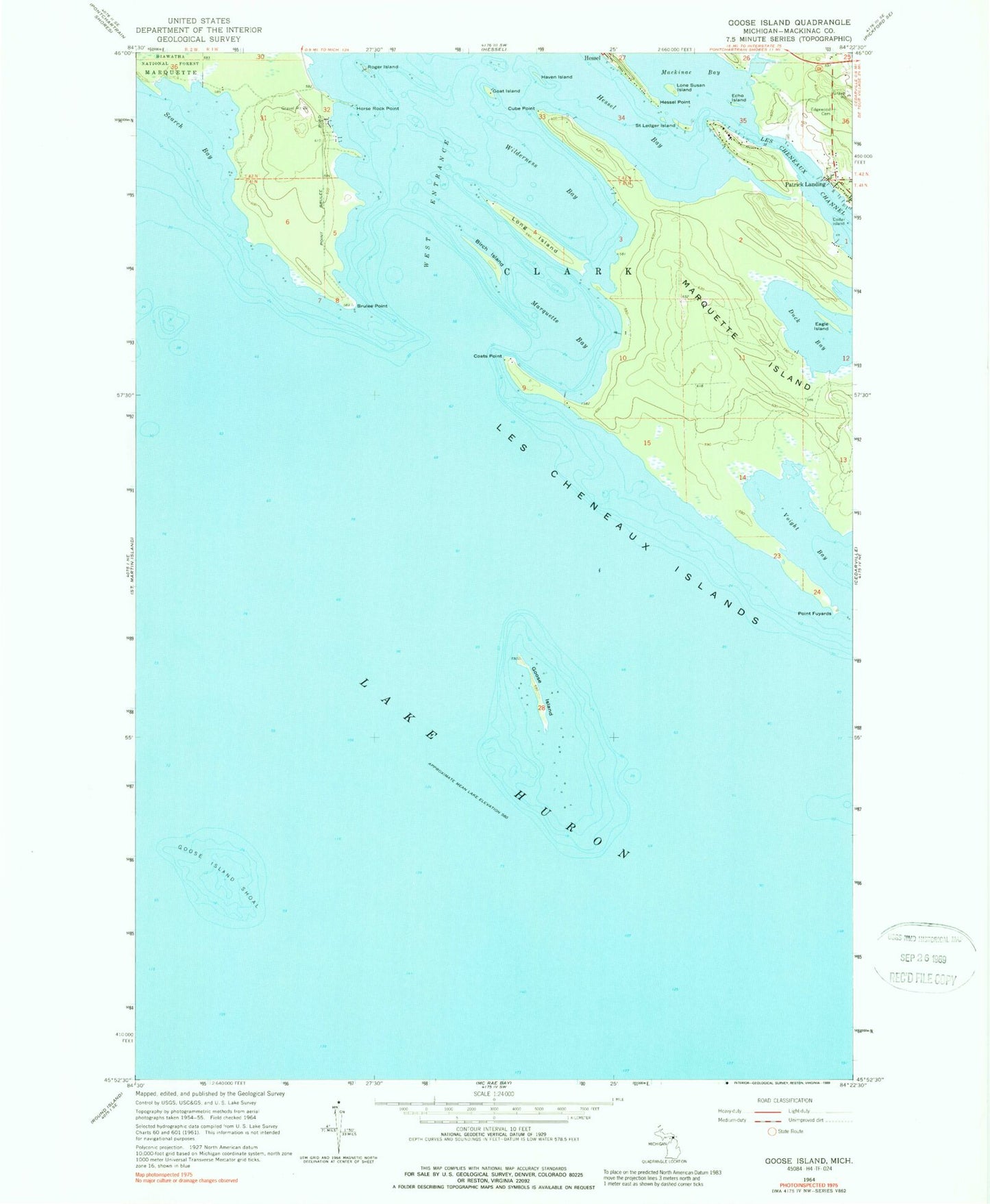
Historical USGS topographic quad map of Goose Island in the state of Michigan. Map scale may vary for some years, but is generally around 1:24,000. Print size is approximately 24" x 27"
This quadrangle is in the following counties: Mackinac.
The map contains contour lines, roads, rivers, towns, and lakes. Printed on high-quality waterproof paper with UV fade-resistant inks, and shipped rolled.
Contains the following named places: Birch Island, Brulee Point, Coats Point, Cube Point, Dollar Island, Duck Bay, Eagle Island, Echo Island, Edgewood Cemetery, Goat Island, Goose Island, Goose Island Shoal, Haven Island, Hessel Point, Horse Rock Point, Les Cheneaux Channel, Les Cheneaux Club Post Office, Lone Susan Island, Long Island, Mackinac Bay, Marquette Bay, Marquette Island, Patrick Landing, Point Fuyards, Roger Island, Saint Ledger Island, Search Bay, Voight Bay, West Entrance, Wilderness Bay