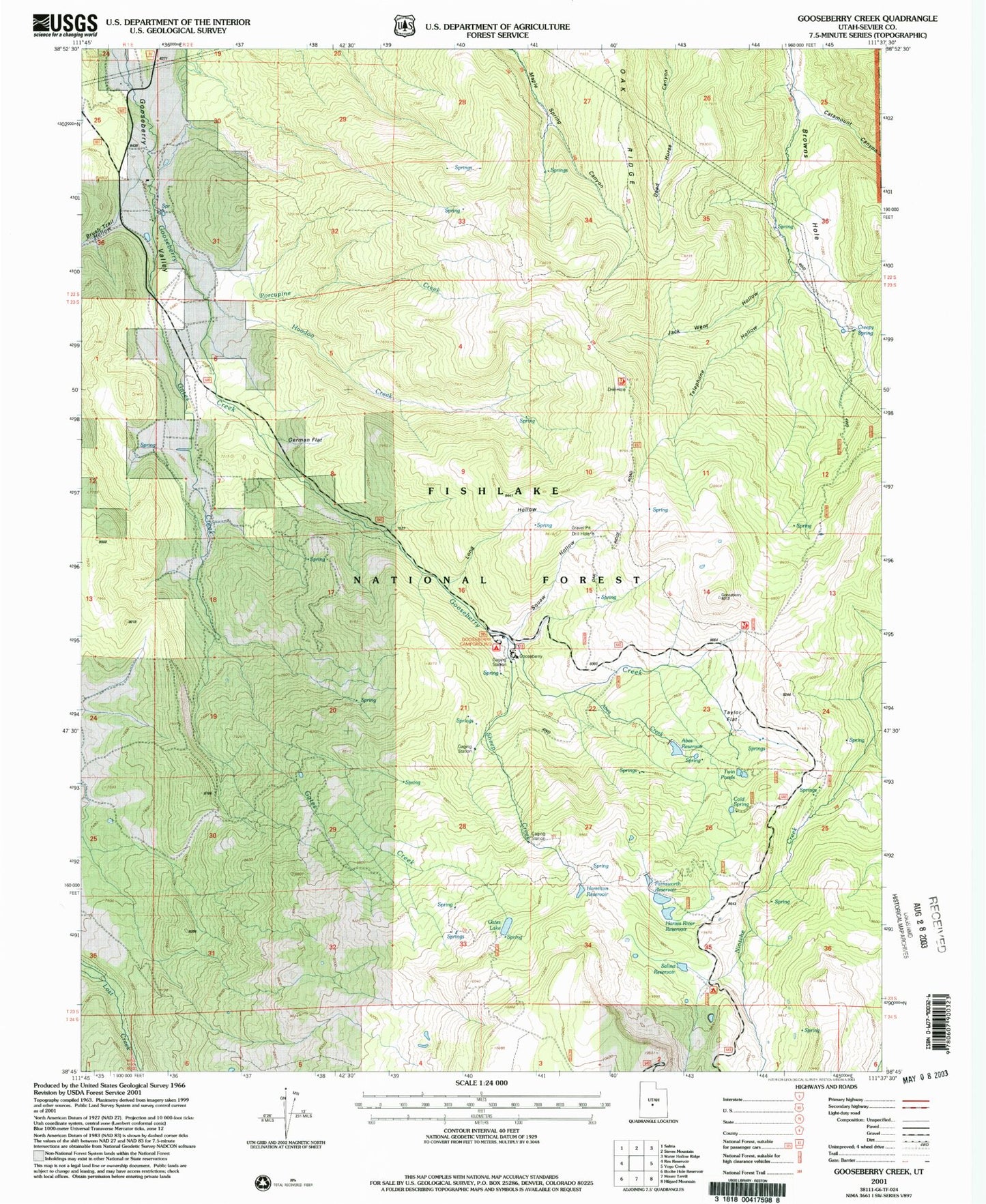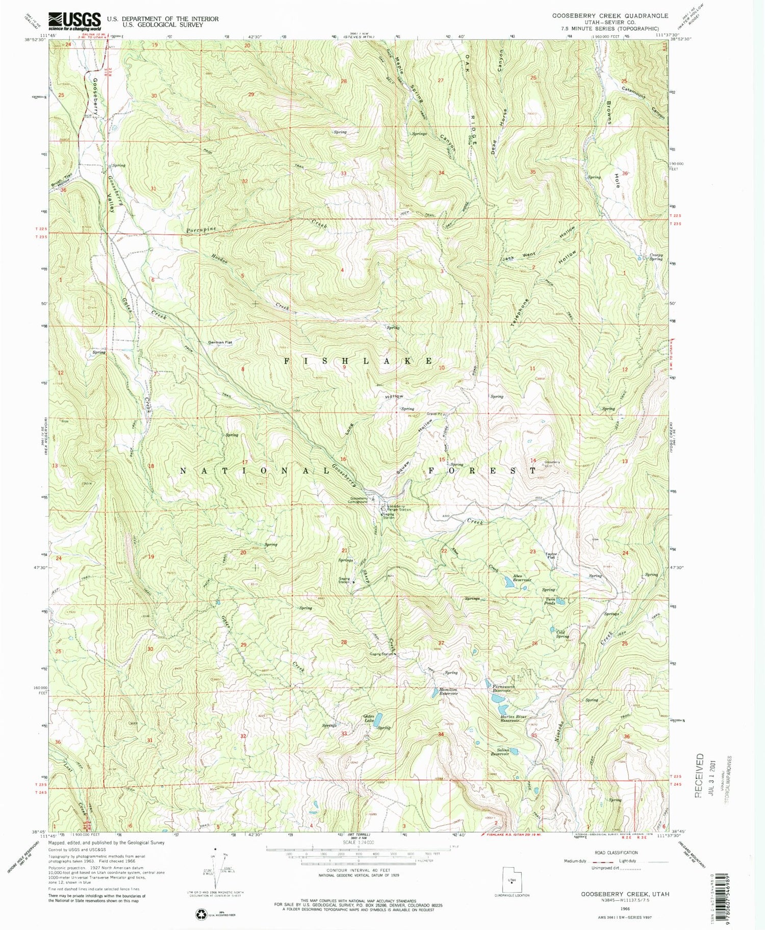
MyTopo
Classic USGS Gooseberry Creek Utah 7.5'x7.5' Topo Map
Couldn't load pickup availability
Historical USGS topographic quad map of Gooseberry Creek in the state of Utah. Map scale may vary for some years, but is generally around 1:24,000. Print size is approximately 24" x 27"
This quadrangle is in the following counties: Sevier.
The map contains contour lines, roads, rivers, towns, and lakes. Printed on high-quality waterproof paper with UV fade-resistant inks, and shipped rolled.
Contains the following named places: Abes Creek, Abes Reservoir, Brush Trail Hollow, Catamount Canyon, Cold Spring, Creepy Spring, Farnsworth Dam, Farnsworth Reservoir, Gates Creek, Gates Lake, German Flat, Gooseberry, Gooseberry Campground, Gooseberry Ranger Station, Hamilton Reservoir, Harves River Reservoir, Hoodoo Creek, Jack Went Hollow, Long Hollow, Oak Ridge, Porcupine Creek, Salina City Dam, Salina Reservoir, Sheep Creek, Squaw Hollow, Taylor Flat, Telephone Hollow, Twin Ponds