MyTopo
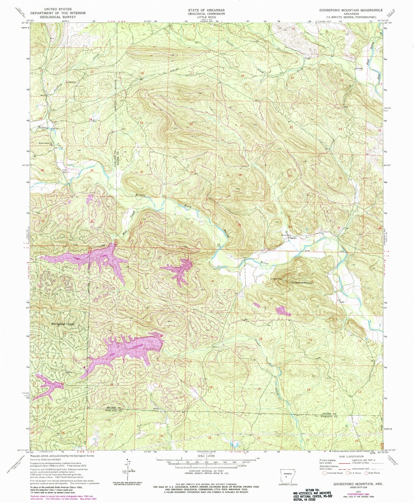
Classic USGS Goosepond Mountain Arkansas 7.5'x7.5' Topo Map
Couldn't load pickup availability
Historical USGS topographic quad map of Goosepond Mountain in the state of Arkansas. Map scale may vary for some years, but is generally around 1:24,000. Print size is approximately 24" x 27"
This quadrangle is in the following counties: Garland, Saline.
The map contains contour lines, roads, rivers, towns, and lakes. Printed on high-quality waterproof paper with UV fade-resistant inks, and shipped rolled.
Contains the following named places: Angling Creek, Antioch Church, Balboa Golf Course, Beaudry, Blocher, Brushy Creek, Coronado Golf Course, Cortez Golf Course, Electric, Goosepond Mountain, Hot Springs Village, Hot Springs Village Census Designated Place, Hot Springs Village Fire Department Cortez Station, Hot Springs Village Fire Department Station 3, Howard Mountain, Jessieville Fire Department Station 3, Lake Balboa, Lake Coronado, Lake Coronado Dam, Lake Cortez, Lake Cortez Dam, Lake Lago, Lake Lago Dam, Lake Pineda, Little Alum Fork, Marble Landmark Church, Mill Creek, Pineda Dam, Talley Cemetery, Township of Marble, ZIP Code: 71909