MyTopo
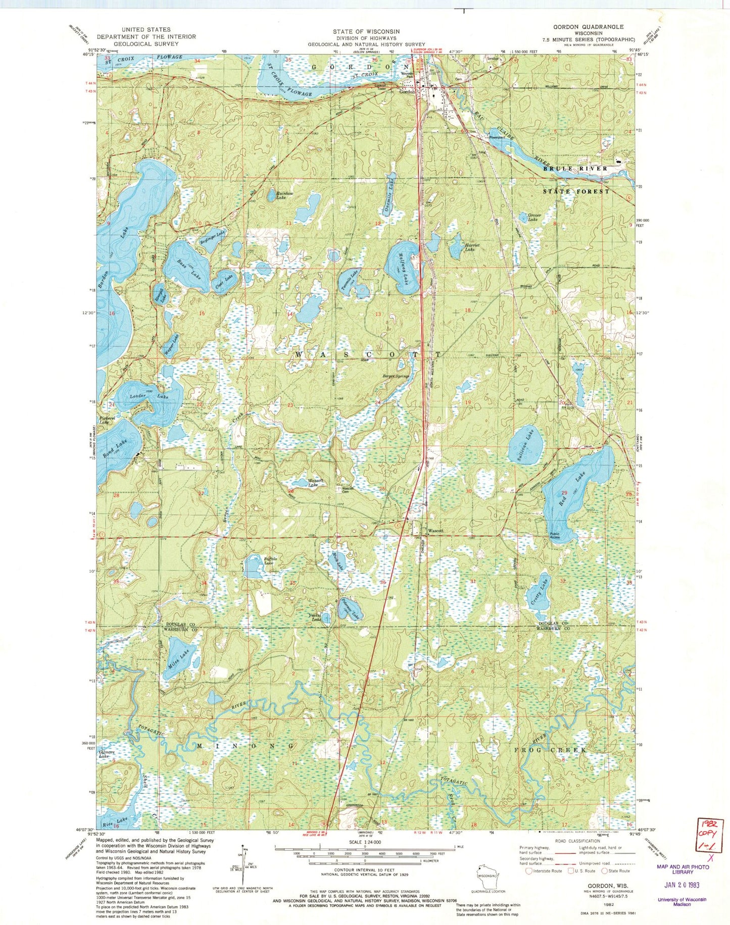
Classic USGS Gordon Wisconsin 7.5'x7.5' Topo Map
Couldn't load pickup availability
Historical USGS topographic quad map of Gordon in the state of Wisconsin. Map scale may vary for some years, but is generally around 1:24,000. Print size is approximately 24" x 27"
This quadrangle is in the following counties: Douglas, Washburn.
The map contains contour lines, roads, rivers, towns, and lakes. Printed on high-quality waterproof paper with UV fade-resistant inks, and shipped rolled.
Contains the following named places: Arrowhead Lake, Bass Lake, Beglinger Lake, Bergen Springs, Bluegill Lake, Bond Lake, Brule River State Forest Annex, Buffalo Lake, Clear Lake, Crotty Lake, Eau Claire River Flowage 33, Frog Creek, Gordon, Gordon 2WP49 Dam, Gordon Census Designated Place, Gordon Post Office, Gordon Town Constable, Gordon Volunteer Fire Department, Gordon Wascott Emergency Medical Services, Grover Lake, Harriet Lake, Kreide Lake, Leader Lake, Miles Lake, Muck Lake, Northwood School, One Mile Lake, Peterson Lake, Rainbow Lake, Red Lake, Rice Lake, Shell Creek, Sullivan Lake, Town of Wascott, Two Mile Lake, Wagner Lake, Wascott, Wascott Cemetery, Wascott Lake, Whitefish Lake, Yoekel Lake