MyTopo
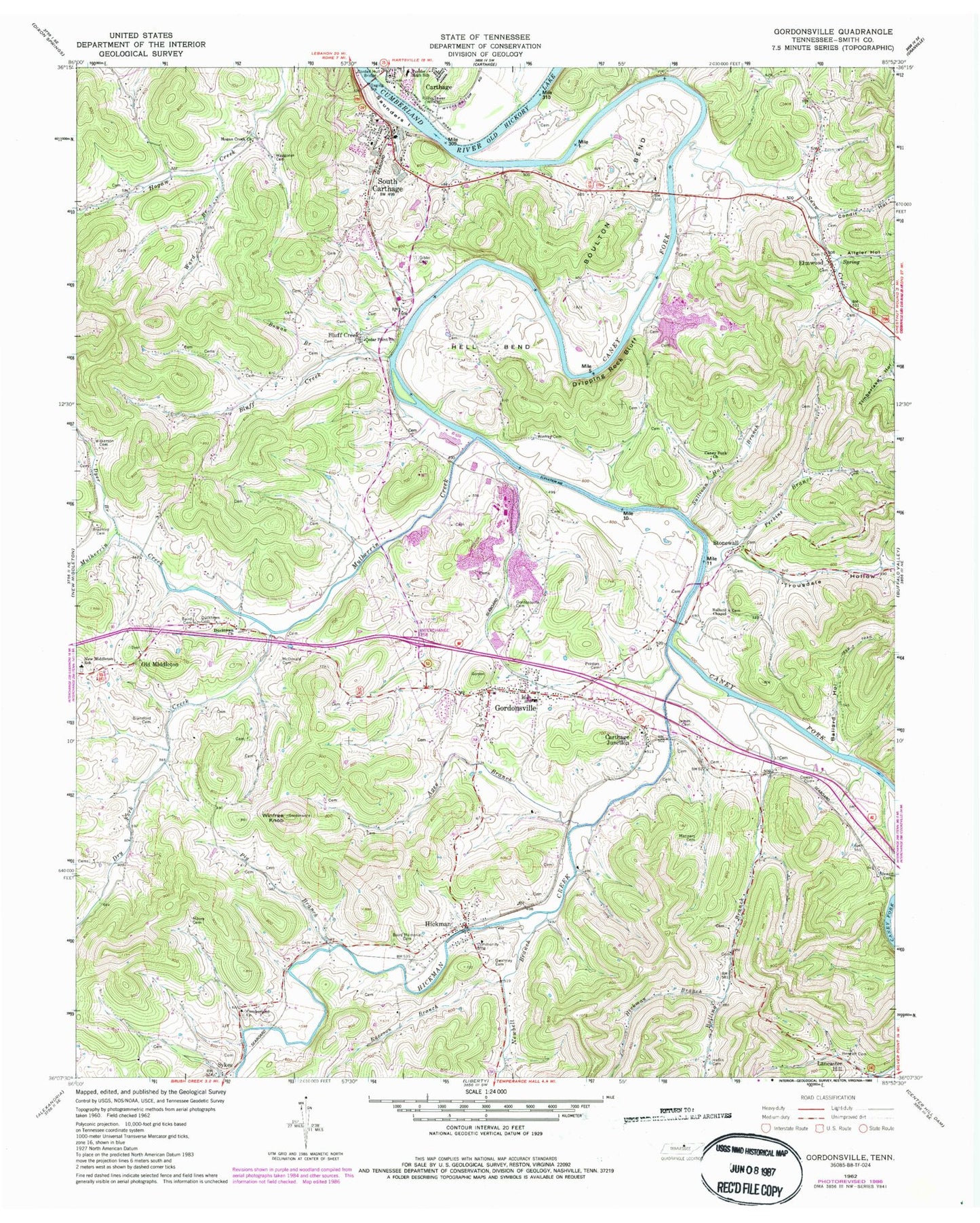
Classic USGS Gordonsville Tennessee 7.5'x7.5' Topo Map
Couldn't load pickup availability
Historical USGS topographic quad map of Gordonsville in the state of Tennessee. Typical map scale is 1:24,000, but may vary for certain years, if available. Print size: 24" x 27"
This quadrangle is in the following counties: Smith.
The map contains contour lines, roads, rivers, towns, and lakes. Printed on high-quality waterproof paper with UV fade-resistant inks, and shipped rolled.
Contains the following named places: Cowan Hollow, Snow Creek, South Carthage, Stewart Cemetery, Stonewall, Sullivan Hall Branch, Trousdale Hollow, Turner High School, Waggoner Cemetery, Ward Branch, Wilkerson Cemetery, Winfree Cemetery, Winfree Knob, Agee Branch, Allgier Hollow, Baird Cemetery, Baird Memorial Cemetery, Ballard Hollow, Bennett Cemetery, Bluff Creek, Bolling Branch, Boman Branch, Bradford Cemetery, Bransford Cemetery, Carthage Junction, Coffee Cemetery, Cordell Hull Bridge, Cowan Cemetery, Dripping Rock Bluff, Dry Fork Creek, Ducktown Cemetery, Dyer Branch, Elmwood, Gibbs Cemetery, Gordonsville, Gordonsville Cemetery, Gwaltney Cemetery, Heflin Cemetery, Hell Bend, Hickman, Hickman Branch, Hickman Creek, Hogan Creek Church, James Cemetery, Lancaster Hill, Manners Cemetery, McDonald Cemetery, Moore Cemetery, Mulherrin Creek, Newbell Branch, Old Middleton, Perkins Branch, Pig Branch, Preston Cemetery, Raccoon Branch, Jersey Miniery Zinc Company Lake, Jersey Miniery Zinc Company Dam, Boulton Bend, Caney Fork Church, Cedar Point Church, Condit Hollow, Stonewall Bridge, Turney Ford Field, Ballard Chapel, Union Hill Cumberland Presbyterian Church, Ducktown Church, Trousdales Ferry (historical), Bluff Creek, Benton McMillian Memorial Bridge, Bluff Creek School (historical), Bolling Branch Church (historical), Bolling Branch School (historical), Bowlings Branch Church of God of Prophecy, Coopers School (historical), Elmwood School (historical), Elmwood United Methodist Church, Gordonsville First Baptist Church, Gordonsville High School, Hickman Baptist Church, Hickman School (historical), Hogan Creek School (historical), Smith County Vocational Center, Stonewall School (historical), Caney Fork, WRKM-AM (Carthage), New Middleton Elementary School, South Carthage Division (historical), Elmwood Post Office, Gordonsville Post Office, Hickman Post Office, Town of Gordonsville, Town of South Carthage, Commissioner District 5, Commissioner District 7, Sykes Fire Department District 1, South Carthage Volunteer Fire Department, Gordonsville City Fire Department, Gordonsville Police Department, South Carthage Police Department, Hickman Census Designated Place