MyTopo
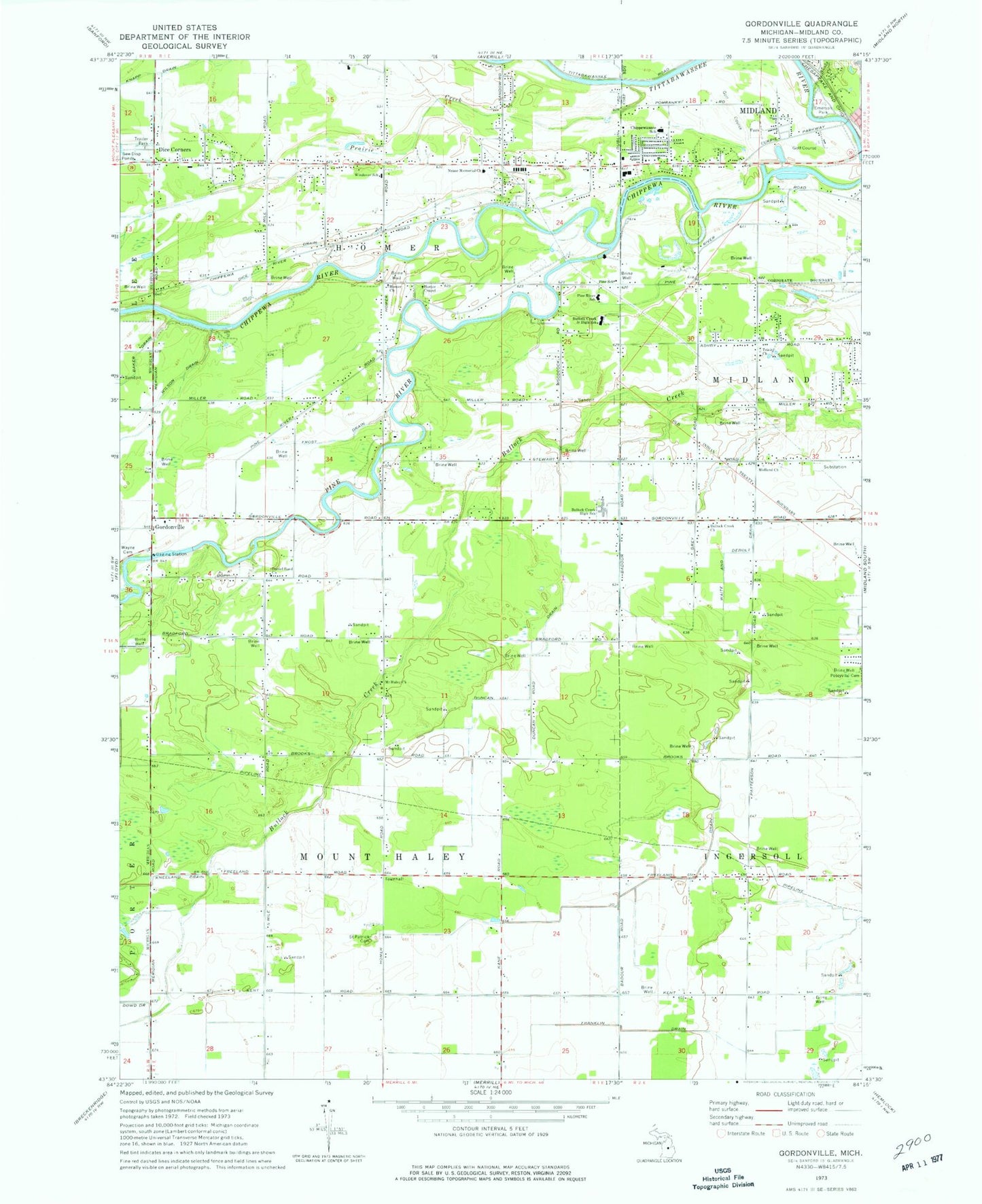
Classic USGS Gordonville Michigan 7.5'x7.5' Topo Map
Couldn't load pickup availability
Historical USGS topographic quad map of Gordonville in the state of Michigan. Map scale may vary for some years, but is generally around 1:24,000. Print size is approximately 24" x 27"
This quadrangle is in the following counties: Midland.
The map contains contour lines, roads, rivers, towns, and lakes. Printed on high-quality waterproof paper with UV fade-resistant inks, and shipped rolled.
Contains the following named places: Alden B Dow Museum of Science, Arbury Park, Barnes Post Office, Bullock Creek Church, Bullock Creek High School, Bullock Creek Junior High School, Chippewa Nature Center, Chippewassee Park, Chippewassee School, Chippewassee School Park, Country Side Mobile Home Park, Crane Post Office, Currie Municipal Golf Course, Daniel Band Church, Dice Corners, Dice Drain, Dow Gardens, Duncan Drain, Emerson Park, Faith Christian Assembly Church, Faith Wesleyan Church, Franklin Drain, Freeland Drain, Frost Drain, Gordonville, Gordonville Post Office, Gordonville United Methodist Church, Grace Bible Church, Homer Chapel, Homer Church, Homer Township Cemetery, Homer Township Fire Department, Knapp Drain, Midland Mennonite Church, Mount Haley Church, Nease Memorial Church, Pine River, Pine River School, Pine School, Prairie Creek, Revere Park, Riverside Golfside Park, Saint Patrick Cemetery, Snake Creek, Thrune Park, Township of Homer, Township of Mount Haley, Towsley Dike Park, Trinity Church, Upper Bridge Historical Marker, Wayne Cemetery, Windover School, ZIP Code: 48640