
MyTopo
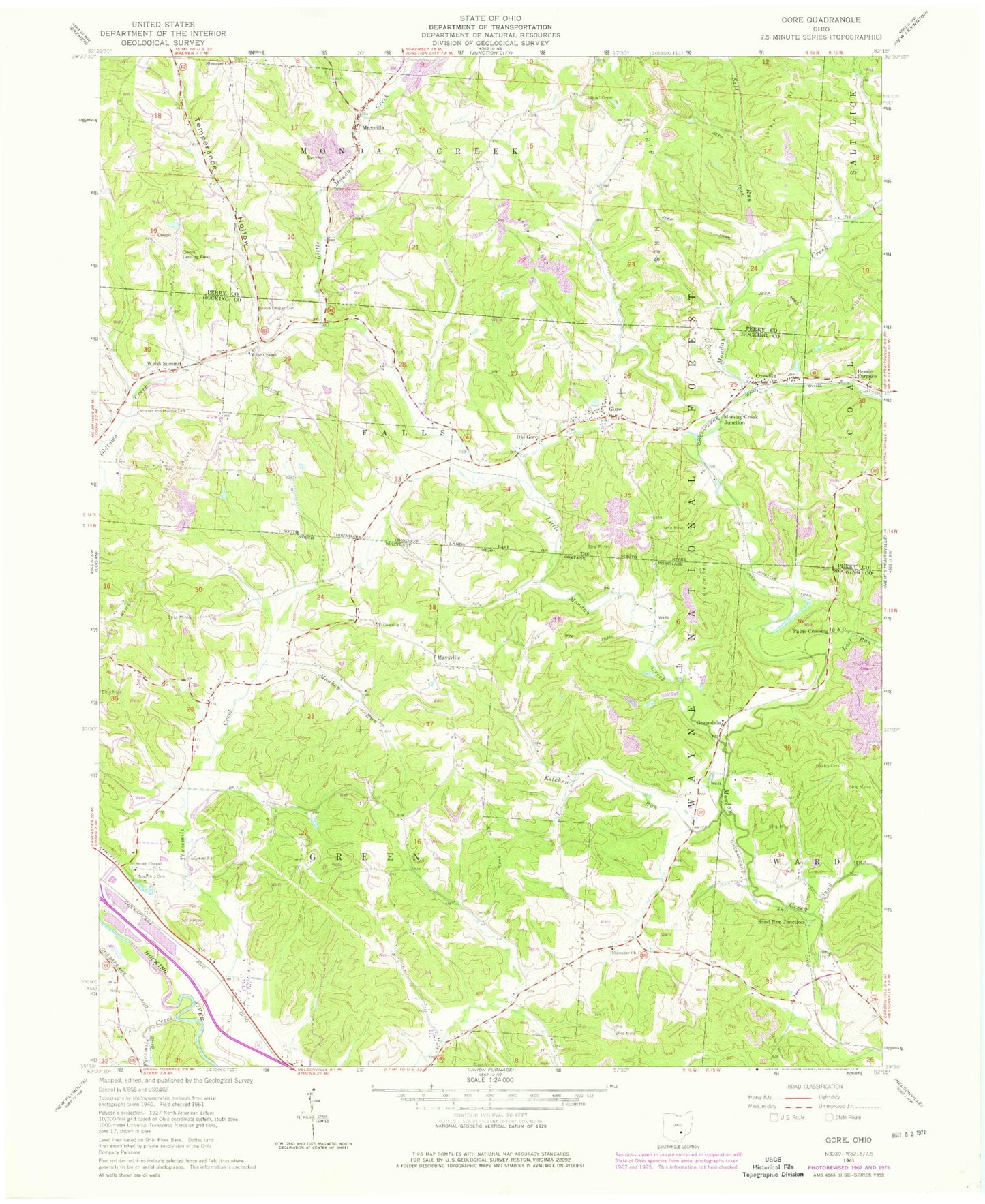
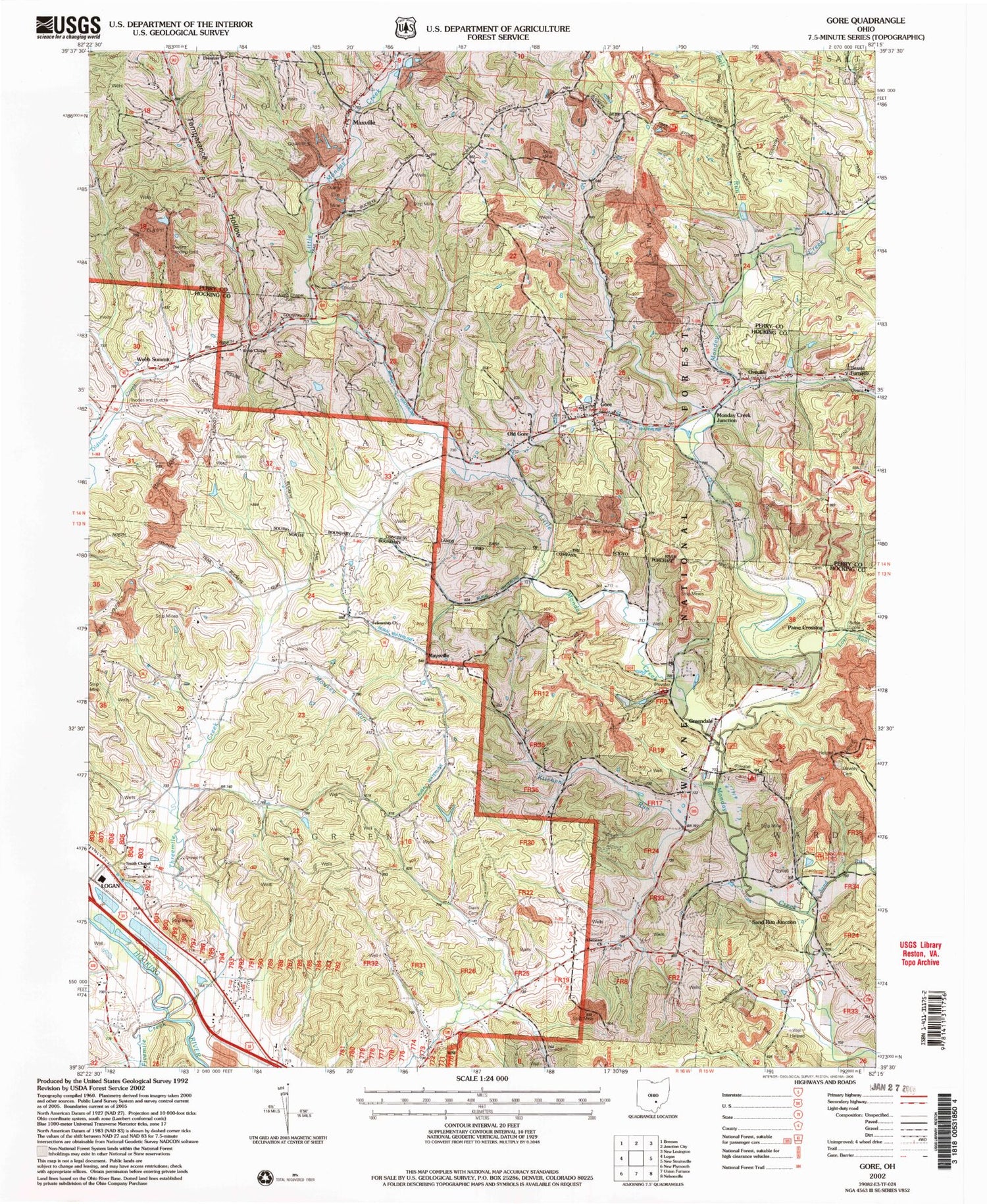
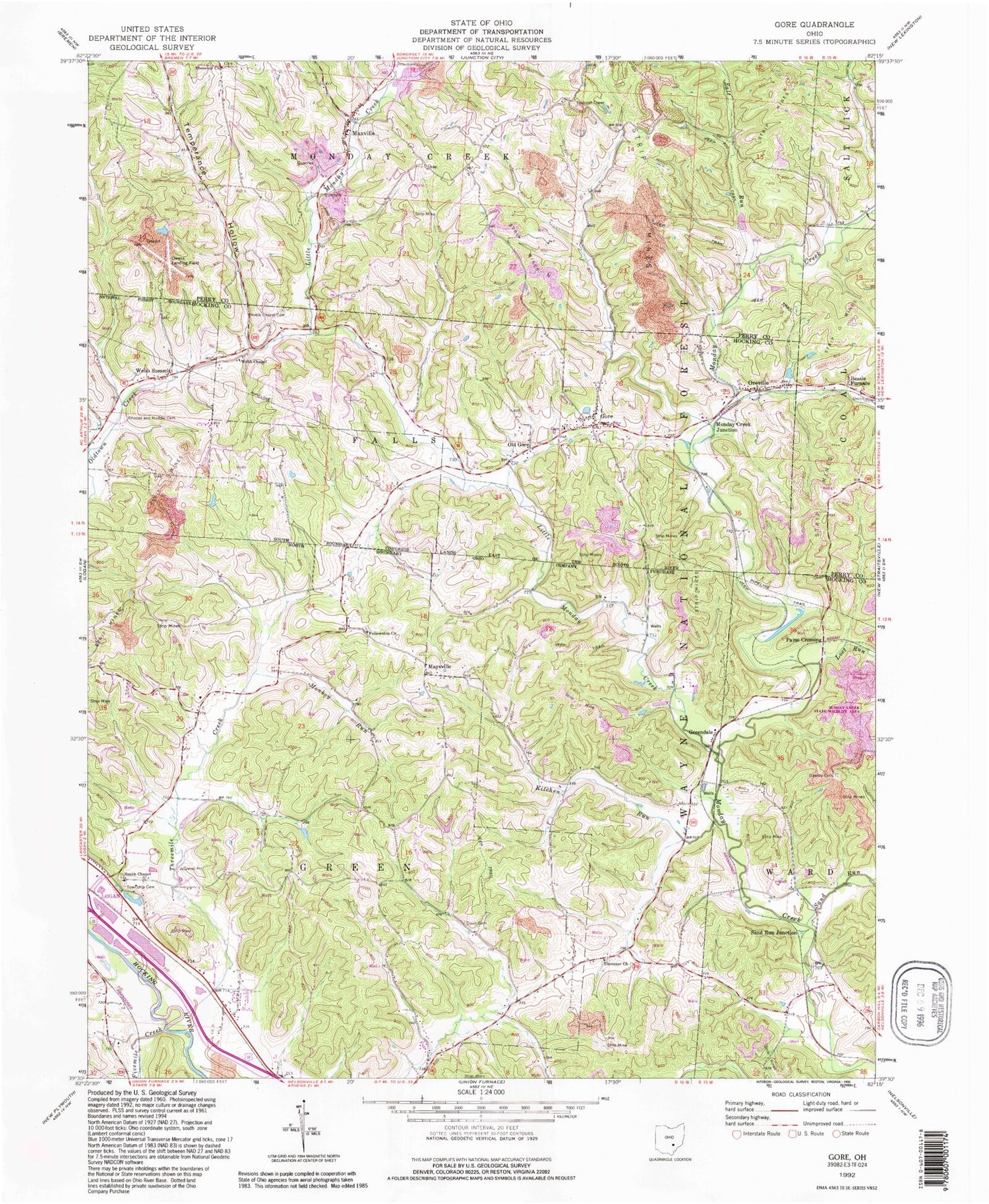
Classic USGS Gore Ohio 7.5'x7.5' Topo Map
Couldn't load pickup availability
Historical USGS topographic quad map of Gore in the state of Ohio. Typical map scale is 1:24,000, but may vary for certain years, if available. Print size: 24" x 27"
This quadrangle is in the following counties: Hocking, Perry.
The map contains contour lines, roads, rivers, towns, and lakes. Printed on high-quality waterproof paper with UV fade-resistant inks, and shipped rolled.
Contains the following named places: Downhour School (historical), Grant School (historical), Guess School (historical), Kachelmacher (historical), Coon School (historical), Hammond School (historical), Terrell School (historical), Sand Run, Lime Kiln Hollow, Winona (historical), Bessie Furnace, Dawley Cemetery, Ebenezer Church, Ebenezer Baptist Church, Fellowship Church, Fivemile Creek, Gore, Greendale, Kitchen Run, Little Monday Creek, Lost Run, Maxville, Maysville, Monday Creek Junction, Monkey Run, Old Gore, Oreville, Paine Crossing, Rhodes and Huddle Cemetery, Salt Run, Sand Run Junction, Smith Chapel, Temperance Hollow, Threemile Creek, Webb Chapel, Webb Chapel Cemetery, Webb Summit, Owens Landing Field (historical), Boyle Tipple, Buckeye Trail, Green Township Cemetery, Central Ohio Council BSA Pond Dam, Central Ohio Council BSA Pond, Tabor Memorial Recreation Area, Sand Run Recreation Area, Taber Memorial Recreation Site, Township of Green, Township of Monday Creek, Ebenezer Cemetery, Fellowship Cemetery, Gore Cemetery, Otterbein Chapel Cemetery, Payne Cemetery, Smith Chapel Cemetery, Ebenezer Baptist Cemetery, Gore Post Office (historical), Greendale Post Office (historical), Kachelmacher Post Office (historical), Webb Summit Post Office (historical), Winona Post Office (historical), Maxville Post Office (historical), Monday Creek Township Volunteer Fire Department, Maxville Quarries, Downhour School (historical), Grant School (historical), Guess School (historical), Kachelmacher (historical), Coon School (historical), Hammond School (historical), Terrell School (historical), Sand Run, Lime Kiln Hollow, Winona (historical), Bessie Furnace, Dawley Cemetery, Ebenezer Church, Ebenezer Baptist Church, Fellowship Church, Fivemile Creek, Gore, Greendale, Kitchen Run, Little Monday Creek, Lost Run, Maxville, Maysville, Monday Creek Junction, Monkey Run, Old Gore, Oreville, Paine Crossing, Rhodes and Huddle Cemetery, Salt Run, Sand Run Junction, Smith Chapel, Temperance Hollow, Threemile Creek, Webb Chapel, Webb Chapel Cemetery, Webb Summit, Owens Landing Field (historical), Boyle Tipple, Buckeye Trail, Green Township Cemetery, Central Ohio Council BSA Pond Dam, Central Ohio Council BSA Pond, Tabor Memorial Recreation Area, Sand Run Recreation Area, Taber Memorial Recreation Site, Township of Green, Township of Monday Creek, Ebenezer Cemetery, Fellowship Cemetery, Gore Cemetery, Otterbein Chapel Cemetery, Payne Cemetery, Smith Chapel Cemetery, Ebenezer Baptist Cemetery, Gore Post Office (historical), Greendale Post Office (historical), Kachelmacher Post Office (historical), Webb Summit Post Office (historical), Winona Post Office (historical), Maxville Post Office (historical), Monday Creek Township Volunteer Fire Department, Maxville Quarries