MyTopo
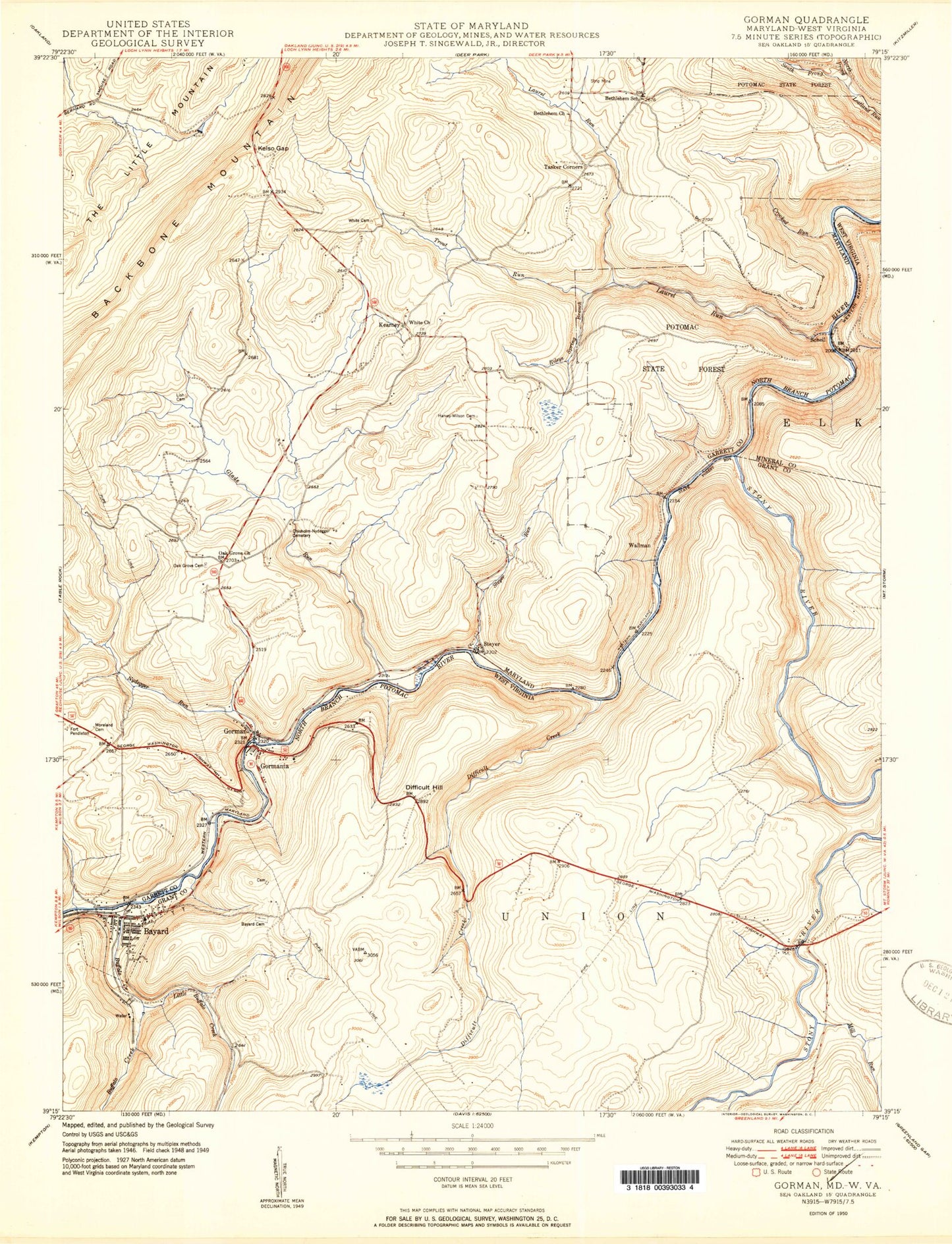
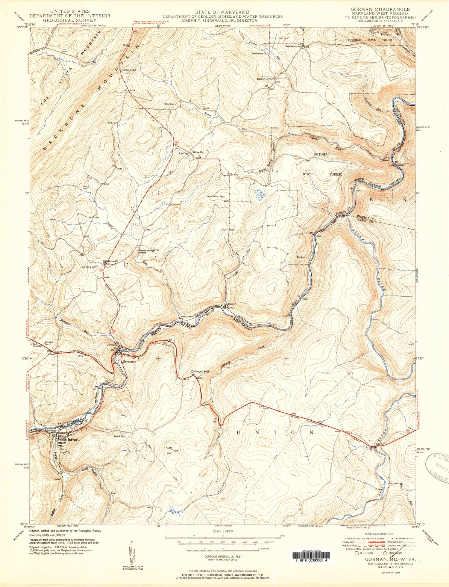
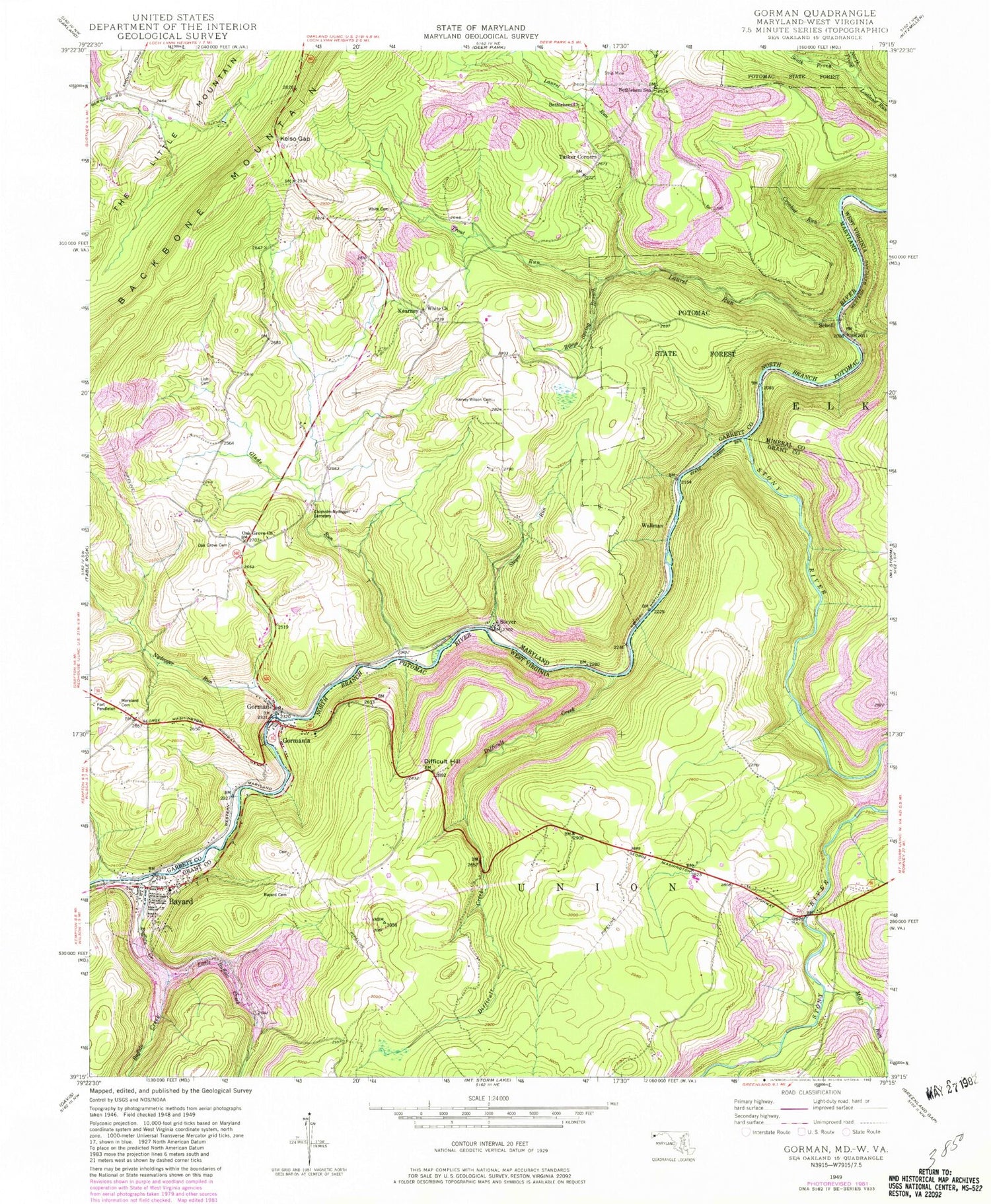
Classic USGS Gorman Maryland 7.5'x7.5' Topo Map
Couldn't load pickup availability
Historical USGS topographic quad map of Gorman in the states of Maryland, West Virginia. Map scale may vary for some years, but is generally around 1:24,000. Print size is approximately 24" x 27"
This quadrangle is in the following counties: Garrett, Grant, Mineral.
The map contains contour lines, roads, rivers, towns, and lakes. Printed on high-quality waterproof paper with UV fade-resistant inks, and shipped rolled.
Contains the following named places: Bayard, Bayard Cemetery, Bayard Post Office, Bayard Truss Bridge, Bayard Volunteer Fire Department, Berrett, Bethlehem Church, Bethlehem School, Bradshaw, Buffalo Creek, Chisholm - Nydegger Cemetery, Crooked Run, Dales Spring, Difficult Creek, Difficult Hill, District 16 Mountain Lake Park, Fort Pendleton, Glade Run, Gorman, Gorman Census Designated Place, Gorman Volunteer Fire Department Station 120, Gormania, Gormania Bridge, Gormania Post Office, Harvey - Wilson Cemetery, Kearney, Kelso Gap, Laurel Run, Lish Cemetery, Little Buffalo Creek, Little Buffalo Creek - North Branch Dam, Little Yok Reservoir Site Number 5, Mill Run, Moreland Cemetery, North Prong Lostland Run, Nydegger Run, Oak Grove Cemetery, Oak Grove Church, Potomac State Forest, Rileys Spring Branch, Schell, South Prong Lostland Run, Steyer, Steyer Run, Stony River, Town of Bayard, Trout Run, Union Educational Complex, Wallman, White Cemetery, White Church, White Church Community Cemetery, ZIP Code: 26720