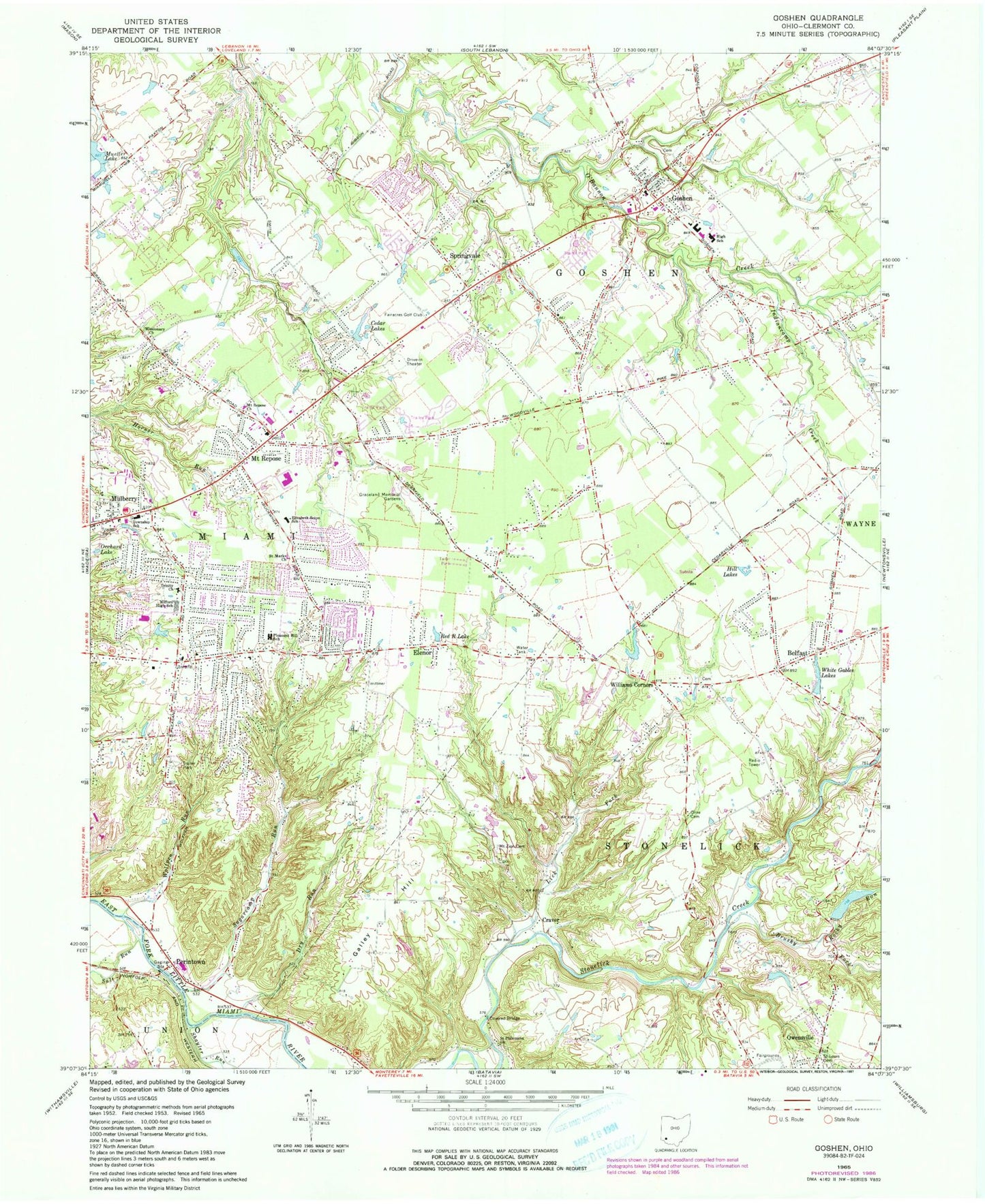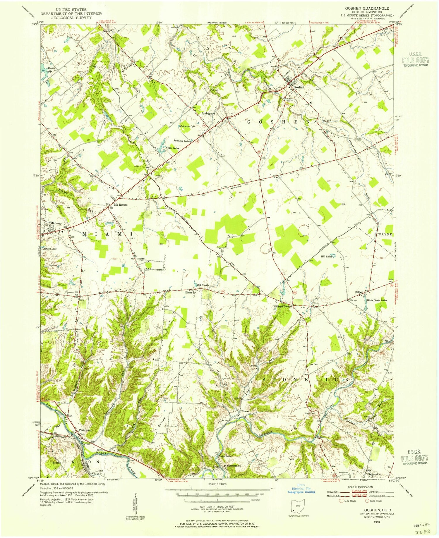
MyTopo
Classic USGS Goshen Ohio 7.5'x7.5' Topo Map
Couldn't load pickup availability
Historical USGS topographic quad map of Goshen in the state of Ohio. Typical map scale is 1:24,000, but may vary for certain years, if available. Print size: 24" x 27"
This quadrangle is in the following counties: Clermont.
The map contains contour lines, roads, rivers, towns, and lakes. Printed on high-quality waterproof paper with UV fade-resistant inks, and shipped rolled.
Contains the following named places: Belfast, Brushy Fork, Cedar Lakes, Dry Run, Elizabeth Seton School, Graceland Memorial Gardens, Hill Lakes, Lick Fork, Milford High School, Missionary Church, Mount Repose Church, Mount Zion Cemetery, Mueller Lake, Olive Cemetery, Orchard Lake, Red R Lake, Rocky Run, Saint Philomena Church, Salt Run, Springvale, White Gables Lakes, Perintown, Craver, Elenor, Galley Hill, Goshen, Mount Repose, Milford Assembly of God Church, Calvary Baptist Church, Belfast United Methodist Church, Spaulding Middle School, Marr Primary School, Cook Elementary School, Goshen Intermediate School, Goshen High School, Manila School (historical), Spread Eagle School (historical), Belfast School (historical), Brushy Fork School (historical), Sugar Grove School (historical), Salem School (historical), Stonelick-Perintown Bridge, Mount Zion School (historical), Galley Hill School (historical), O'Bannon Creek Golf Course, Hickory Woods Golf Course, Union School (historical), Wood Creek Golf Course, Miami Elementary School, Milford Junior High School, Clermont County Fairgrounds, Live Oaks Vocational School, Miami Township Hall, Smith Elementary School, Saint Marks Lutheran Church, Trinity United Methodist Church, Williams Corners, Ashdale, Mulberry, Indiancamp Creek, Shayler Run, Sugarcamp Run, Wolfpen Run, Cincinnati Nature Center Lake, Heritage Lake Dam, Heritage Lake, Syrian Shrine Oasis Lake Dam, Wiemeyer Pond Dam, Wiemeyer Pond, Sumner Pond Dam, Sumner Pond, Eagles Nest Golf Course, Charles L Seipelt Elementary School, Obannon Creek Aerodrome, Township of Goshen, Township of Miami, Township of Stonelick, Fairacres Lake, Pleasant Hill Church (historical), Rapp Cemetery, Day Heights, Goshen Cemetery, Saint Louis Catholic Cemetery, Saint Philomena Cemetery, Simpkins Cemetery, Goshen Post Office, Perintown Post Office (historical), Belfast Post Office (historical), Mulberry Post Office (historical), Mount Repose Post Office (historical), Craver Post Office (historical), Elenor Post Office (historical), Oasis Golf Course, Longfield Acres Park, Miami Meadow Park, Mount Repose Census Designated Place, Day Heights Census Designated Place, Stonelick Township Fire and Rescue Station 2, Miami Township Fire and EMS Station 28, Miami Township Fire and EMS Station 26, Goshen Township Fire and EMS Station 18, Goshen Census Designated Place, Goshen Township Police Department, Miami Township Police Department