
MyTopo
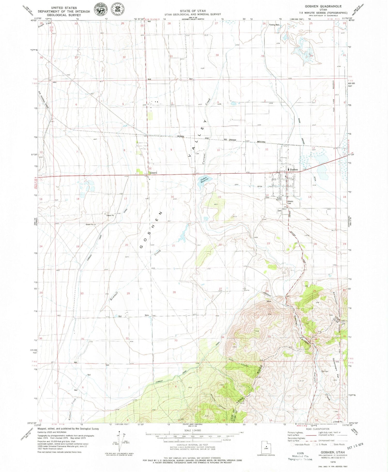
Classic USGS Goshen Utah 7.5'x7.5' Topo Map
Couldn't load pickup availability
Historical USGS topographic quad map of Goshen in the state of Utah. Map scale may vary for some years, but is generally around 1:24,000. Print size is approximately 24" x 27"
This quadrangle is in the following counties: Juab, Utah.
The map contains contour lines, roads, rivers, towns, and lakes. Printed on high-quality waterproof paper with UV fade-resistant inks, and shipped rolled.
Contains the following named places: Alcorns Canyon, City Ditch, Crooked Canyon, Currant Creek, Currant Creek Canal, Elberta Census Designated Place, Elberta Post Office, First Canyon, Goosenest Canyon, Goshen, Goshen Canyon, Goshen Cemetery, Goshen Division, Goshen Elementary School, Goshen Fire Department, Goshen Post Office, Goshen Reservoir, Government Canyon, Government Flat, Kimball Creek, Lant, Mount Nebo, The Church of Jesus Christ of Latter Day Saints, Town of Goshen, ZIP Codes: 84626, 84633


