MyTopo
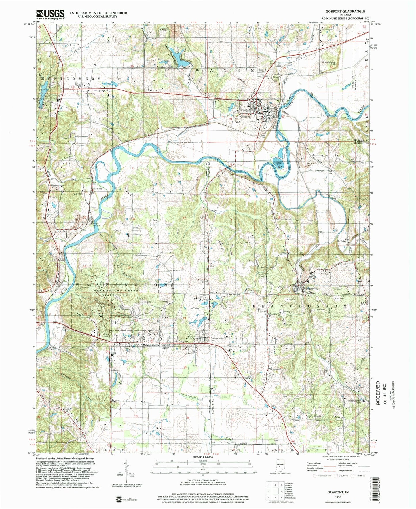
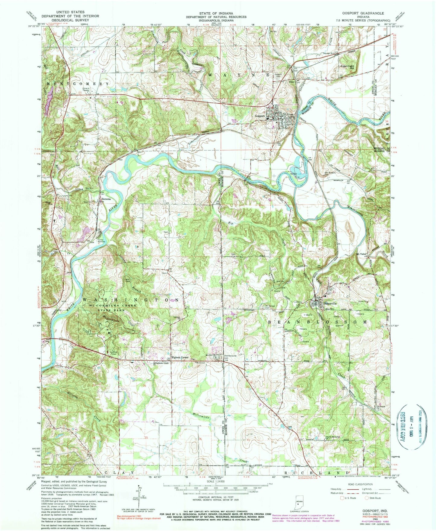
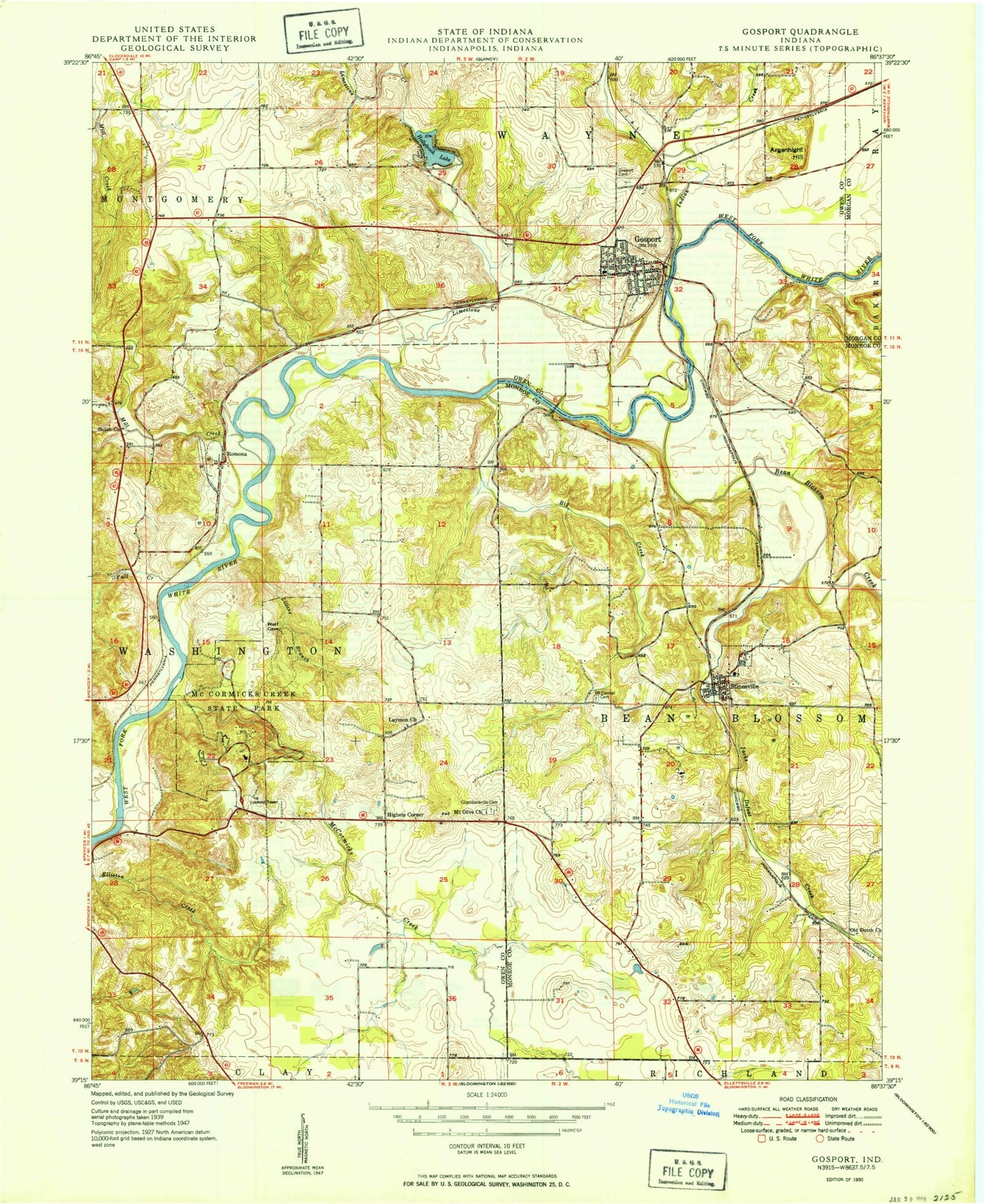
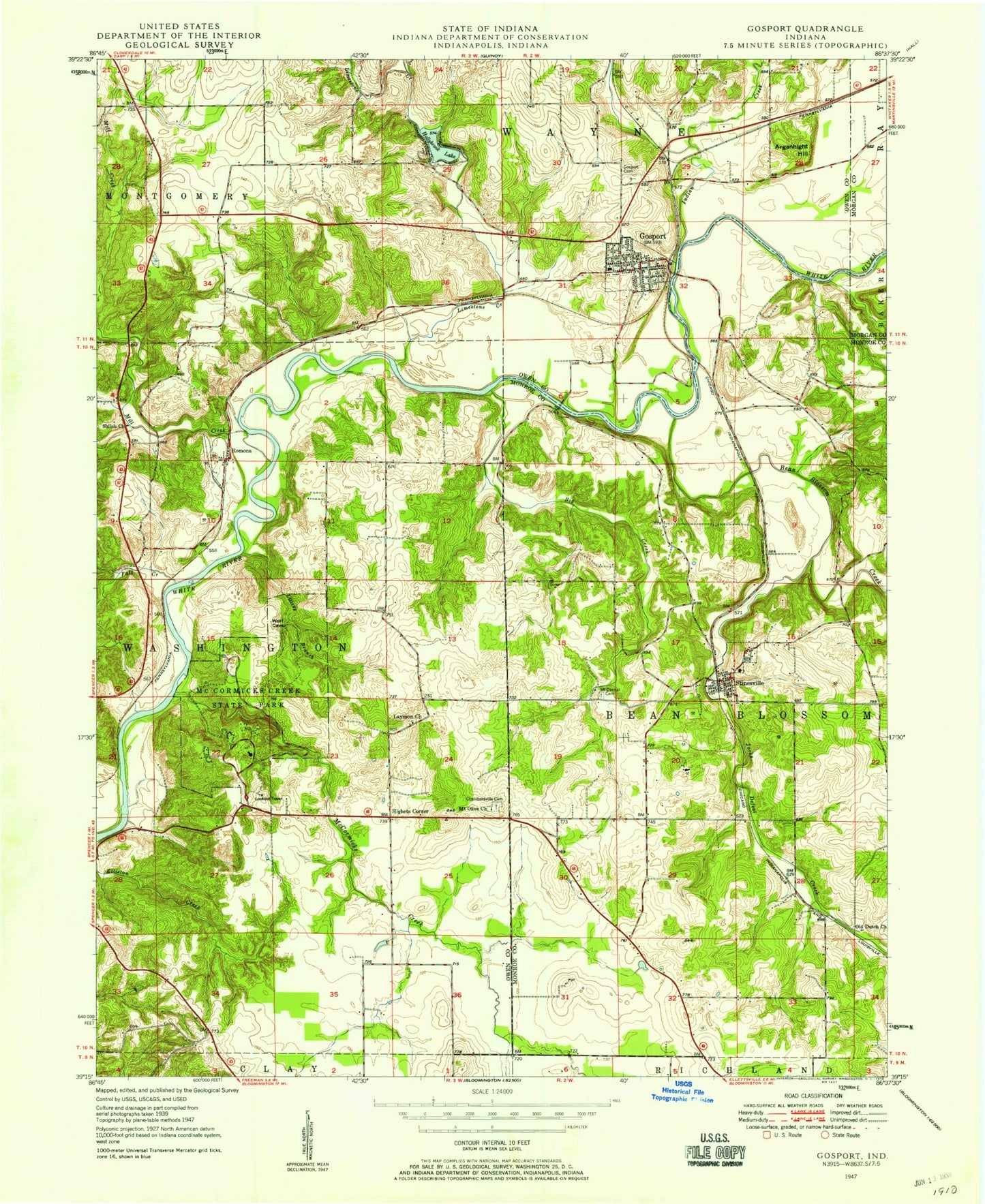
Classic USGS Gosport Indiana 7.5'x7.5' Topo Map
Couldn't load pickup availability
Historical USGS topographic quad map of Gosport in the state of Indiana. Typical map scale is 1:24,000, but may vary for certain years, if available. Print size: 24" x 27"
This quadrangle is in the following counties: Monroe, Morgan, Owen.
The map contains contour lines, roads, rivers, towns, and lakes. Printed on high-quality waterproof paper with UV fade-resistant inks, and shipped rolled.
Contains the following named places: Beanblossom Creek, Big Creek, Camp Romona, Chafin Memorial Church, Chambersville Cemetery, Fall Creek, Gosport, Gosport Cemetery, Highets Corner, Hollybrook Lake, Indian Creek, Jacks Defeat Creek, Laymon Church, Limestone Creek, Littens Branch, Little Mill Creek, McCormicks Creek, McCormicks Creek Church, Mill Creek, Mount Carmel Cemetery, Mount Olive Church, Mount Tabor, Old Dutch Church, Romona, Shiloh Church, Silex, Stinesville, Van Buskirk Cemetery, Gosport Elementary School, Stinesville Elementary School, Amazon Lake Dam, Amazon Lake, Farm Pond Dam, Farm Pond, Murdy Station, McCormicks Creek State Park, Arganbright Hill, Township of Bean Blossom, Township of Wayne, Town of Gosport, Town of Stinesville, Gosport Quarry, Bean Blossom Township - Stinesville Fire Department, Gosport Volunteer Fire Department, Gosport Fire Department Station 2, Bean Blossom - Stinesville Fire Department, Wolf Natural Bridges, Stinesville Police Department, Gosport Police Department, Gosport Post Office, Stinesville Post Office, Beanblossom Creek, Big Creek, Camp Romona, Chafin Memorial Church, Chambersville Cemetery, Fall Creek, Gosport, Gosport Cemetery, Highets Corner, Hollybrook Lake, Indian Creek, Jacks Defeat Creek, Laymon Church, Limestone Creek, Littens Branch, Little Mill Creek, McCormicks Creek, McCormicks Creek Church, Mill Creek, Mount Carmel Cemetery, Mount Olive Church, Mount Tabor, Old Dutch Church, Romona, Shiloh Church, Silex, Stinesville, Van Buskirk Cemetery, Gosport Elementary School, Stinesville Elementary School, Amazon Lake Dam, Amazon Lake, Farm Pond Dam, Farm Pond, Murdy Station, McCormicks Creek State Park, Arganbright Hill, Township of Bean Blossom, Township of Wayne, Town of Gosport, Town of Stinesville, Gosport Quarry, Bean Blossom Township - Stinesville Fire Department, Gosport Volunteer Fire Department, Gosport Fire Department Station 2, Bean Blossom - Stinesville Fire Department, Wolf Natural Bridges, Stinesville Police Department, Gosport Police Department, Gosport Post Office, Stinesville Post Office, Beanblossom Creek, Big Creek, Camp Romona, Chafin Memorial Church, Chambersville Cemetery, Fall Creek, Gosport, Gosport Cemetery, Highets Corner, Hollybrook Lake, Indian Creek, Jacks Defeat Creek, Laymon Church, Limestone Creek, Littens Branch, Little Mill Creek, McCormicks Creek, McCormicks Creek Church, Mill Creek, Mount Carmel Cemetery, Mount Olive Church, Mount Tabor, Old Dutch Church, Romona, Shiloh Church, Silex, Stinesville, Van Buskirk Cemetery, Gosport Elementary School, Stinesville Elementary School, Amazon Lake Dam, Amazon Lake, Farm Pond Dam, Farm Pond, Murdy Station, McCormicks Creek State Park, Arganbright Hill, Township of Bean Blossom, Township of Wayne, Town of Gosport, Town of Stinesville, Gosport Quarry, Bean Blossom Township - Stinesville Fire Department, Gosport Volunteer Fire Department, Gosport Fire Department Station 2, Bean Blossom - Stinesville Fire Department, Wolf Natural Bridges, Stinesville Police Department, Gosport Police Department, Gosport Post Office, Stinesville Post Office