MyTopo
Classic USGS Gothenburg SW Nebraska 7.5'x7.5' Topo Map
Regular price
$16.95
Regular price
Sale price
$16.95
Unit price
per
Couldn't load pickup availability
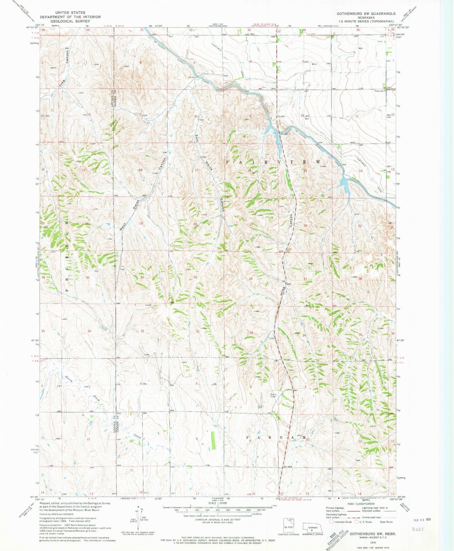
Historical USGS topographic quad map of Gothenburg SW in the state of Nebraska. Map scale may vary for some years, but is generally around 1:24,000. Print size is approximately 24" x 27"
This quadrangle is in the following counties: Dawson, Lincoln.
The map contains contour lines, roads, rivers, towns, and lakes. Printed on high-quality waterproof paper with UV fade-resistant inks, and shipped rolled.
Contains the following named places: Earth Dam-Canal Mile 408 Dam, Earth Dam-Canal Mile 427 Dam, East Smith Canyon, Fairview Election Precinct, Hiles Canyon, Potters School, Thirtymile Canal, West Smith Canyon, Wiggins Dam, Wiggins Reservoir, Young Dam, Young Reservoir