MyTopo
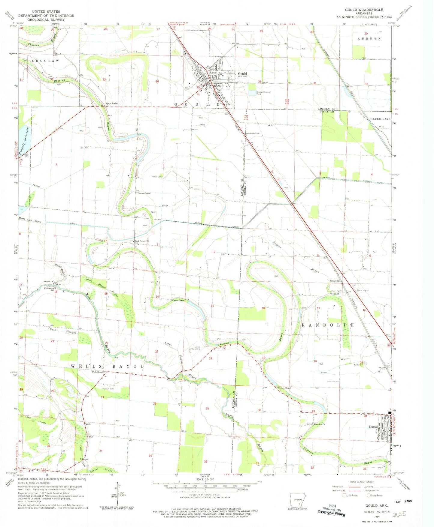
Classic USGS Gould Arkansas 7.5'x7.5' Topo Map
Couldn't load pickup availability
Historical USGS topographic quad map of Gould in the state of Arkansas. Map scale may vary for some years, but is generally around 1:24,000. Print size is approximately 24" x 27"
This quadrangle is in the following counties: Desha, Lincoln.
The map contains contour lines, roads, rivers, towns, and lakes. Printed on high-quality waterproof paper with UV fade-resistant inks, and shipped rolled.
Contains the following named places: Almetta Church, Bailey Chapel Church, Banks Cemetery, Billy Free Municipal Airport, Choctaw Bayou, City of Gould, Curry Brake, Dark Corner School, Dark Corners Church, Eugene Bayou, Flynn, Gibson Brake, Gould, Gould Elementary School, Gould Fire Department, Gould High School, Gould Middle School, Gould Police Department, Gould Post Office, Holthoff Reservoir, Hudson Landing Strip, KDDA-AM (Dumas), Kerch Canal, KXFE-FM (Dumas), Ladd Canal, Little Wagon Bayou, Madden Cemetery, Mayer Airport, Mills, Mount Moriah Church, Oems Free Gift Church, Parma, Rankin Chapel Baptist Church, Reedville, Reedville Airport, Reedville School, Rotan, Smyrna Missionary Baptist Church, Thomas Cemetery, Thomas Chapel, Township of Gould, Township of Randolph, Township of Wells Bayou, Twin Sloughs, Union Grove Church, Wagon Bayou, Watson Chapel, Wells Bayou, Wells Bayou School, Wells Chapel, West Dumas Church of God in Christ, ZIP Code: 71639