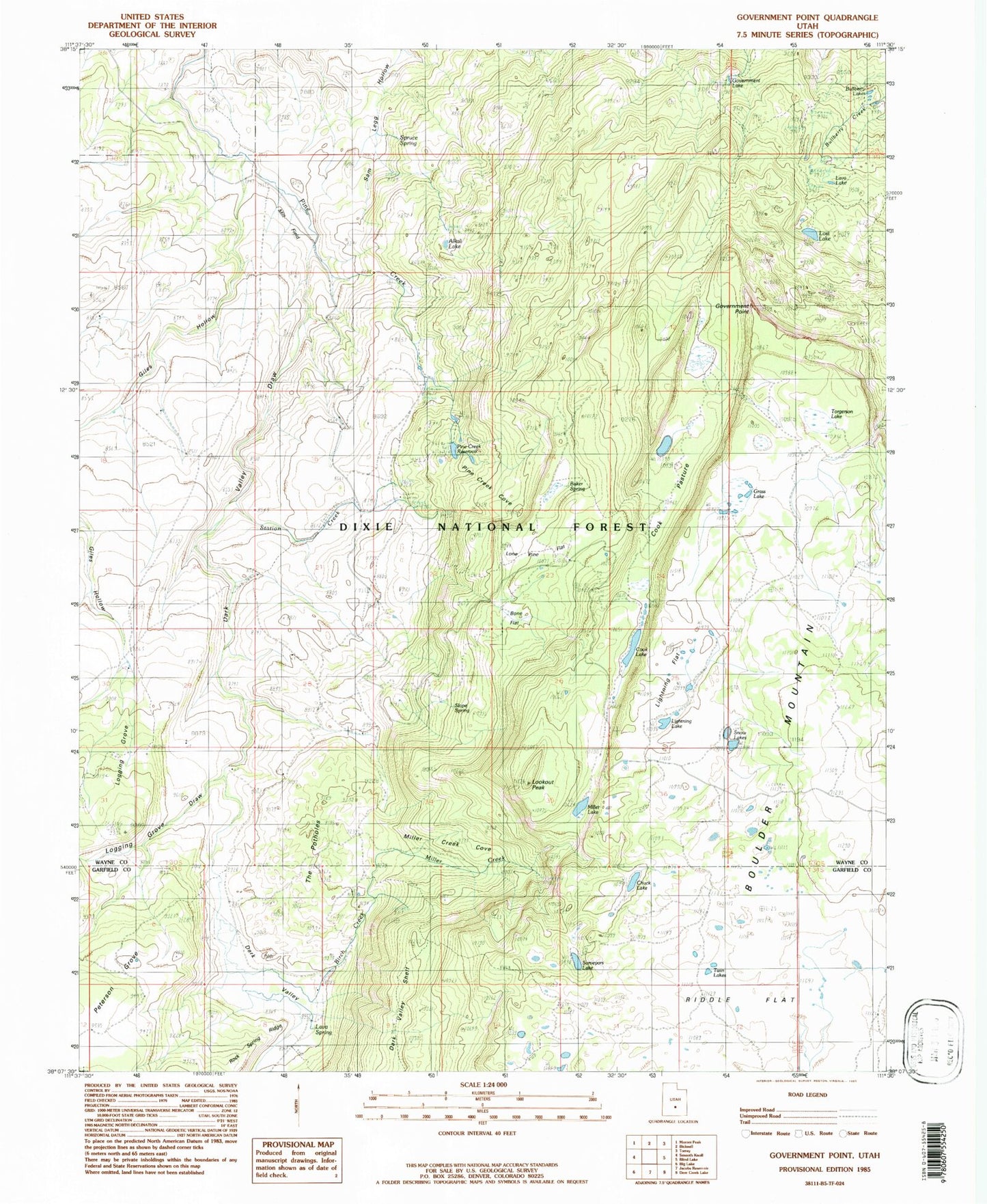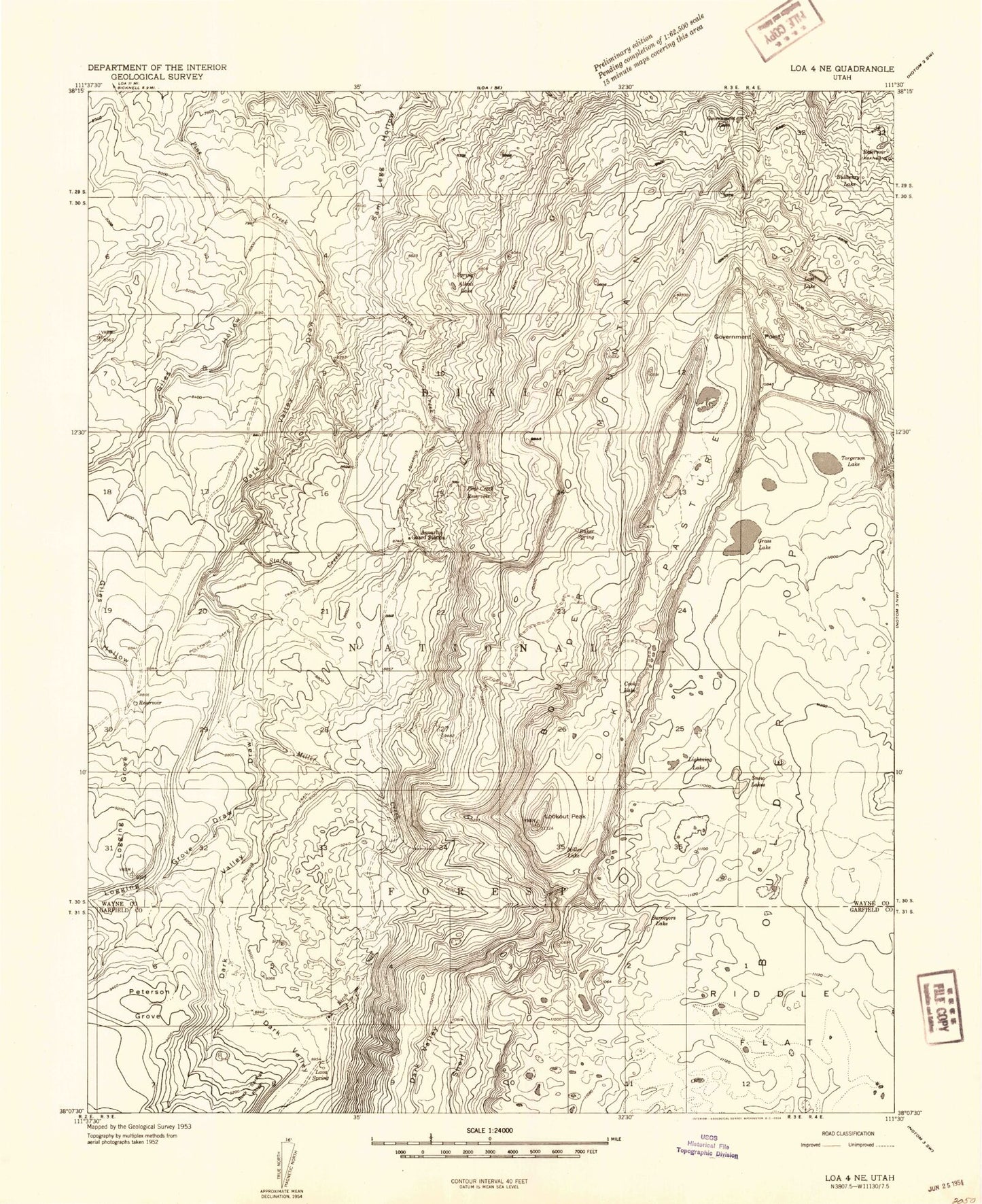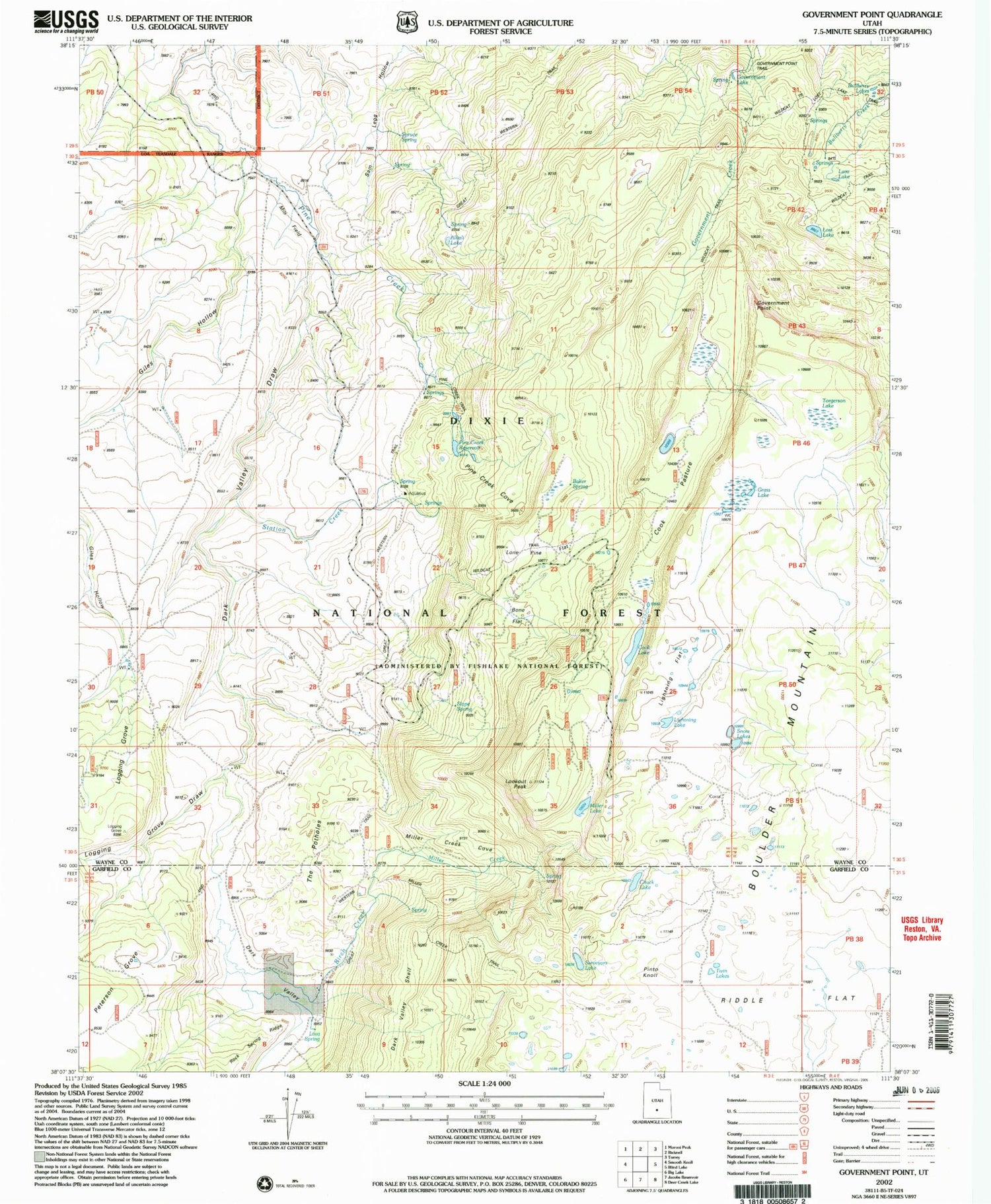
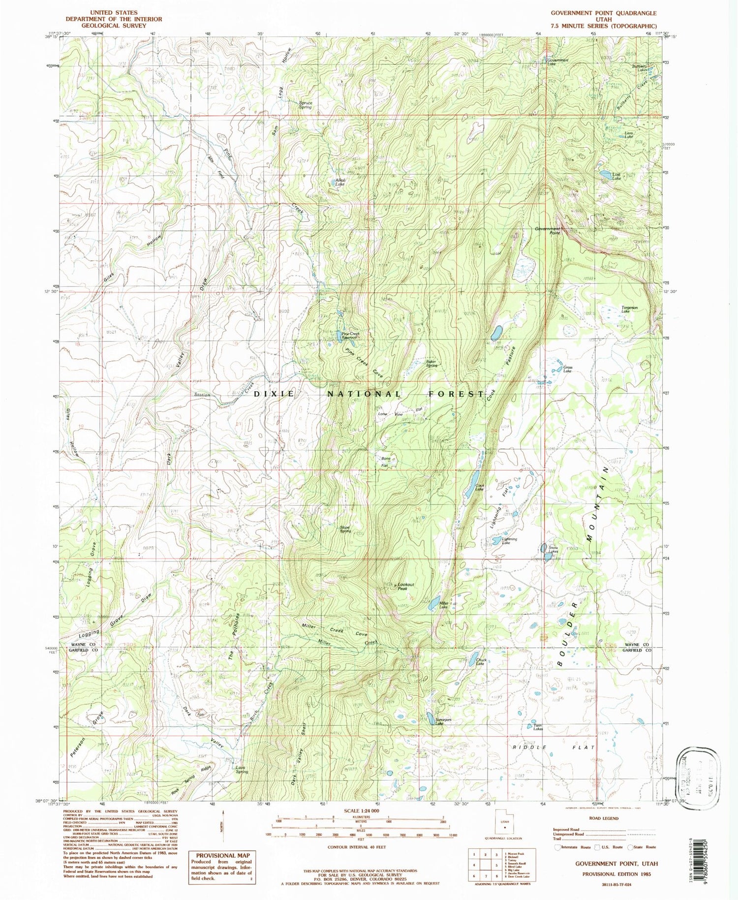
MyTopo
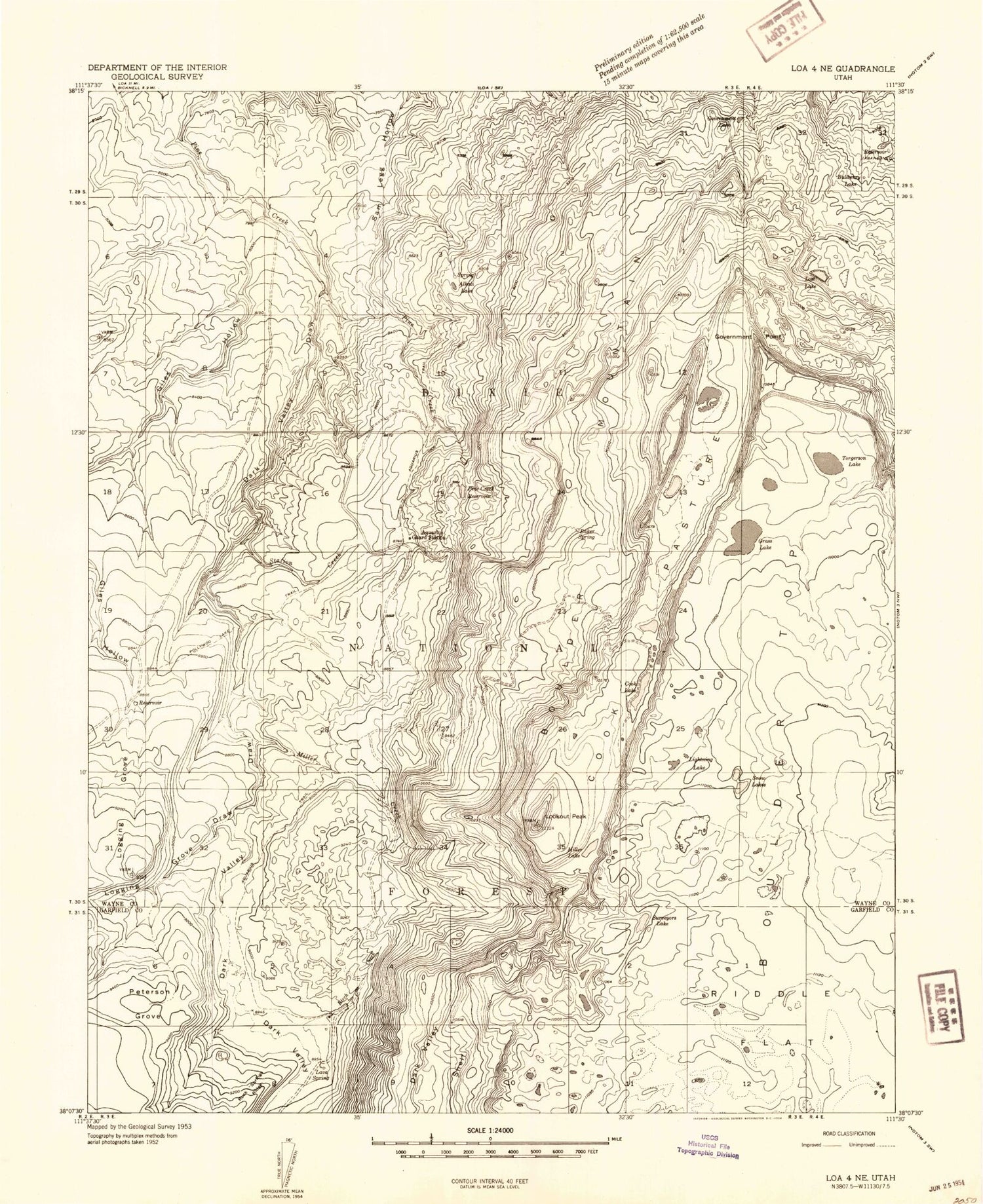
Classic USGS Government Point Utah 7.5'x7.5' Topo Map
Couldn't load pickup availability
Historical USGS topographic quad map of Government Point in the state of Utah. Typical map scale is 1:24,000, but may vary for certain years, if available. Print size: 24" x 27"
This quadrangle is in the following counties: Garfield, Wayne.
The map contains contour lines, roads, rivers, towns, and lakes. Printed on high-quality waterproof paper with UV fade-resistant inks, and shipped rolled.
Contains the following named places: Alkali Lake, Aquarius Guard Station, Aquarius Trail, Baker Spring, Birch Creek, Cook Lake, Cook Pasture, Government Lake, Government Point, Grass Lake, Lava Spring, Lightning Lake, Lookout Peak, Lost Lake, Miller Creek, Miller Lake, Pine Creek Reservoir, Pollywog Lake Trail, Snow Lakes, Station Creek, Chuck Lake, Torgerson Lake, Pine Creek Reservoir Dam, Dark Valley Draw, Lava Lake, Lightning Flat, Lone Pine Flat, Mill Field, Miller Creek Cove, Pine Creek Cove, The Potholes, Slope Spring, Twin Lakes, Bullberry Lakes, Bluebell Knoll, Boulder Mountain, Dark Valley, Giles Hollow, Logging Grove, Logging Grove Draw, Peterson Grove, Twin Lakes, Pinto Knoll, Spruce Spring, Surveyors Lake, West Lake, Alkali Lake, Aquarius Guard Station, Aquarius Trail, Baker Spring, Birch Creek, Cook Lake, Cook Pasture, Government Lake, Government Point, Grass Lake, Lava Spring, Lightning Lake, Lookout Peak, Lost Lake, Miller Creek, Miller Lake, Pine Creek Reservoir, Pollywog Lake Trail, Snow Lakes, Station Creek, Chuck Lake, Torgerson Lake, Pine Creek Reservoir Dam, Dark Valley Draw, Lava Lake, Lightning Flat, Lone Pine Flat, Mill Field, Miller Creek Cove, Pine Creek Cove, The Potholes, Slope Spring, Twin Lakes, Bullberry Lakes, Bluebell Knoll, Boulder Mountain, Dark Valley, Giles Hollow, Logging Grove, Logging Grove Draw, Peterson Grove, Twin Lakes, Pinto Knoll, Spruce Spring, Surveyors Lake, West Lake