MyTopo
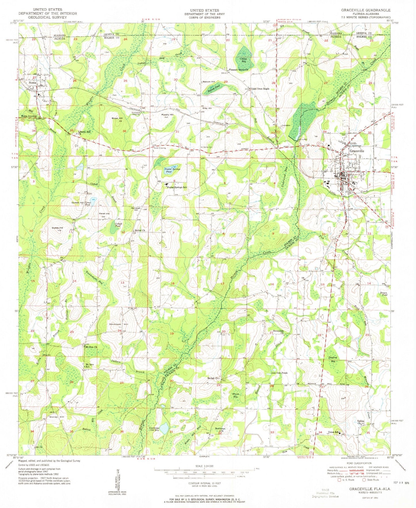
Classic USGS Graceville Florida 7.5'x7.5' Topo Map
Couldn't load pickup availability
Historical USGS topographic quad map of Graceville in the state of Florida. Map scale may vary for some years, but is generally around 1:24,000. Print size is approximately 24" x 27"
This quadrangle is in the following counties: Geneva, Holmes, Jackson.
The map contains contour lines, roads, rivers, towns, and lakes. Printed on high-quality waterproof paper with UV fade-resistant inks, and shipped rolled.
Contains the following named places: Balcom Hill, Balcom Pond, Baptist Bible Institute, Bell Branch, Bethel Church, Beulah Church, Big Branch, Boggy Branch, Brock Bay, Broom Bay, Brown Hill, Brown Pond, Buzzard Bay, Camp Pond, Campbellton Graceville Hospital, City of Graceville, Cobb Cross Roads, Collins Bay, Collins Mill, Corbett Branch, Corbett Hill, Corbett Pond, Courtneys Old Bay, Damascus Baptist Church, Damascus Cemetery, Danford Bay, East Mount Zion Church, Eleanor, Faith Church, Fish Branch, Galilee Church, Graceville, Graceville Division, Graceville Elementary School, Graceville Fire and Rescue Station 30, Graceville High School, Graceville Police Department, Graceville Post Office, Hicks Old Bay, Holland Branch, Jackson Branch, Kelley Branch, Liberty Hill Church, Lighter Snag Creek, Little Creek, Live Oak Pond, Marsh Hill, McIntosh Hill, Mill Branch, Mount Zion School, Murphy Hill, Newhome Church, Noma, Noma Junction, Pleasant Grove Church, Poplar Springs Pond, Poplar Springs School, Richardson Bay, Riley Hill, Selma Cemetery, Selma Church, Smothers Hill, Stokes Hill, Sunnyside Church, Tendil Crossing, Town of Noma, Underwood Bay, Underwood Crossing, Union School, Worley Hill, WYDA-FM (Graceville), Wynnlum, ZIP Code: 32440


