MyTopo
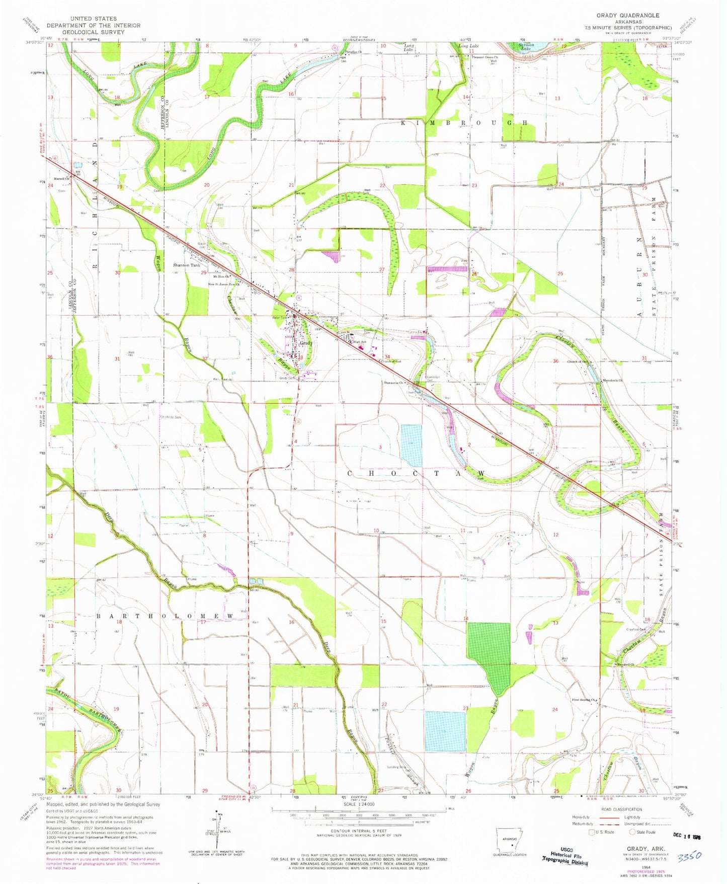
Classic USGS Grady Arkansas 7.5'x7.5' Topo Map
Couldn't load pickup availability
Historical USGS topographic quad map of Grady in the state of Arkansas. Map scale may vary for some years, but is generally around 1:24,000. Print size is approximately 24" x 27"
This quadrangle is in the following counties: Jefferson, Lincoln.
The map contains contour lines, roads, rivers, towns, and lakes. Printed on high-quality waterproof paper with UV fade-resistant inks, and shipped rolled.
Contains the following named places: Bethel Church, Church of God, City of Grady, Crawford Cemetery, Damascus Church, Dolton, Dorabell Church, First Baptist Church, Four Groves, Gocio Cemetery, Grady, Grady Cemetery, Grady Elementary School, Grady Fire Department, Grady High School, Grady Police Department, Grady Post Office, Grady Public Library, Hawley Cemetery, Kennedy High School, Lee School, Long Lake, Lowe Cemetery, Macedonia Church, Marzell Church, Matthews Field, McBride Cemetery, Mount Calvary Cemetery, Mount Calvary Church, Mount Pisgah Church, Mount Zion Church, New Saint James Zion Church, Palestine Church, Paradise Church, Pleasant Grove Cemetery, Pleasant Grove Church, Randolph Cemetery, Saint Pauls Church, Sarassa, Sarassa Lake, Shannon Tank, Silt, Township of Choctaw, Woodville, ZIP Code: 71644