MyTopo
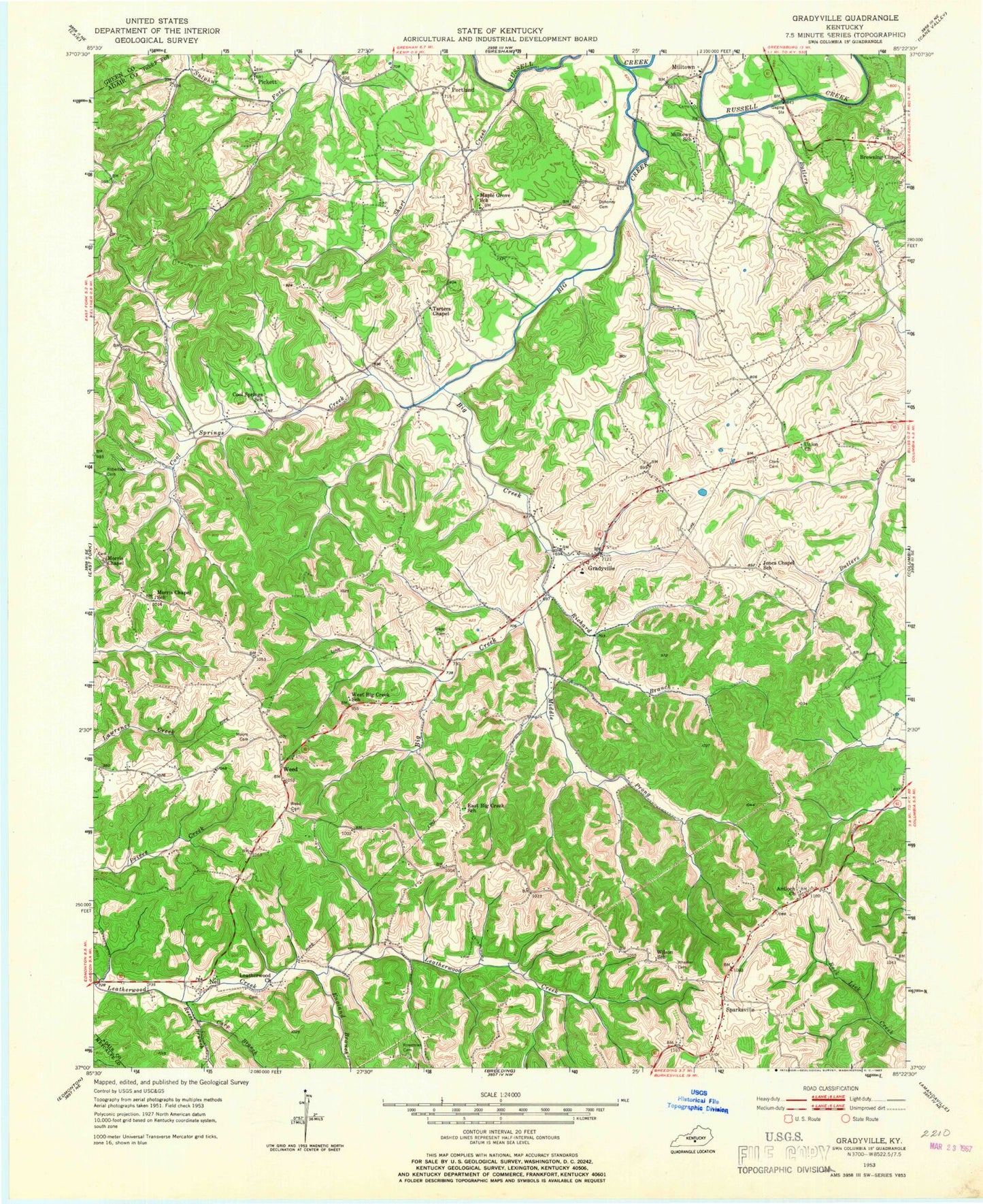
Classic USGS Gradyville Kentucky 7.5'x7.5' Topo Map
Couldn't load pickup availability
Historical USGS topographic quad map of Gradyville in the state of Kentucky. Map scale may vary for some years, but is generally around 1:24,000. Print size is approximately 24" x 27"
This quadrangle is in the following counties: Adair, Green, Metcalfe.
The map contains contour lines, roads, rivers, towns, and lakes. Printed on high-quality waterproof paper with UV fade-resistant inks, and shipped rolled.
Contains the following named places: Antioch Church, Bethany Chapel, Big Creek, Butlers Fork, Carp Branch, Clark Cemetery, Cool Springs Creek, Dohoney Cemetery, England Branch, Gradyville, Gradyville Baptist Church, Gradyville Division, Gradyville Post Office, Jones Chapel, Leatherwood Church, Middle Prong Big Creek, Milltown, Milltown Church, Moore Cemetery, Morris Chapel, Moss Cemetery, Mount Matney, Nell, New Tarters Chapel, Pickett, Portland, Reece Branch, Richard Branch, Robertson Cemetery, Rowetown Cemetery, Rowetown School, Shirley Branch, Short Creek, Sparksville, Stapp Cemetery, Sulphur Fork, Tarters Cemetery, Taters Chapel, Union Cemetery, Weed, Weed Cemetery, Weed Ridge, Wheeler Cemetery