MyTopo
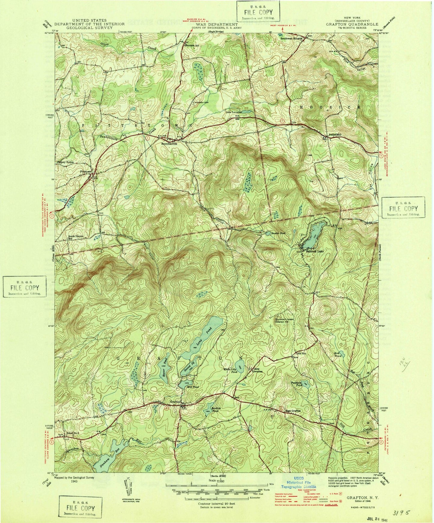
Classic USGS Grafton New York 7.5'x7.5' Topo Map
Couldn't load pickup availability
Historical USGS topographic quad map of Grafton in the state of New York. Typical map scale is 1:24,000, but may vary for certain years, if available. Print size: 24" x 27"
This quadrangle is in the following counties: Rensselaer.
The map contains contour lines, roads, rivers, towns, and lakes. Printed on high-quality waterproof paper with UV fade-resistant inks, and shipped rolled.
Contains the following named places: Babcock Lake, Banker Pond, Boyntonville, Camp Yowochas, Cobb School, Couch Hollow, Dickinson Hill, Dunham Reservoir, East Grafton, Lake Elizabeth, Fox Hollow, Grafton, Groveside School, Long Pond, Lake Lorraine, Mill Pond, Peckham Pond, Pittstown, Potter Hill, Red Pond, Saint Georges Church, Second Pond, Shaver Pond, South District School, Southwest Hoosick, Ward Hollow, Warren Cemetery, White Lily Pond, Factory Hollow, School Number 5, Town of Grafton, Grafton United Methodist Church, Pittstown United Methodist Church, Mountain Chapel Church, Saint John Francis Regis Catholic Church, Grafton Elementary School, Grafton Volunteer Fire Company, Pittstown Volunteer Fire Department, Pittstown Volunteer Emergency Corps, Grafton Post Office