MyTopo
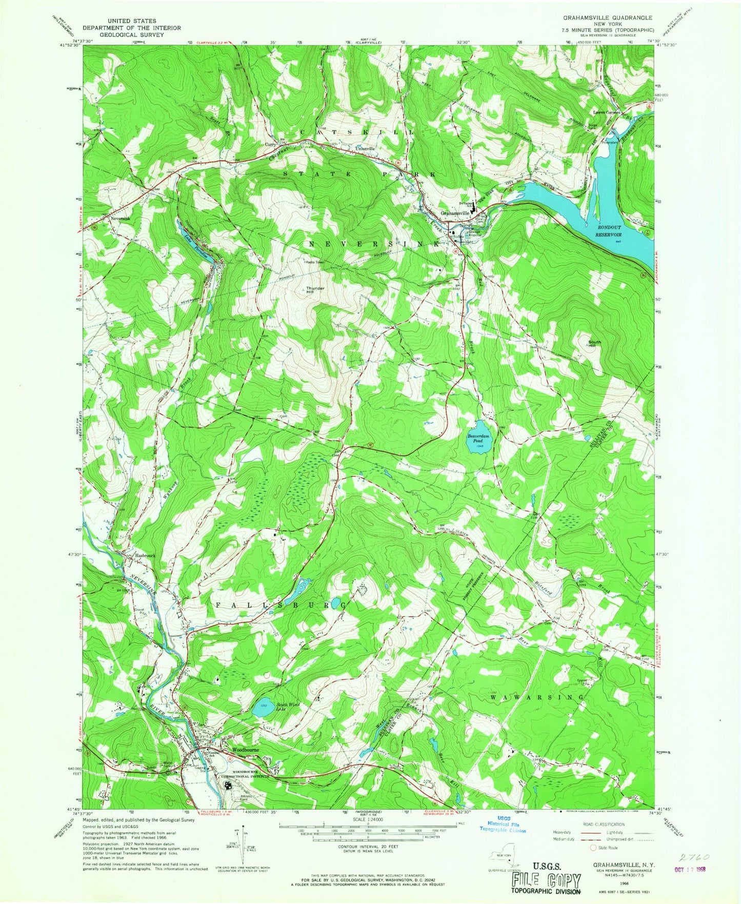
Classic USGS Grahamsville New York 7.5'x7.5' Topo Map
Couldn't load pickup availability
Historical USGS topographic quad map of Grahamsville in the state of New York. Typical map scale is 1:24,000, but may vary for certain years, if available. Print size: 24" x 27"
This quadrangle is in the following counties: Sullivan, Ulster.
The map contains contour lines, roads, rivers, towns, and lakes. Printed on high-quality waterproof paper with UV fade-resistant inks, and shipped rolled.
Contains the following named places: Beaverdam Pond, Central School, Chestnut Creek, Curry, Grahamsville, Hasbrouck, Lowes Corners, Neversink, Neversink Rondout Aqueduct, Lake Paradise, Red Brook, Grahamsville Rural Cemetery, Scott Brook, South Hill, South Wind Lake, Sugarloaf Brook, Thunder Hill, Tri - Valley High School, Unionville, Woodbourne, Wynkoop Brook, Woodbourne Correctional Facility, Town of Neversink, Allison Farms, Laughing Duck Farm, Grahamsville Wastewater Treatment Plant, Grahamsville Post Office, Woodbourne Post Office, Sunrise Mobile Home Park, Daniel Pierce Library, Neversink Town Hall, Tri - Valley Middle School, Tri - Valley Elementary School, Grahamsville Volunteer Fire Department, Woodbourne Fire Company Number 1, Grahamsville First Aid Squad, Neversink Volunteer Fire Department Station 1 and Ambulance, Neversink Post Office, Grahamsville Census Designated Place, Woodbourne Census Designated Place