MyTopo
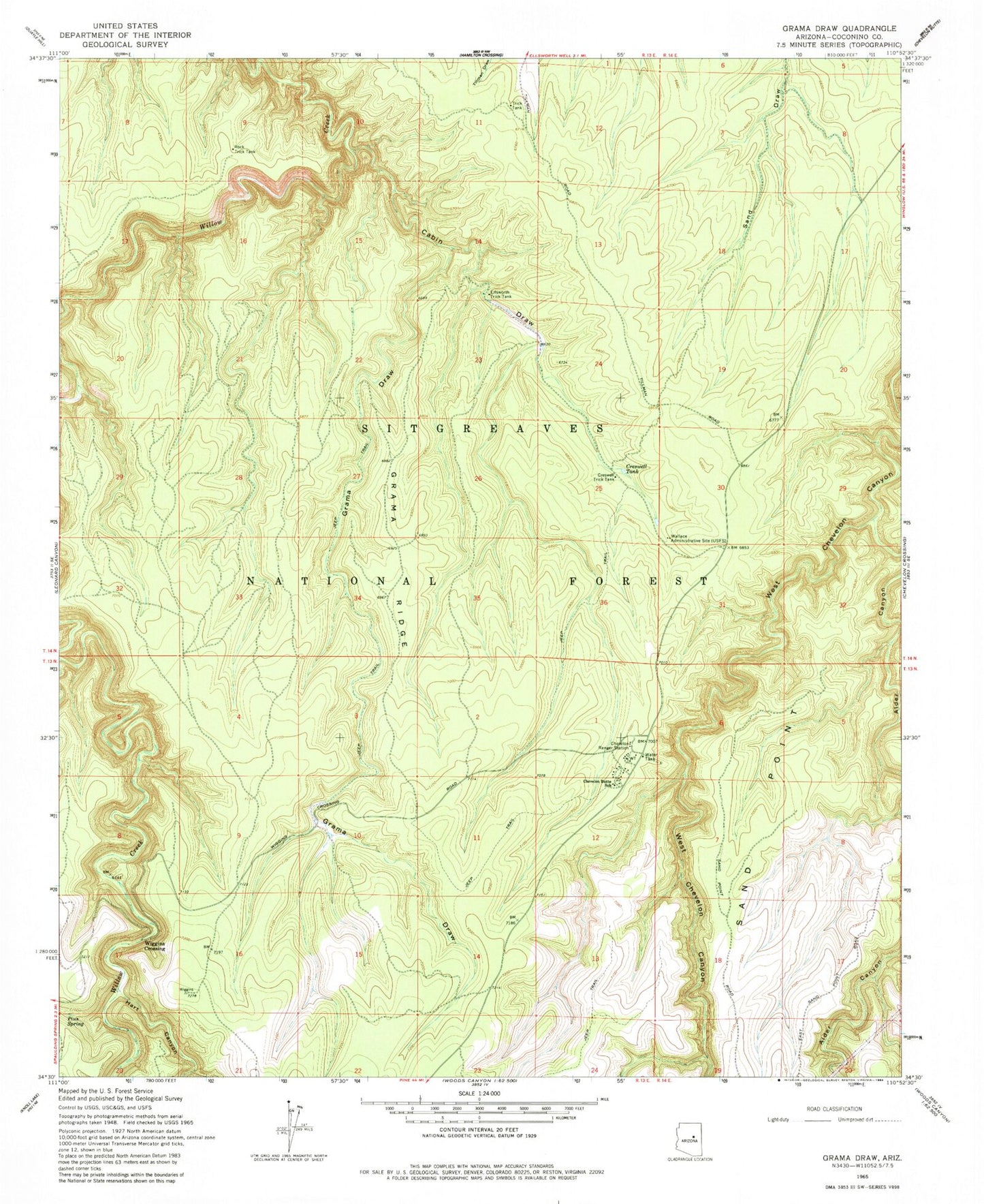
Classic USGS Grama Draw Arizona 7.5'x7.5' Topo Map
Couldn't load pickup availability
Historical USGS topographic quad map of Grama Draw in the state of Arizona. Map scale may vary for some years, but is generally around 1:24,000. Print size is approximately 24" x 27"
This quadrangle is in the following counties: Coconino.
The map contains contour lines, roads, rivers, towns, and lakes. Printed on high-quality waterproof paper with UV fade-resistant inks, and shipped rolled.
Contains the following named places: Alder Canyon, Alder Creek, Barney Ridge, Cabin Draw, Chevelon Butte School, Chevelon Ranger Station, Chevelon Work Center, Creswell Tank, Creswell Trick Tank, Duke City Logging Camp, East Fork Willow Creek, Ellsworth Trick Tank, Grama Draw, Grama Ridge, Grama Trick Tank, Hart Canyon, Highway Tank, Middle Ridge, Pius Spring, Rock Trick Tank, Sand Draw Tank, Sand Point, Tillman Trick Tank, Tillman Water Catchment, Tillman Well, Wallace Administrative City, Wallace Forest Service Facility, West Fork Willow Creek, Widowmaker Draw, Wiggins Crossing