MyTopo
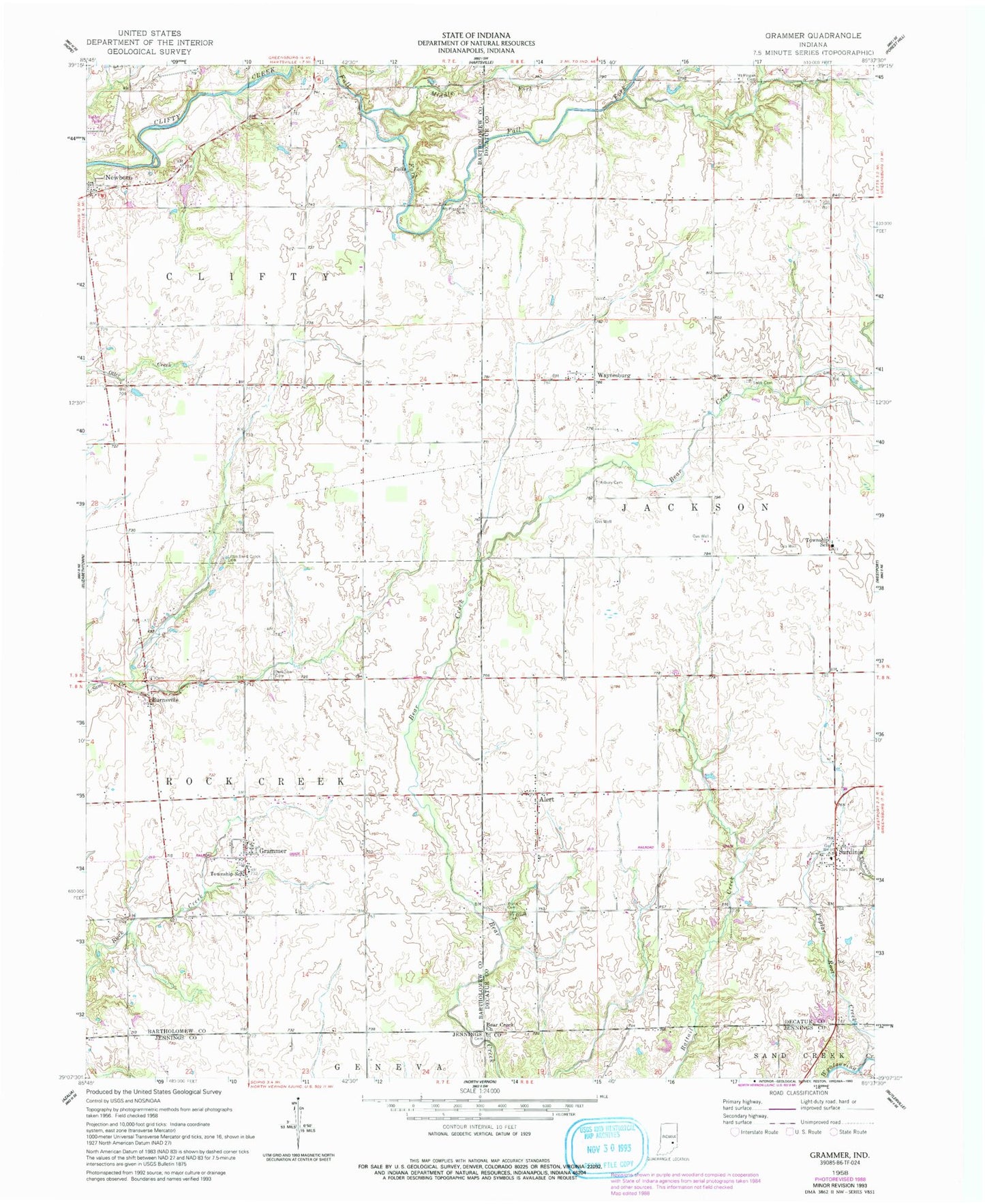
Classic USGS Grammer Indiana 7.5'x7.5' Topo Map
Couldn't load pickup availability
Historical USGS topographic quad map of Grammer in the state of Indiana. Map scale may vary for some years, but is generally around 1:24,000. Print size is approximately 24" x 27"
This quadrangle is in the following counties: Bartholomew, Decatur, Jennings.
The map contains contour lines, roads, rivers, towns, and lakes. Printed on high-quality waterproof paper with UV fade-resistant inks, and shipped rolled.
Contains the following named places: Alert, Asbury Cemetery, Bear Creek Church, Burnsville, Grammer, Little Sand Creek Cemetery, Middle Fork Fall Fork, Mount Olivet Cemetery, Mount Pisgah Cemetery, Mount Pleasant Cemetery, Parkison Cemetery, Sardinia, Shirk Cemetery, Township of Clifty, Township of Jackson, Township of Rock Creek, Waynesburg, Williams Flying Field, Wynn Cemetery, ZIP Code: 47244