MyTopo
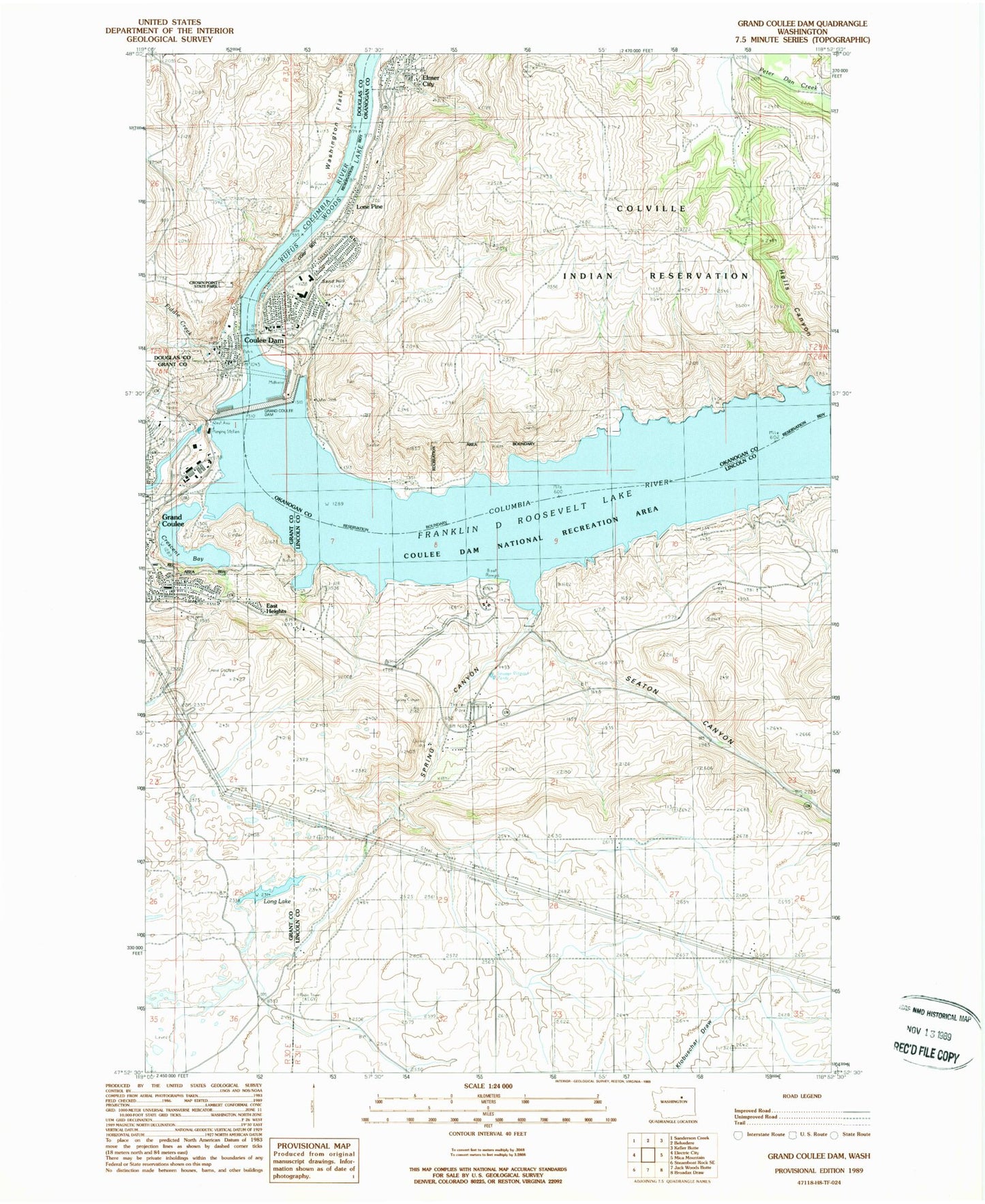
Classic USGS Grand Coulee Dam Washington 7.5'x7.5' Topo Map
Couldn't load pickup availability
Historical USGS topographic quad map of Grand Coulee Dam in the state of Washington. Map scale may vary for some years, but is generally around 1:24,000. Print size is approximately 24" x 27"
This quadrangle is in the following counties: Douglas, Grant, Lincoln, Okanogan.
The map contains contour lines, roads, rivers, towns, and lakes. Printed on high-quality waterproof paper with UV fade-resistant inks, and shipped rolled.
Contains the following named places: Central School, Cole Park, Columbia Elementary School, Coulee Dam, Coulee Dam Community Church, Coulee Dam Fire Department, Coulee Dam Police Department, Coulee Dam Post Office, Coulee Dam Seaplane Base, Crescent Bay, Crown Point State Park, Crown Point Vista, Douglas Park, East Heights, Eden Harbor, Elmer City, Elmer City Post Office, Fiddle Creek, Gibbs Bay, Grand Coulee Dam, Greene Memorial Field, Hells Canyon, KEYG-AM (Grand Coulee), KEYG-FM (Grand Coulee), Lake Roosevelt National Recreation Area Headquarters, Lake Roosevelt Schools, Lone Pine, Long Lake, Mason City, Mead Park, Okanogan County Fire District 2, Pine Tree Point, Rattlesnake Canyon, Sand Hill, Seaton Canyon, Spring Canyon, The Church of Jesus Christ of Latter Day Saints, Town of Coulee Dam, Town of Elmer City, Washington Flats, ZIP Code: 99124