
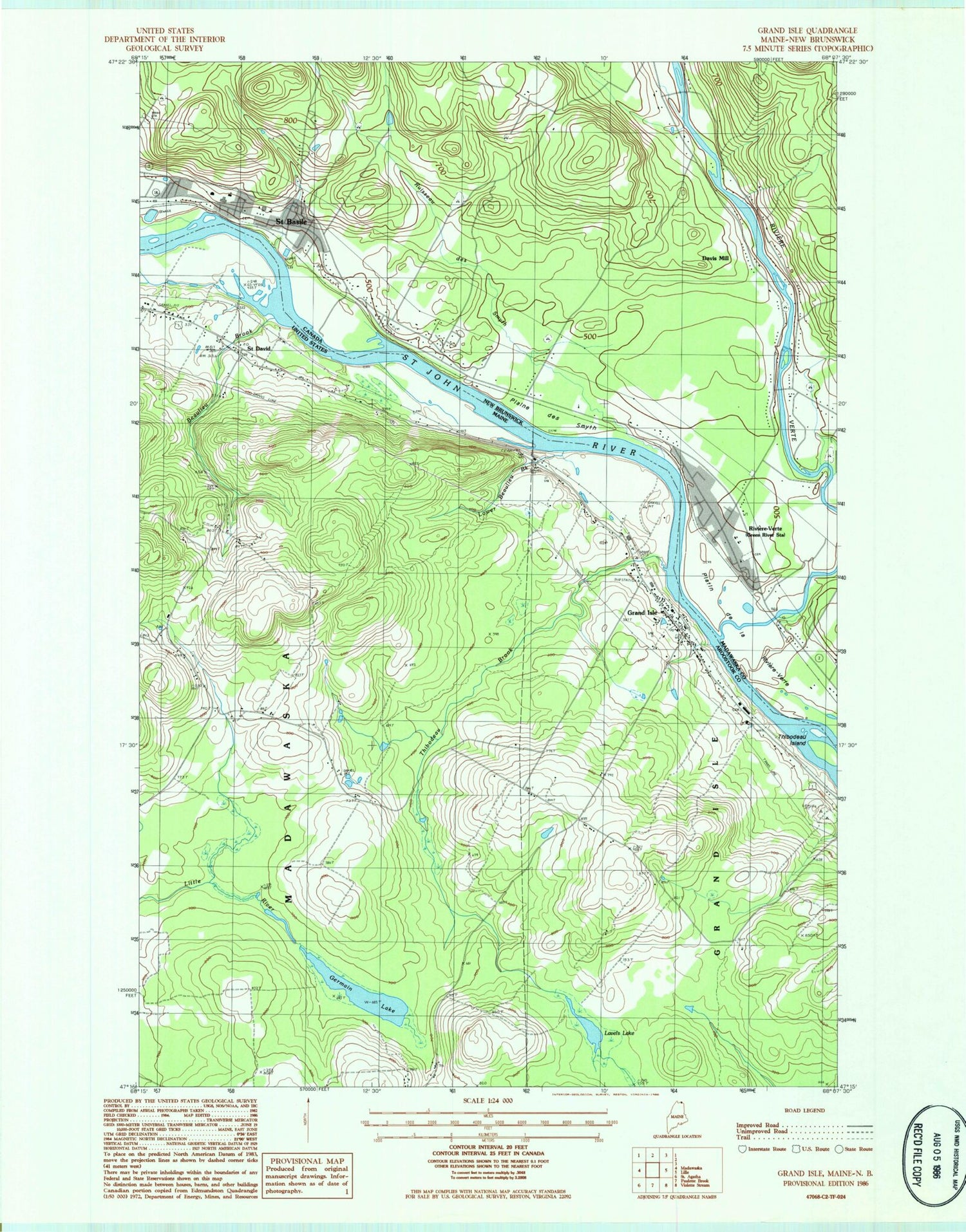
MyTopo
Classic USGS Grand Isle Maine 7.5'x7.5' Topo Map
Couldn't load pickup availability
Historical USGS topographic quad map of Grand Isle in the state of Maine. Map scale may vary for some years, but is generally around 1:24,000. Print size is approximately 24" x 27"
This quadrangle is in the following counties: Aroostook.
The map contains contour lines, roads, rivers, towns, and lakes. Printed on high-quality waterproof paper with UV fade-resistant inks, and shipped rolled.
Contains the following named places: Beaulieu Brook, Doucette School, Germain Lake, Grand Isle, Grand Isle Census Designated Place, Grand Isle Fire Department, Grand Isle Post Office, Grande Isle Elementary School, Lavels Lake, Lower Beaulieu Branch, Saint David, Saint Gerard Cemetery, Saint Gerard Church, School Number 1, School Number 6, School Number 9, Thibodeau Brook, Thibodeau Island, Town of Madawaska, ZIP Codes: 04746, 04773


