MyTopo
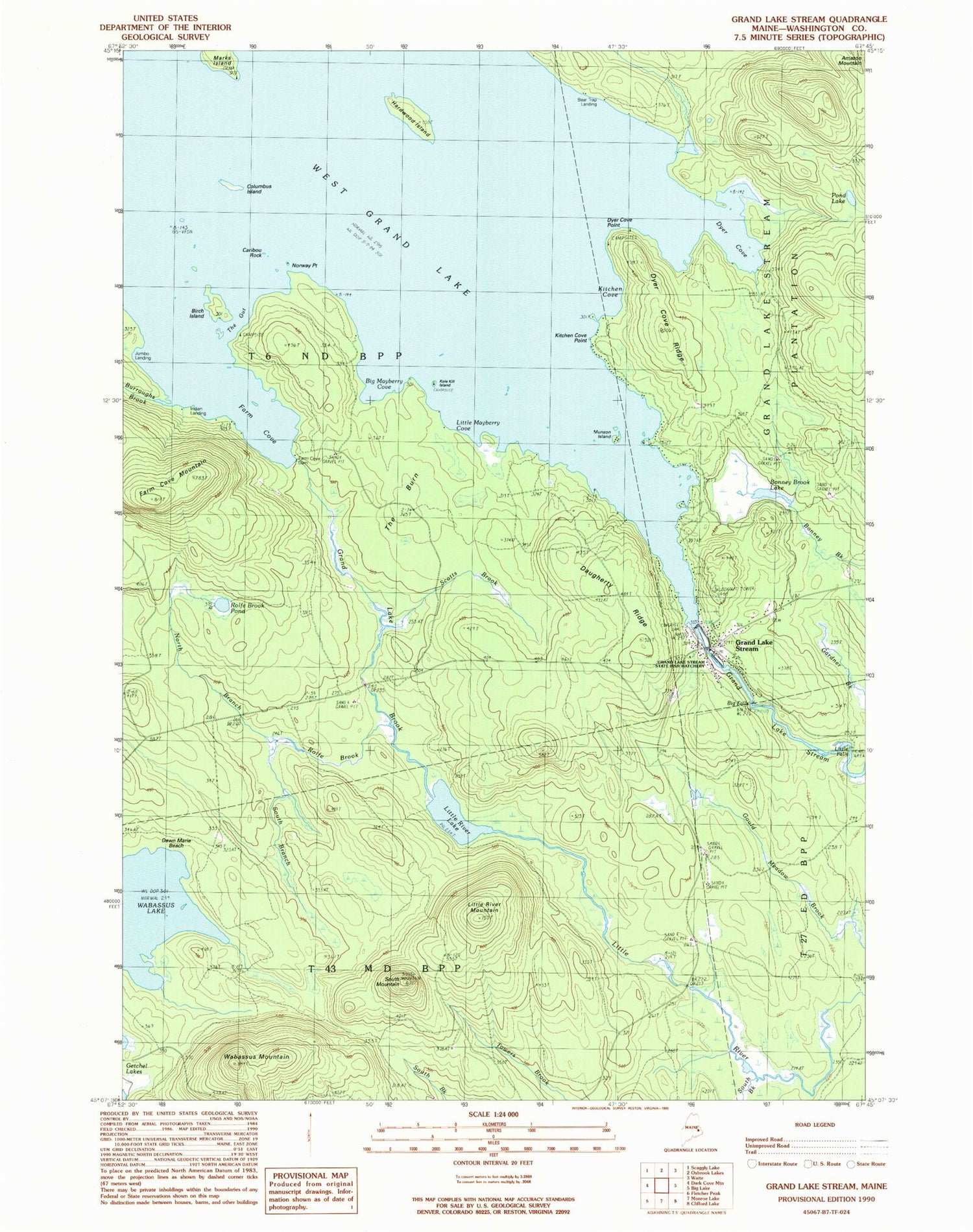
Classic USGS Grand Lake Stream Maine 7.5'x7.5' Topo Map
Couldn't load pickup availability
Historical USGS topographic quad map of Grand Lake Stream in the state of Maine. Typical map scale is 1:24,000, but may vary for certain years, if available. Print size: 24" x 27"
This quadrangle is in the following counties: Washington.
The map contains contour lines, roads, rivers, towns, and lakes. Printed on high-quality waterproof paper with UV fade-resistant inks, and shipped rolled.
Contains the following named places: Big Falls, Big Mayberry Cove, Birch Island, Bonney Brook Lake, Burroughs Brook, Caribou Rock, Columbus Island, Daugherty Ridge, Dawn Marie Beach, Dyer Cove, Dyer Cove Point, Dyer Cove Ridge, Farm Cove, Farm Cove Dam, Farm Cove Mountain, Grand Lake Brook, Grand Lake Stream, Hardwood Island, Kitchen Cove, Kitchen Cove Point, Kole Kill Island, Little Falls, Little Mayberry Cove, Little River Lake, Little River Mountain, Marks Island, Munson Island, North Branch Rolfe Brook, Norway Point, Pond Lake, Rolfe Brook, Rolfe Brook Pond, Scotts Brook, South Branch Rolfe Brook, South Brook, South Mountain, The Burn, The Gut, Wabassus Mountain, West Grand Lake, Bear Trap Landing, Indian Landing, Unorganized Territory of North Washington, Grand Lake Stream Dam, Grand Lake Stream Post Office, Grand Lake Stream State Fish Hatchery, T6 ND BPP, Grand Lake Stream Volunteer Fire Department, Grand Lake Stream Volunteer Ambulance