MyTopo
Classic USGS Grand Marais Michigan 7.5'x7.5' Topo Map
Couldn't load pickup availability
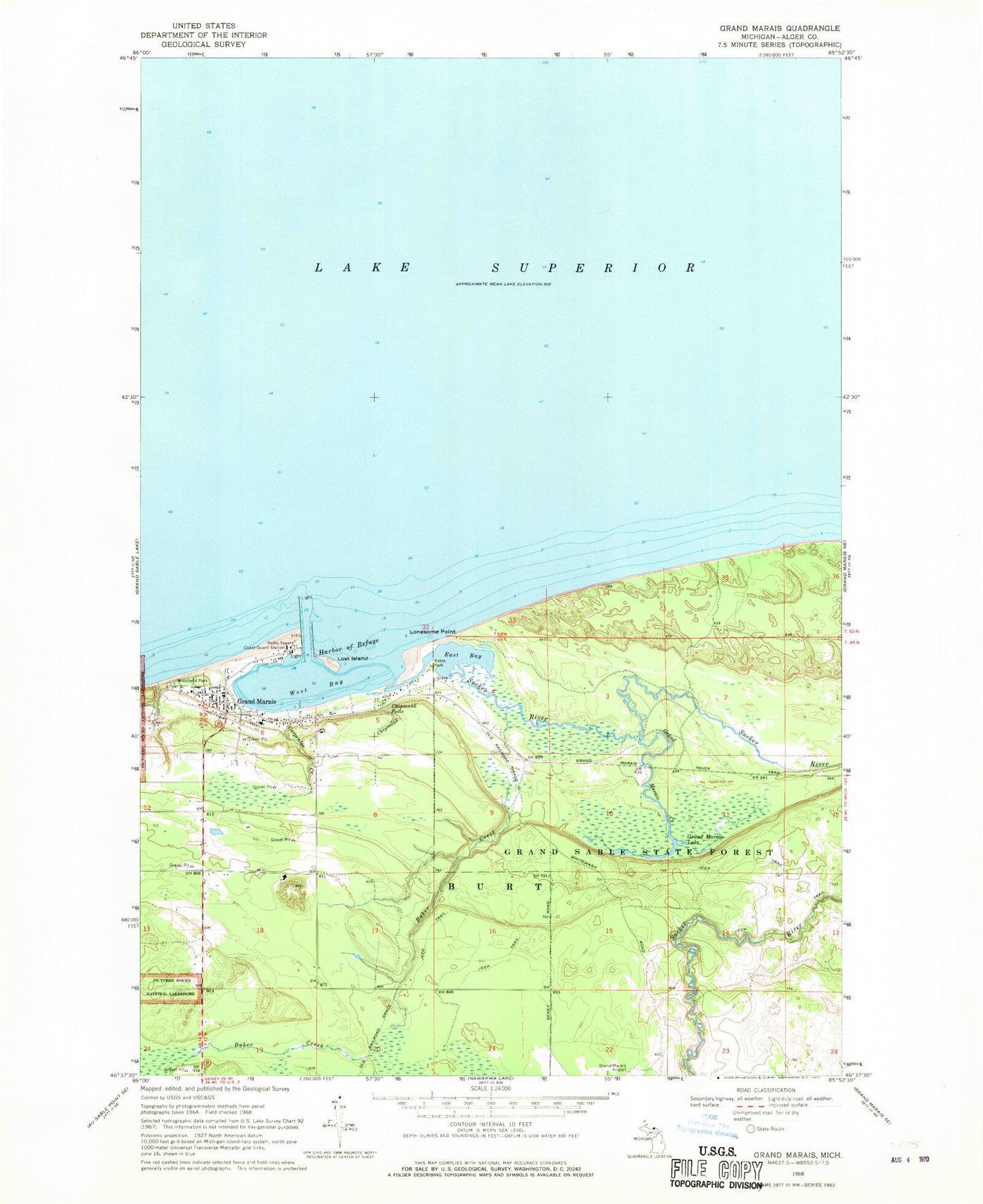
Historical USGS topographic quad map of Grand Marais in the state of Michigan. Map scale may vary for some years, but is generally around 1:24,000. Print size is approximately 24" x 27"
This quadrangle is in the following counties: Alger.
The map contains contour lines, roads, rivers, towns, and lakes. Printed on high-quality waterproof paper with UV fade-resistant inks, and shipped rolled.
Contains the following named places: Baker Creek, Bird Grave, Burt Township Ambulance Service, Burt Township Fire Department, Burt Township Medical Center, Burt Township School, Carpenter Creek, Chipmunk Creek, Chipmunk Falls, East Bay, Endress Oil Company, First Lutheran Church, Gitche Gumee Museum, Grand Marais, Grand Marais Air Force Station, Grand Marais Census Designated Place, Grand Marais Creek, Grand Marais Historical Marker, Grand Marais Historical Society Museum, Grand Marais Lake, Grand Marais Post Office, Grand Marais Station, Grand Marais United Methodist Church, Harbor of Refuge, Holy Rosary Catholic Cemetery, Holy Rosary Parish, Kahle Park, Lonesome Point, Lost Island, Outer Light, Rose Hill Cemetery, Sucker River, West Bay, Woodland Park, Woodland Park Campgrounds