MyTopo
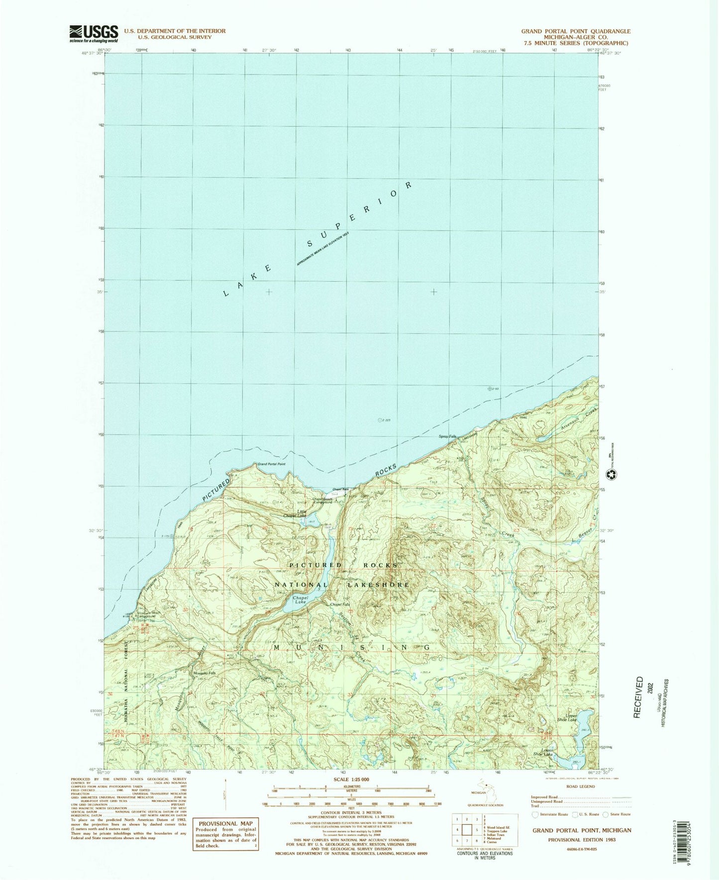
Classic USGS Grand Portal Point Michigan 7.5'x7.5' Topo Map
Couldn't load pickup availability
Historical USGS topographic quad map of Grand Portal Point in the state of Michigan. Typical map scale is 1:24,000, but may vary for certain years, if available. Print size: 24" x 27"
This quadrangle is in the following counties: Alger.
The map contains contour lines, roads, rivers, towns, and lakes. Printed on high-quality waterproof paper with UV fade-resistant inks, and shipped rolled.
Contains the following named places: Chapel Creek, Chapel Lake, Grand Portal Point, Lower Shoe Lake, Spray Creek, Upper Shoe Lake, Chapel Falls, Chapel Rock, Little Chapel Lake, Mosquito Falls, Mosquito River, Pictured Rocks, Section Thirtyfour Creek, Spray Falls, Sail Rock, Mosquito Beach Campground, Chapel Beach Campground, Lakeshore Trail, Lovers Leap, Grand Portal