MyTopo
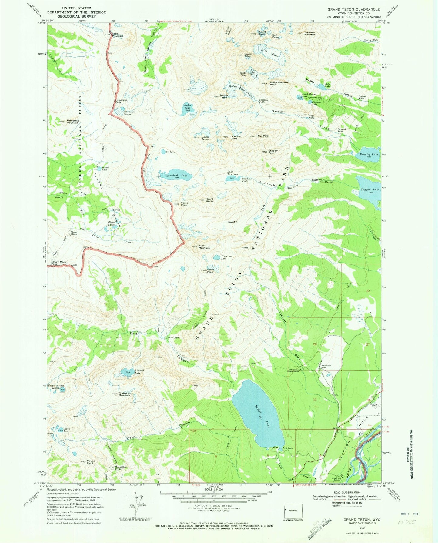
USGS Classic Grand Teton Wyoming 7.5'x7.5' Topo Map
Couldn't load pickup availability
Historical USGS topographic quad map of Grand Teton in the state of Wyoming. Scale: 1:24000. Print size: 24" x 27"
This quadrangle is in the following counties: Teton.
The map contains contour lines, roads, rivers, towns, lakes, and grids including latitude / longitude and UTM / MGRS. Printed on high-quality waterproof paper with UV fade-resistant inks.
Contains the following named places: Albright Peak, Stewart Draw, Alaska Basin, Alaska Basin Trail, Amphitheater Lake, Amphitheater Lake Trail, Avalanche Canyon, Bannock Falls, Basin Lakes, Battleship Mountain, Bradley Lake, Broken Falls, Cleft Falls, Cloudveil Dome, Coyote Lake, Death Canyon, Delta Lake, Disappointment Peak, East Prong, Forget-me-not Lakes, Garnet Canyon, Glacier Falls, Mount Hunt, Hurricane Pass, Icefloe Lake, J Y Ranch, Kit Lake, Middle Teton, Middle Teton Glacier, Mount Hunt Divide, Mount Meek Pass, Open Canyon, Open Canyon Trail, Phelps Lake, Prospectors Mountain, R Lazy S Ranch, Rimrock Lake, Schoolroom Glacier, Shadow Peak, Sheep Steps, Shoshoko Falls, Snowdrift Lake, South Fork, South Fork Avalanche Canyon, South Teton, Spalding Falls, Static Peak, Sunset Lake, Surprise Lake, Table Mountain, Lake Taminah, Teepe Glacier, Teepe Pillar, Teewinot Mountain, Teton Glacier, The Wall, Timberline Lake, Valley Trail, Valley Trail, Veiled Peak, White Grass Ranch, White Grass Ranger Station, Taggart Lake, Mount Owen, Mount Wister, Buck Mountain, Nez Perce, Grand Teton