MyTopo
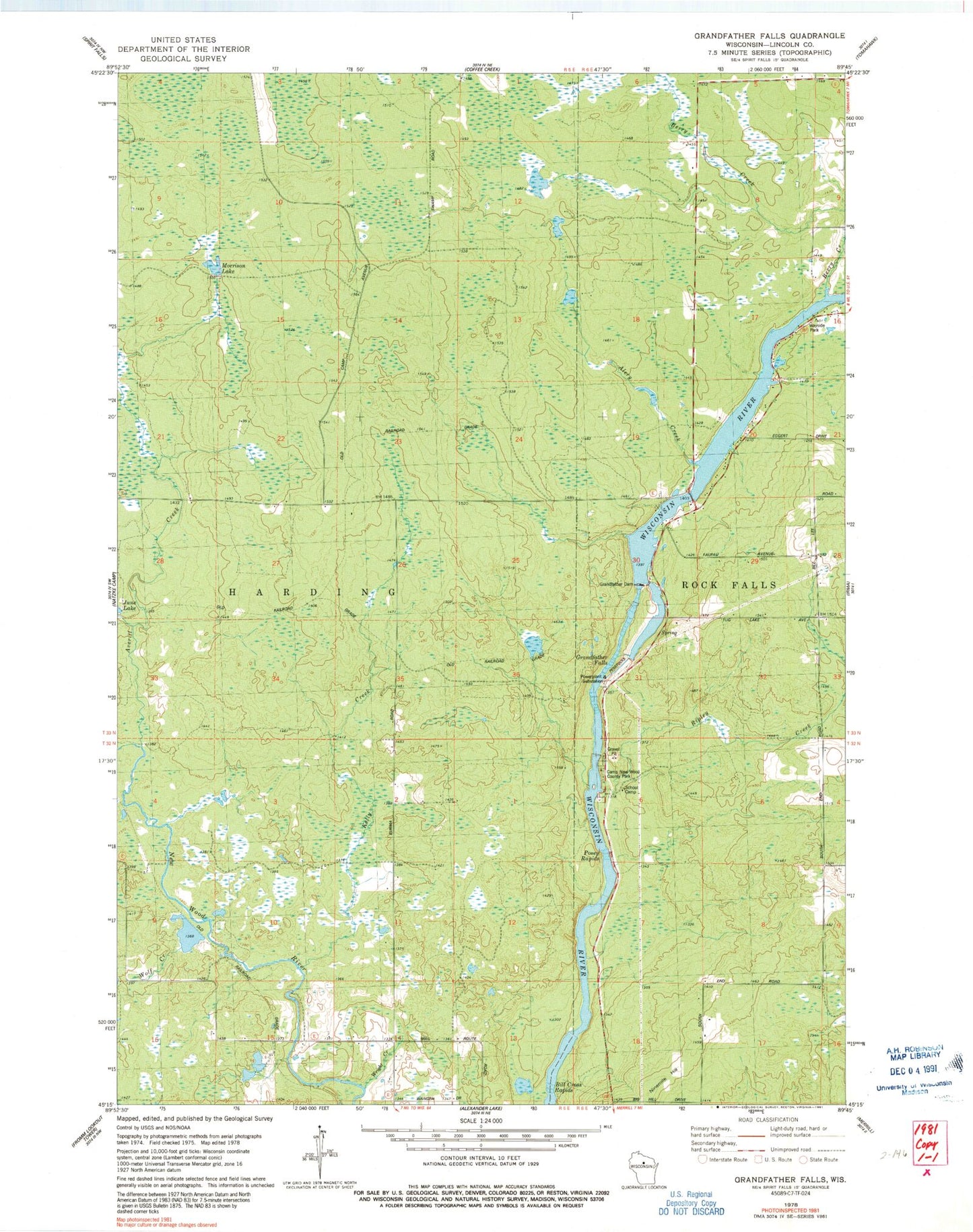
Classic USGS Grandfather Falls Wisconsin 7.5'x7.5' Topo Map
Couldn't load pickup availability
Historical USGS topographic quad map of Grandfather Falls in the state of Wisconsin. Map scale may vary for some years, but is generally around 1:24,000. Print size is approximately 24" x 27"
This quadrangle is in the following counties: Lincoln.
The map contains contour lines, roads, rivers, towns, and lakes. Printed on high-quality waterproof paper with UV fade-resistant inks, and shipped rolled.
Contains the following named places: Alery Creek, Averill Creek, Berry Creek, Bill Cross Rapids, Camp New Wood County Park, Grandfather Dam, Grandfather Falls, Grandfather Flowage 2295, Grandmother School, Kelly Creek, Morrison Lake, New Wood School, Posey Rapids, Ripley Creek, Town of Harding, Upper Grandfather Falls 2WP357 Dam, Wolf Creek, Wright Creek