MyTopo
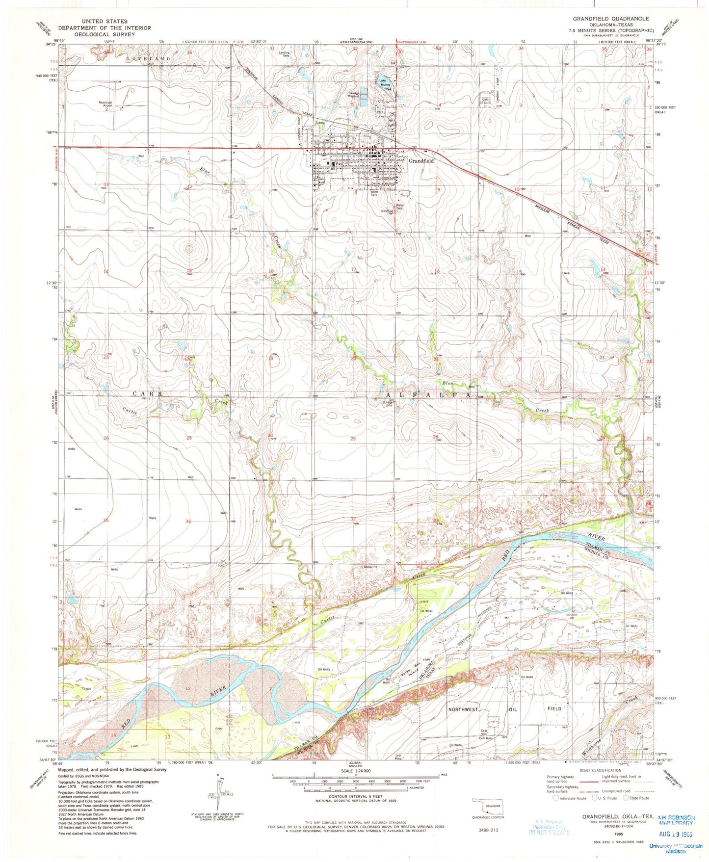
Classic USGS Grandfield Oklahoma 7.5'x7.5' Topo Map
Couldn't load pickup availability
Historical USGS topographic quad map of Grandfield in the state of Oklahoma. Map scale may vary for some years, but is generally around 1:24,000. Print size is approximately 24" x 27"
This quadrangle is in the following counties: Tillman, Wichita.
The map contains contour lines, roads, rivers, towns, and lakes. Printed on high-quality waterproof paper with UV fade-resistant inks, and shipped rolled.
Contains the following named places: Bule Creek, Burke Bet Island, City of Grandfield, Curtis Creek, Eschiti Cemetery, Eschiti Methodist Church Cemetery, Grandfield, Grandfield Ambulance Service, Grandfield Cemetery, Grandfield Elementary School, Grandfield High School, Grandfield Municipal Airport, Grandfield Police Department, Grandfield Post Office, Grandfield Volunteer Fire Department, KSWO-TV (Lawton), Lake Murray Park, Northwest Oil Field, Red River Oil Field, Sage School, Township of Alfalfa, ZIP Code: 73546