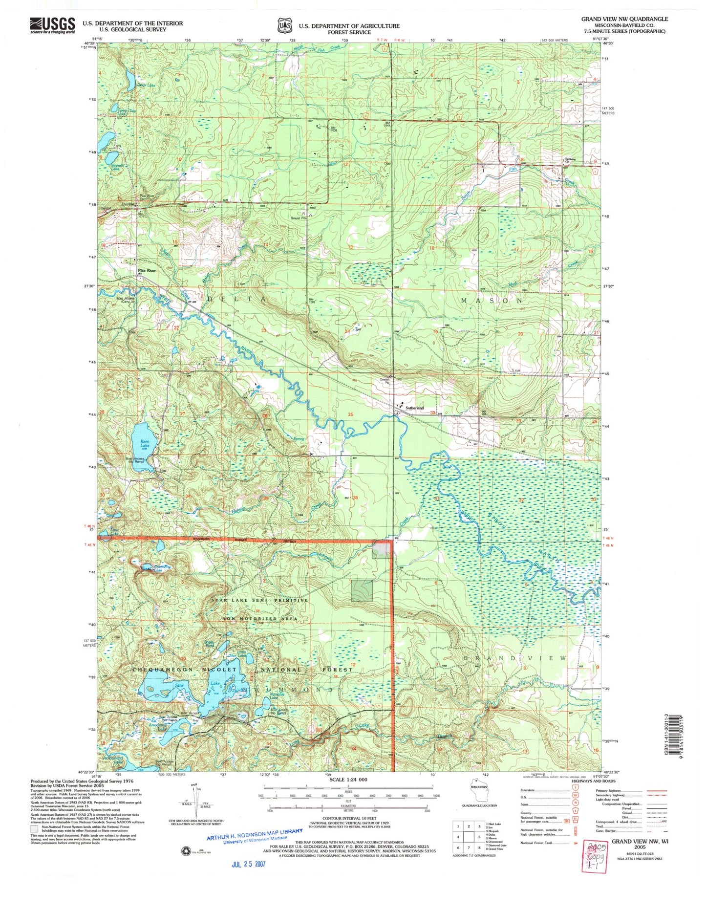
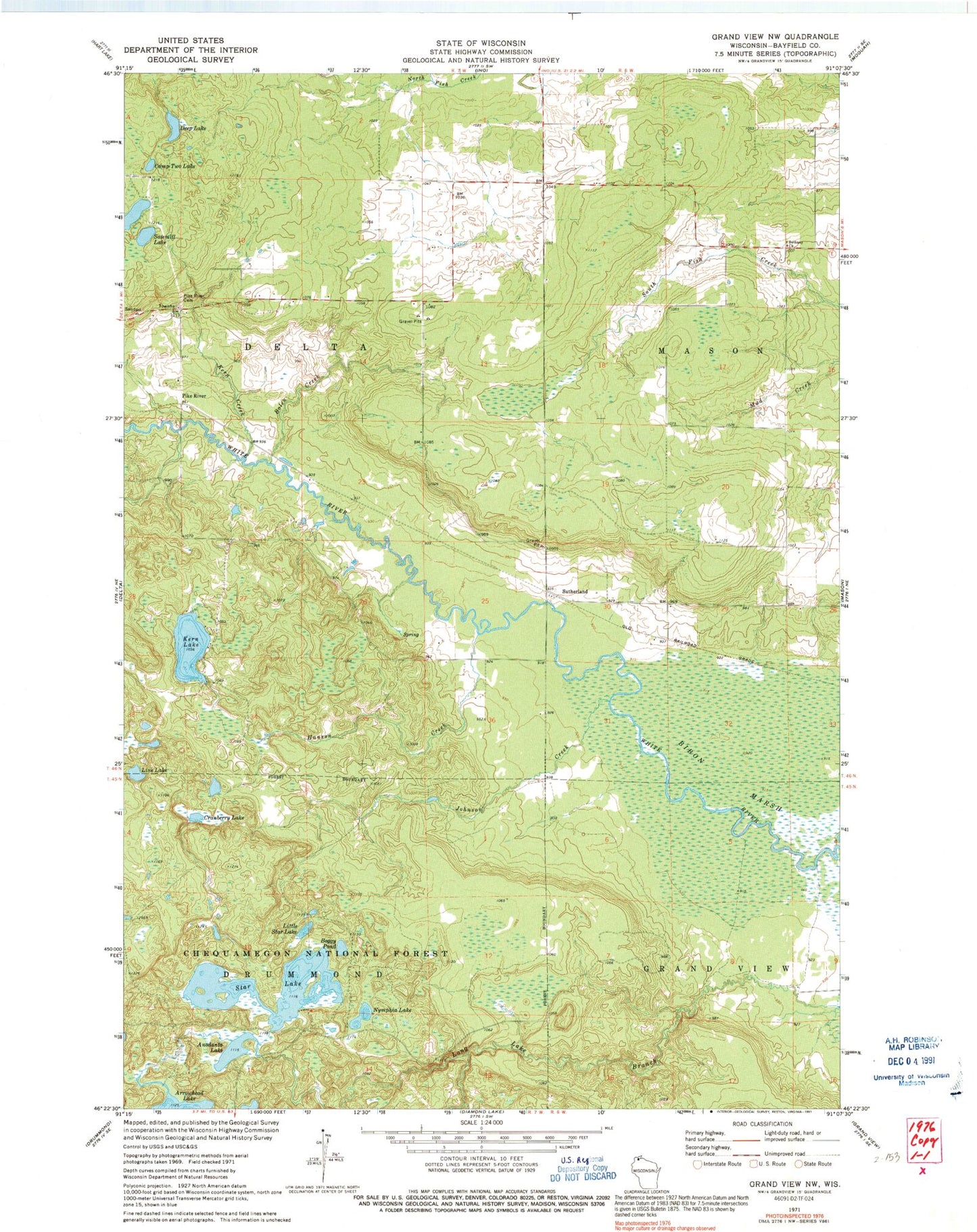
MyTopo
Classic USGS Grandview NW Wisconsin 7.5'x7.5' Topo Map
Couldn't load pickup availability
Historical USGS topographic quad map of Grandview NW in the state of Wisconsin. Map scale may vary for some years, but is generally around 1:24,000. Print size is approximately 24" x 27"
This quadrangle is in the following counties: Bayfield.
The map contains contour lines, roads, rivers, towns, and lakes. Printed on high-quality waterproof paper with UV fade-resistant inks, and shipped rolled.
Contains the following named places: Anodanta Lake, Arrowhead Lake, Bethany Church, Boggy Pond, Bolen Creek, Camp Two Lake, Cranberry Lake, Deep Lake, Delta Cemetery, Hanson Creek, Jader Creek, Johnson Creek, Kern Creek, Kern Lake, Line Lake, Little Star Lake, Nymphia Lake, Pike River, Sajdak Springs State Natural Area, Sawmill Lake, Star Lake, Sutherland, ZIP Code: 54856