MyTopo
Classic USGS Grandview Point NE Arizona 7.5'x7.5' Topo Map
Couldn't load pickup availability
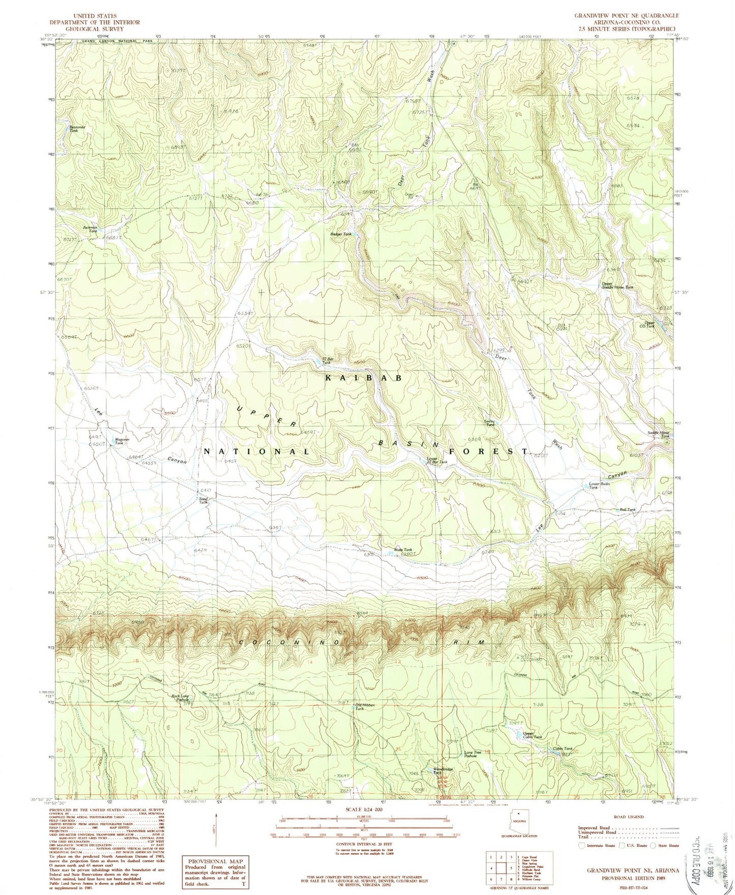
Historical USGS topographic quad map of Grandview Point NE in the state of Arizona. Map scale may vary for some years, but is generally around 1:24,000. Print size is approximately 24" x 27"
This quadrangle is in the following counties: Coconino.
The map contains contour lines, roads, rivers, towns, and lakes. Printed on high-quality waterproof paper with UV fade-resistant inks, and shipped rolled.
Contains the following named places: Badger Tank, Bentonite Tank, Buff Tank, Bull Tank, Cabin Tank, Deer Tank, Deer Tank Wash, Deer Wash Tank, Freshour Tank, Jackman Tank, Lone Tree Pothole, Long Tree Pothole, Long Tree Tank, Lower Basin Tank, Lower Seventy-seven Bar Tank, Old Hibben Tank, Rock Lake Pothole, Saddle Horse Tank, Sand Tank, Seeley Tank, Seventy-seven Bar Tank, Upper Basin, Upper Cabin Tank, Upper Co Tank, Upper Saddle Horse Tank, Waggoner Tank, Watts Tank, Woodbridge Tank