MyTopo
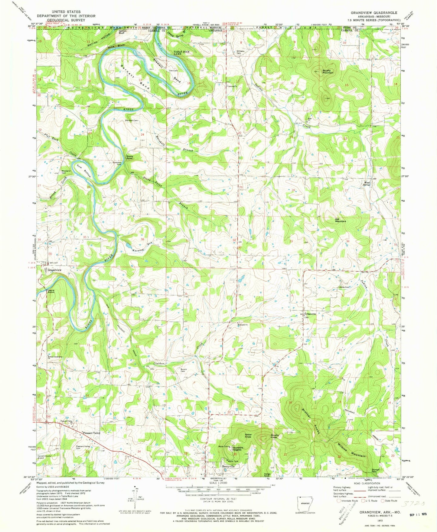
Classic USGS Grandview Arkansas 7.5'x7.5' Topo Map
Couldn't load pickup availability
Historical USGS topographic quad map of Grandview in the states of Arkansas, Missouri. Map scale may vary for some years, but is generally around 1:24,000. Print size is approximately 24" x 27"
This quadrangle is in the following counties: Barry, Carroll, Stone.
The map contains contour lines, roads, rivers, towns, and lakes. Printed on high-quality waterproof paper with UV fade-resistant inks, and shipped rolled.
Contains the following named places: Ant Mountain, Antioch Church of God of the Apostolic Faith, Barnett Bend, Berkes Community Church, Blackjack Cemetery, Blackjack Church, Brother Knobs, Brush Creek, Brushy Knob, Brushy Mountain, Bunch Cemetery, Carr Cemetery, Carroll County Airport, Clabber Creek, Duncan Gap, Flat Rock Creek, Freeman, Fuller Lake, Fuller Lake Dam, Gallion Bluff, Gallion Hollow, Grandview, Grandview Post Office, Gum Bottom, Herd Spring, High, High Cemetery, High Church, High Post Office, Indian Creek, Jones Cemetery, KSCC-FM (Berryville), Marshall Branch, Marshall Cemetery, Moreland Cemetery, Pine Bluff, Pleasant Valley, Pleasant Valley Cemetery, Pleasant Valley Church, Polo, Saunders Heights, Sister Knob, Stewart Bend, Stony Point, Stony Point Branch, Summers Ford, Township of Polo, Urbanette, Urbanette School, Waxweed Run, Wilkins Mountain, Williams Cemetery, Wood Spring