MyTopo
Classic USGS Grandy Lake Washington 7.5'x7.5' Topo Map
Couldn't load pickup availability
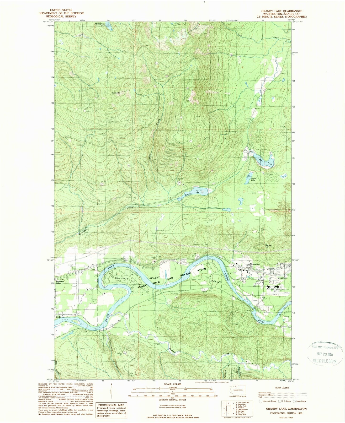
Historical USGS topographic quad map of Grandy Lake in the state of Washington. Map scale may vary for some years, but is generally around 1:24,000. Print size is approximately 24" x 27"
This quadrangle is in the following counties: Skagit.
The map contains contour lines, roads, rivers, towns, and lakes. Printed on high-quality waterproof paper with UV fade-resistant inks, and shipped rolled.
Contains the following named places: Baker River Ranger Station, Burpee Hill, Cape Horn, Community Bible Church, Concrete Assembly of God Church, Concrete Elementary School, Concrete High School, Concrete Middle School, Concrete Post Office, Concrete School District 11 Office, Concrete Town Hall, Dalles Bridge, Eagle Hill Quarry, Finney Creek, Forest Park Cemetery, Goat Mountain, Grandy Lake, Grassmere, Hatchery Creek, Lake Tyee, Mears Field, Mount Baker Presbyterian Church, Pressentin Creek, Quartz Creek, Skagit County Fire District 10 Grassmere Fire Department, Skagit County Sheriff's Office Concrete / East Detachment, Skagit Lake Dam, Skagit River School House, Springsteen Lake, Timberline Mobile Home Park, Town of Concrete, Vogler Lake